16 Opal Close, Litherland, Liverpool, L21 7RE
About 16 Opal Close
16 Opal Close is a two-bedroom semi-detached house in Litherland, Liverpool, Liverpool (L21 7RE). It has a recorded floor area of 71 m² (around 764 sq ft), construction records dating it to 1991-1995 and council tax band B. The latest certificate (April 2018) shows a D (score 57), a step below the typical UK home. The recommended improvements would lift it to B (score 83), a 2-band jump.
Held since October 2002 — that's 24 years off the open market, well above the local norm. Today's modelled estimate of £144,000 sits 80.5% above the 2002 sale of £79,800. On a £-per-square-foot basis, the last sale (£104/sq ft) was about 20.7% below the postcode norm.
What this property has
Inside
- Bedrooms2
- CloakroomYes
Outside
- Private gardenFront and rear
Building
- Heating systemGas
- RefurbishedYes
Everything you need to know about 16 Opal Close
The true value, the hidden risks and the full sale history, in one report.
30-day money-back guarantee

The data behind every report


Energy performance
Recommended upgrades on file would lift this property by multiple EPC bands.
EPC Rating
Planning history
16 Opal Close has no planning applications on record.
The full report still covers planning activity across the surrounding area.
Sales history & valuation
16 Opal Close valuation sits well clear of the typical sold price in this postcode.
£144,000
Modelled from EPC, postcode comparables.
£79,800
Recorded with HM Land Registry.
Sales timeline
24 October 2002Most recent
£79,800
Median price across the last 5 sales in L21 7RE: £127,000 (2024–2022).
Nearby sales in L21 7RE
7 Opal Close, Litherland, Liverpool, L21 7RE
Sold Jan 2024
£140,00019 Opal Close, Litherland, Liverpool, L21 7RE
Sold Oct 2022
£160,00014 Opal Close, Litherland, Liverpool, L21 7RE
Sold Oct 2022
£90,00011 Opal Close, Litherland, Liverpool, L21 7RE
Sold May 2022
£127,00026 Opal Close, Litherland, Liverpool, L21 7RE
Sold Apr 2022
£73,500
Versus other Opal Close homes
16 Opal Close outperforms the street on years held by a wide margin.
Price per m²
£1,124
Street avg £1,637
Floor Area
71 m²
Street avg 80 m²
Habitable Rooms
3 rooms
Street avg 4 rooms
CO₂ Emissions
3.9 t/year
Street avg 3.1 t/year
Everything you need to know about 16 Opal Close
The true value, the hidden risks and the full sale history, in one report.
30-day money-back guarantee
The data behind every report
Similar properties nearby
1 Kent Avenue, Litherland
L21 7QJ
1 Amos Avenue
L21 7QH
1 Gale Road, Litherland
L21 7QR
1 Ruby Close, Litherland
L21 7RH
1 Amethyst Close, Litherland
L21 7RD
1 Boundary Road, Litherland
L21 7LA
1 Sefton Moss Villas
L21 7QX
1 Alexandra Mount
L21 7PN
The neighbourhood at a glance
Reported crime in the wider district is trending notably upward year-on-year.
Crime
4/mo
Rising year-on-year across the wider district.
Nearest stop
0.1 km
Springfield Avenue — bus stop.
Closest school
0.3 km
St Philip's Church of England Controlled Primary School. 40 schools nearby.
Go deeper on the local area
The full report breaks down crime, transport links, schools and air quality in depth.
Road noise across the postcode
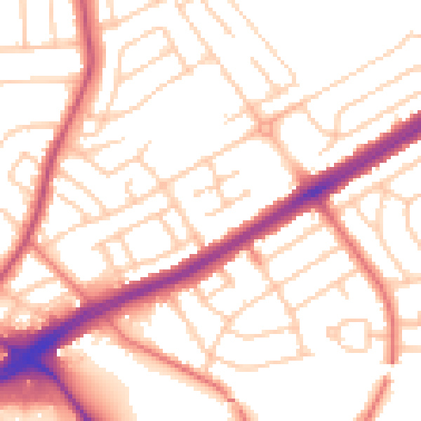
Daytime· 07:00 – 23:00
53.5dB

Night-time· 23:00 – 07:00
42.9dB