9 Mahon Avenue, Bootle, L20 6AP
About 9 Mahon Avenue
9 Mahon Avenue is a three-bedroom mid-terrace house in Bootle (L20 6AP). It has a recorded floor area of 71 m² (around 764 sq ft), construction records dating it to 1930-1949 and council tax band A. The latest certificate (December 2020) shows a C (score 74). When first surveyed in November 2008 the rating was D, the property has climbed 1 band since. Between certificates, wall efficiency went from Very Poor to Good, window efficiency went from Very Poor to Average and hot-water efficiency went from Average to Good. The recommended improvements would push it to B (score 89).
Across 2000–2021, sale prices on this property compounded at 6.6% per year. Today's modelled estimate of £157,000 is 42.7% above the 2021 sale price. On a £-per-square-foot basis, the last sale (£144/sq ft) was about 47.3% above the typical sold price in the postcode. Most recent transfer: June 2021 at £110,000. That sale was during the post-pandemic price surge, when transactions cleared materially above pre-2020 trend.
What this property has
Inside
- Bedrooms3
- Bathrooms1
Outside
- ParkingOff road
Building
- Heating systemGas
Everything you need to know about 9 Mahon Avenue
The true value, the hidden risks and the full sale history, in one report.
30-day money-back guarantee

The data behind every report


Energy performance
EPC Rating
Property Improvements
Changes detected from historical EPC data
Heating controls changed
Hot water efficiency improved
Single glazing replaced with double or better glazing
Wall insulation improved
More low energy lighting installed
Planning history
9 Mahon Avenue has no planning applications on record.
Notable planning nearby
1applications of note in the surrounding area
Sales history & valuation
Sale price has grown by over 3x since 2000.
£157,000
Modelled from EPC, postcode comparables and a sale-price growth of 6.6% per year over 21 years.
£110,000
Growth on file: 6.6% per year over 21 years.
Sales timeline
20 June 2021Most recent
£110,000
+38.5%over 13 years28 June 2007
£79,430
+173.9%over 6 years21 September 2000
£29,000
Median price across the last 5 sales in L20 6AP: £79,950 (2021–2004).
Versus other Mahon Avenue homes
9 Mahon Avenue outperforms the street on habitable rooms by a wide margin.
EPC Rating
74 (C)
Street avg 72 (C)
Floor Area
71 m²
Street avg 73 m²
CO₂ Emissions
2.2 t/year
Street avg 2.4 t/year
Habitable Rooms
5 rooms
Street avg 4 rooms
Everything you need to know about 9 Mahon Avenue
The true value, the hidden risks and the full sale history, in one report.
30-day money-back guarantee
The data behind every report
Similar properties nearby
The neighbourhood at a glance
Reported crime in the wider district is trending notably upward year-on-year.
Crime
7/mo
Rising year-on-year across the wider district.
Nearest stop
0.1 km
Ainsdale Road — bus stop.
Closest school
0.2 km
King's Leadership Academy Hawthornes. 39 schools nearby.
Go deeper on the local area
The full report breaks down crime, transport links, schools and air quality in depth.
Road noise across the postcode
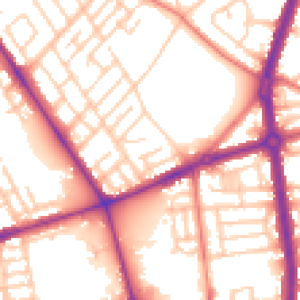
Daytime· 07:00 – 23:00
55.8dB

Night-time· 23:00 – 07:00
46.0dB