1 Holly Bank Avenue, Liverpool, L14 7AG
About 1 Holly Bank Avenue
1 Holly Bank Avenue is a three-bedroom detached house in Liverpool (L14 7AG). It has a recorded floor area of 96 m² (around 1033 sq ft) and council tax band D. The latest certificate (September 2013) returns a B (score 83), comfortably above the UK average. The latest certificate is from September 2013, so improvements made since then won't be reflected. The property has an EV charger on record, all of which lower running costs and tend to lift resale appeal. Other recorded features include notable views. Our model identifies extension potential, subject to local planning policy.
One planning record on file: an extension approved in 2021. Past consents include an extension, meaningful when judging how the property has evolved. Today's modelled estimate of £368,000 is 13.2% above the 2021 sale price. On a £-per-square-foot basis, the last sale (£315/sq ft) was about 40.9% above the typical sold price in the postcode. At 96 m² it's 20% smaller than the typical home in the postcode (120 m² median across 28 EPCs). Most recent transfer: December 2021 at £325,000. That sale was during the post-pandemic price surge, when transactions cleared materially above pre-2020 trend.
What this property has
Inside
- Bedrooms3
- Bathrooms3
- EnsuiteYes
Outside
- Private gardenRear
- GarageYes
- Notable viewsYes
Building
- EV chargerYes
- Extension potentialPossible
Everything you need to know about 1 Holly Bank Avenue
The true value, the hidden risks and the full sale history, in one report.
Pick your report · every report is £14.99
One time fee only - money back guarantee

The data behind every report


Energy performance
1 Holly Bank Avenue's EPC is over a decade old — improvements since won't be reflected.
EPC Expired
This certificate is over 10 years old and is no longer valid.Expired 04 Sept 2023
EPC Rating
Get a survey for this property
Level 2 HomeBuyer Report
We've checked 10 risk factors against the available data for this property and believe a Level 2 HomeBuyer Report could be a suitable option for you.
From £595 · Includes VAT
Planning history
Council records include a two-storey side extension at 1 Holly Bank Avenue.
1 application on record at 1 Holly Bank Avenue, Liverpool, L14 7AG
- Mar 2021ExtensionFullOutcome in report
Extension: Two storey · Side of property
ERECTION OF TWO STOREY SIDE EXTENSION (DEMOLITION OF EXISTING DETACHED GARAGE)
- Documents
- 11 docs on file
- Reference
- 21/00010/FUL
Unlock 1 Holly Bank Avenue, Liverpool, L14 7AG's full planning history
You're seeing the shape of it. The report has the substance.
- Every decision — granted, refused or withdrawn (1 on record)
- All 1 application on this property in full
- The 11 documents, officer reports & conditions
- What the pattern means for extending or converting here
One time fee only - money back guarantee
Sales history & valuation
The latest sale landed in the post-pandemic price surge — useful context when reading the figure.
£368,000
Modelled from EPC, postcode comparables.
£325,000
Recorded with HM Land Registry.
Sales timeline
1 December 2021Most recent
£325,000
Median price across the last 5 sales in L14 7AG: £365,000 (2025–2020).
Nearby sales in L14 7AG
41 Holly Bank Avenue, Liverpool, L14 7AG
Sold Mar 2025
£430,00043 Holly Bank Avenue, Liverpool, L14 7AG
Sold Oct 2024
£365,00019 Holly Bank Avenue, Liverpool, L14 7AG
Sold Feb 2023
£302,00053 Holly Bank Avenue, Liverpool, L14 7AG
Sold Dec 2020
£381,0003 Holly Bank Avenue, Liverpool, L14 7AG
Sold Nov 2020
£276,000
Versus other Holly Bank Avenue homes
On floor area, 1 Holly Bank Avenue runs well behind the street norm.
Price per m²
£3,385
Street avg £2,603
Floor Area
96 m²
Street avg 122 m²
CO₂ Emissions
1.6 t/year
Street avg 1.9 t/year
Years Held
5 years
Street avg 8 years
Everything you need to know about 1 Holly Bank Avenue
The true value, the hidden risks and the full sale history, in one report.
Pick your report · every report is £14.99
One time fee only - money back guarantee
The data behind every report
Similar properties nearby
1 Coronation Avenue, Knotty Ash
L14 7NS
1 Coronation Drive, Knotty Ash
L14 7NT
1 Leyfield Way
L14 7AE
1 Bradfield Road
L14 7AQ
1 Swanside Avenue
L14 7NP
1 Eton House, Marwood Road
L14 7AY
1 Pilch Lane
L14 7QA
1 Ashfield Way
L14 7AD
The neighbourhood at a glance
Rail-style transport is unusually close for this postcode.
Crime
6/mo
Rising year-on-year across the wider district.
Nearest stop
0.1 km
Evington Drive — bus stop.
Closest school
0.6 km
Malvern Primary School. 50 schools nearby.
Go deeper on the local area
A Local Area report breaks down crime, transport links, schools and air quality in depth.
Road noise across the postcode
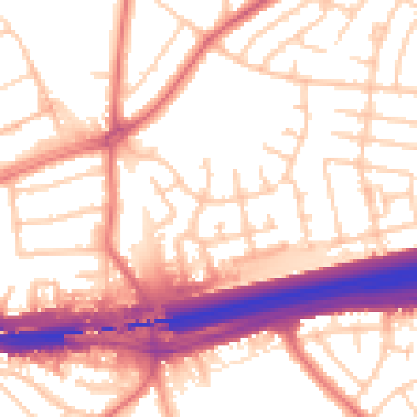
Daytime· 07:00 – 23:00
55.6dB

Night-time· 23:00 – 07:00
46.5dB