Flat 1, 5 Seymour Road, Broadgreen, Liverpool, L14 3LH
About Flat 1
Flat 1 is a semi-detached house in Broadgreen, Liverpool, Liverpool (L14 3LH). It has a recorded floor area of 64 m² (around 689 sq ft), construction records dating it to before 1900 and council tax band A. At 64 m² this is the 8th smallest of 9 units on EPC record in the building, where floor areas span 34–125 m². The building's EPC ratings span E to C, with this unit at the bottom. On EPC score it ranks last in the building (42 versus a best of 69). The latest certificate (June 2019) shows an E (score 42), well below the UK norm with real room to improve. The recommended improvements would lift it to C (score 77), a 2-band jump. Main heating runs on electricity.
At 64 m² it's 20.8% larger than the typical home in the postcode (53 m² median across 75 EPCs). On energy efficiency it sits in the bottom 10% of properties in this postcode — significant headroom for improvement.
Everything you need to know about Flat 1
The true value, the hidden risks and the full sale history, in one report.
Pick your report · every report is £14.99
One time fee only - money back guarantee

The data behind every report


Energy performance
Flat 1 sits at the bottom of the postcode for energy efficiency — meaningful headroom to improve.
EPC Rating
Get a survey for this property
Level 3 Building Survey
Because the property was built before 1919 and has solid (non-cavity) walls, we believe a Level 3 building survey should be considered.
From £820 · Includes VAT
Planning history
Flat 1 has no planning applications on record.
A planning report still maps activity across the surrounding area and reads this property's extension & conversion potential.
Sales history & valuation
Flat 1 has no Land Registry sales on file, suggesting it has stayed in the same hands since registration began.
£151,000
Modelled from EPC, postcode comparables.
No sales recorded with HM Land Registry
That can mean the property has never traded since the registry began publishing in 1995, was a new build that hasn't been registered yet, or is held in the same hands long-term.
Median price across the last 5 sales in L14 3LH: £123,000 (2025–2022).
Nearby sales in L14 3LH
47 Seymour Road, Broadgreen, Liverpool, L14 3LH
Sold Jun 2025
£134,00029 Seymour Road, Broadgreen, Liverpool, L14 3LH
Sold Nov 2024
£123,00010 Seymour Road, Broadgreen, Liverpool, L14 3LH
Sold Nov 2023
£52,50049 Seymour Road, Broadgreen, Liverpool, L14 3LH
Sold Apr 2023
£150,0007 Seymour Road, Broadgreen, Liverpool, L14 3LH
Sold Apr 2022
£55,000
Versus other Seymour Road homes
Flat 1 is notably below the street on co₂ emissions.
EPC Rating
42 (E)
Street avg 65 (D)
Floor Area
64 m²
Street avg 49 m²
CO₂ Emissions
6.6 t/year
Street avg 2.6 t/year
Habitable Rooms
3 rooms
Street avg 2 rooms
Everything you need to know about Flat 1
The true value, the hidden risks and the full sale history, in one report.
Pick your report · every report is £14.99
One time fee only - money back guarantee
The data behind every report
Similar properties nearby
Flat 1, 9 Seymour Road, Broadgreen
L14 3LH
Flat 2, 12 Jubilee Avenue
L14 3NB
30 32, Flat 2, Old Thomas Lane
L14 3NA
Flat 2, 2 Seymour Road, Broadgreen
L14 3LH
Flat 1, 12 Jubilee Avenue
L14 3NB
Flat 1, 12 Seymour Road, Broadgreen
L14 3LH
Flat 1, 8 Seymour Road, Broadgreen
L14 3LH
Flat 2, 20 Old Thomas Lane
L14 3NA
The neighbourhood at a glance
Rail-style transport is unusually close for this postcode.
Crime
6/mo
Rising year-on-year across the wider district.
Nearest stop
0.2 km
Broad Green Station — bus stop.
Closest school
0.7 km
Dixons Broadgreen Academy. 54 schools nearby.
Go deeper on the local area
A Local Area report breaks down crime, transport links, schools and air quality in depth.
Road noise across the postcode
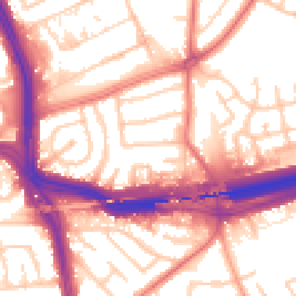
Daytime· 07:00 – 23:00
57.2dB

Night-time· 23:00 – 07:00
48.3dB