71 Turriff Road, Liverpool, L14 2EJ
About 71 Turriff Road
71 Turriff Road is a three-bedroom semi-detached house in Liverpool (L14 2EJ). It has a recorded floor area of 69 m² (around 743 sq ft), construction records dating it to 1983-1990 and council tax band B. The latest certificate (March 2015) shows a D (score 65), on the cusp of jumping into the C band. The recommended improvements would lift it to B (score 86), a 2-band jump. The latest certificate is from March 2015, so improvements made since then won't be reflected. Other recorded features include a conservatory. Period features are noted in the property record. The home occupies a corner plot.
Across 1999–2023, sale prices on this property compounded at 5.2% per year. Today's modelled estimate of £196,000 is 12.6% above the 2023 sale price. On a £-per-square-foot basis, the last sale (£234/sq ft) was about 102.5% above the typical sold price in the postcode. Last sale on file: £174,000 in December 2023.
What this property has
Inside
- Bedrooms3
- Bathrooms1
- Dining roomYes
- ConservatoryYes
Outside
- Private gardenFront and rear
- DrivewayYes
- Corner plotYes
Building
- Central heatingYes
- Period featuresYes
Everything you need to know about 71 Turriff Road
The true value, the hidden risks and the full sale history, in one report.
Pick your report · every report is £14.99
One time fee only - money back guarantee

The data behind every report


Energy performance
Recommended upgrades on file would lift this property by multiple EPC bands.
EPC Expired
This certificate is over 10 years old and is no longer valid.Expired 17 Mar 2025
EPC Rating
Get a survey for this property
Level 2 HomeBuyer Report
We've checked 10 risk factors against the available data for this property and believe a Level 2 HomeBuyer Report could be a suitable option for you.
From £495 · Includes VAT
Planning history
71 Turriff Road has no planning applications on record.
But the area is active
1 notable application nearby — larger schemes and conversions that could reshape the street. The report maps them all.
Sales history & valuation
Sale price has grown by over 3x since 1999.
£196,000
Modelled from EPC, postcode comparables and a sale-price growth of 5.2% per year over 25 years.
£174,000
Growth on file: 5.2% per year over 25 years.
Sales timeline
4 December 2023Most recent
£174,000
+248.3%over 24 years26 February 1999
£49,950
Median price across the last 5 sales in L14 2EJ: £153,000 (2025–2024).
Nearby sales in L14 2EJ
Versus other Turriff Road homes
71 Turriff Road outperforms the street on price per m² by a wide margin.
Price per m²
£2,522
Street avg £1,776
Floor Area
69 m²
Street avg 70 m²
Habitable Rooms
5 rooms
Street avg 4 rooms
CO₂ Emissions
3.1 t/year
Street avg 2.8 t/year
Everything you need to know about 71 Turriff Road
The true value, the hidden risks and the full sale history, in one report.
Pick your report · every report is £14.99
One time fee only - money back guarantee
The data behind every report
Similar properties nearby
The neighbourhood at a glance
Reported crime in the wider district is trending notably upward year-on-year.
Crime
6/mo
Rising year-on-year across the wider district.
Nearest stop
0.2 km
Taurus Road — bus stop.
Closest school
0.5 km
Blueberry Park. 37 schools nearby.
Go deeper on the local area
A Local Area report breaks down crime, transport links, schools and air quality in depth.
Road noise across the postcode
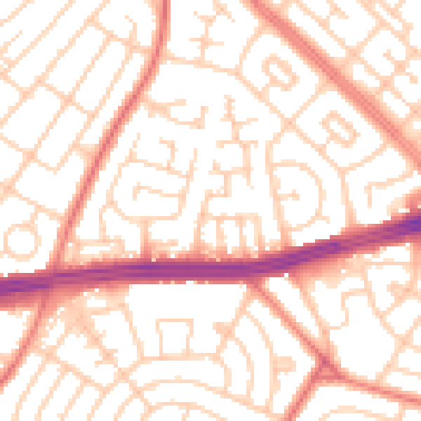
Daytime· 07:00 – 23:00
53.5dB

Night-time· 23:00 – 07:00
41.7dB