Are you a property professional?Get qualified leads from motivated homeowners.
Get started19 Keston Avenue, New Haw, Addlestone, KT15 3EE
4 sales on record
About 19 Keston Avenue
A plain-English summary derived from public records, EPC certificates, sold prices and local data.
19 Keston Avenue is a four-bedroom semi-detached house in New Haw, Addlestone, Addlestone (KT15 3EE). It has a recorded floor area of 116 m² (around 1249 sq ft), construction records dating it to 1950-1966 and council tax band C. The latest certificate (November 2017) shows a C (score 73). When first surveyed in January 2012 the rating was D, the property has climbed 1 band since. The recommended improvements would push it to B (score 83).
Sale prices here have outpaced England HPI: 10.4% per year against 0% for the wider region. Today's modelled estimate of £595,000 is 19% above the 2018 sale price. On a £-per-square-foot basis, the last sale (£400/sq ft) was about 19.6% above the typical sold price in the postcode. At 116 m² the property is well over the postcode median (81 m² across 11 EPCs), placing it in the larger end of the local stock. Its energy rating outperforms most of the postcode (better than 82% of similar EPCs). On the market in March 2018 and unlisted since — roughly 8 years. Across the public record there are 4 sales, relatively high churn for a single property. 7 planning records sit against the property, 5 approved, 2 refused. Past consents include an extension and a porch, meaningful when judging how the property has evolved.
What this property has
Pulled from EPC certificates, claim submissions and our property model. Empty categories are hidden — we only show what's known.
Inside
- Bedrooms4
- Bathrooms2
Outside
- Private gardenYes
Building
Energy performance
Every EPC certificate filed against this property — current rating, recorded improvements, and where there's headroom to reach a higher band.
Current Certificate(1 of 2)
Nov 2017
EPC Rating
A
B
C
C73
D
E
F
G
Main Heating
Gas
Main Fuel
Gas
Hot Water
Good
Windows
Average
CO2 Emissions
3.3 t/year
Occupancy
Owner Occupied
Planning history
Applications and permits filed against 19 Keston Avenue, New Haw, Addlestone, KT15 3EE, sourced from the PlanIt planning register.
19 Keston Avenue has 3 separate extension applications on the council record.
- Aug 2017PorchGrant Consent - subject to conditions
Proposed rear dormer and front porch infill extension.
Sales history & valuation
Recorded transactions, our model's current estimate, and a quick read on what neighbouring properties have sold for.
Latest sale on 19 Keston Avenue was the highest on Land Registry record across the postcode.
Current estimate
See how we calculated this£595,000
Modelled from EPC, postcode comparables and a sale-price growth of 10.4% per year over 22 years.
Last sold (2018)
£500,000
Growth on file: 10.4% per year over 22 years.
Sales timeline
Versus other Keston Avenue homes
Four headline reads against 11 similar houses on this street, drawn from the latest EPC and Land Registry data.
Price per m² for 19 Keston Avenue runs comfortably ahead of the street norm.
Price per m²
£4,310
Street avg £3,224
Floor Area
116 m²
Street avg 78 m²
Habitable Rooms
5 rooms
Similar properties nearby
A handful of close matches in the same postcode area, ranked by likeness on bedrooms, type and floor area.
The neighbourhood at a glance
A condensed read of the local area. Each tile links through to the full breakdown on the Addlestone district page.
Rail-style transport is unusually close for this postcode.
Crime
3/mo
Steady year-on-year across the wider district.
Nearest stop
0.3 km
Farleigh Road — bus stop.
Road noise across the postcode
Modelled day and night-time noise levels around KT15 3EE from Defra's strategic mapping. The pin marks this postcode's centroid.
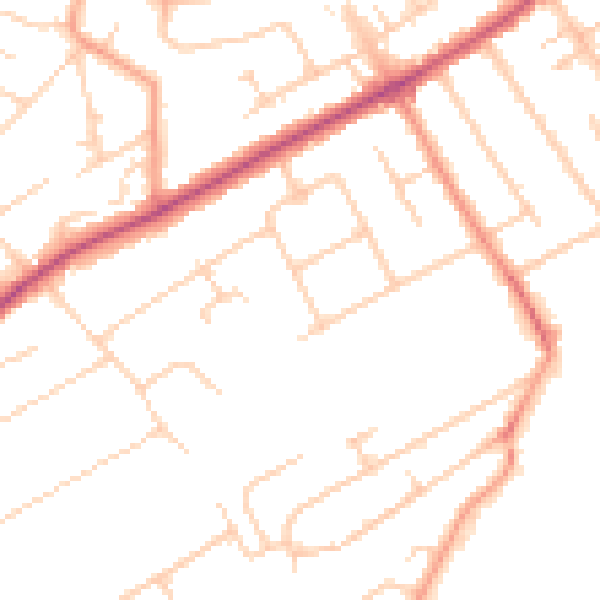
Daytime· 07:00 – 23:00
50.5dB

Everything within walking distance
Schools, transport stops and scenic spots near this property — 49 points of interest in total.
Beautiful places to visit nearby
Curated scenic spots within reach of this postcode, served by Beautifulplaces.ai. Photography and tagging come from their open dataset.
Common questions
The questions buyers, sellers and homeowners most often ask about 19 Keston Avenue, New Haw, Addlestone, KT15 3EE. Each answer is also embedded as structured data for search engines.