26 Garland Street, Bury St Edmunds, IP33 1HB
About 26 Garland Street
26 Garland Street is a three-bedroom mid-terrace house in Bury St Edmunds (IP33 1HB). It has a recorded floor area of 80 m² (around 865 sq ft), construction records dating it to before 1900 and council tax band B. The latest certificate (August 2011) shows a D (score 63), on the cusp of jumping into the C band. Earlier certificates rated it C (November 2009); the latest reading is one band lower. Between certificates, window efficiency dropped from Average to Poor and hot-water efficiency dropped from Very Good to Good. The latest certificate is from August 2011, so improvements made since then won't be reflected.
4 planning records sit against the property, 3 approved, 1 refused. Past consents include tree works, an extension, a conservatory and new windows, meaningful when judging how the property has evolved. Across 2004–2012, sale prices on this property compounded at 2.7% per year. Today's modelled estimate of £375,000 is 44.2% above the 2012 sale price. On a £-per-square-foot basis, the last sale (£301/sq ft) was about 48.4% above the typical sold price in the postcode. On the market in November 2012 and unlisted since — roughly 14 years. At 80 m² it's 22% smaller than the typical home in the postcode (103 m² median across 23 EPCs).
What this property has
Inside
- Bedrooms3
- Bathrooms2
Outside
- Private gardenRear
- GarageYes
Building
- Heating systemGas
- RefurbishedYes
Everything you need to know about 26 Garland Street
The true value, the hidden risks and the full sale history, in one report.
Pick your report · from £14.99
One time fee only - money back guarantee

The data behind every report


Energy performance
26 Garland Street's EPC is over a decade old — improvements since won't be reflected.
EPC Expired
This certificate is over 10 years old and is no longer valid.Expired 29 Aug 2021
EPC Rating
Certificate validity
Expired on 29 August 2021

Get a survey for this property
Level 3 Building Survey
Because the property was built before 1919 and has solid (non-cavity) walls, we believe a Level 3 building survey should be considered.
From £955 · Includes VAT
Planning history
26 Garland Street has an approved rear extension on the planning record.
4 applications on record at 26 Garland Street, Bury St Edmunds, IP33 1HB
- Mar 2002RenovationFullOutcome in report
Planning Application - Replacement of two front windows with timber sash windows
New Windows- Reference
- SE/02/1286/P
- More recent applications — locked
- Tree WorksJan 2019Decision
- Tree WorksMar 2018Decision
+ 1 more application in the report
Unlock 26 Garland Street, Bury St Edmunds, IP33 1HB's full planning history
You're seeing the shape of it. The report has the substance.
- Every decision — granted, refused or withdrawn (4 on record)
- All 4 applications on this property in full, plus 1 notable nearby
- The 33 documents, officer reports & conditions
- What the pattern means for extending or converting here
One time fee only - money back guarantee
Sales history & valuation
26 Garland Street saw 3 transfers in just over a decade — high turnover for the postcode.
£375,000
Modelled from EPC, postcode comparables and a sale-price growth of 2.7% per year over 9 years.
£260,000
Growth on file: 2.7% per year over 9 years.
Sales timeline
26 November 2012Most recent
£260,000
+28.7%over 7 years12 April 2005
£202,000
-2.4%over 1 year17 March 2004
£207,000
Median price across the last 5 sales in IP33 1HB: £369,000 (2025–2022).
Nearby sales in IP33 1HB
30 Garland Street, Bury St Edmunds, IP33 1HB
Sold Aug 2025
£420,00042 Garland Street, Bury St Edmunds, IP33 1HB
Sold Mar 2025
£376,00041 Garland Street, Bury St Edmunds, IP33 1HB
Sold Jul 2024
£369,00050 Garland Street, Bury St Edmunds, IP33 1HB
Sold Apr 2023
£265,00043 Garland Street, Bury St Edmunds, IP33 1HB
Sold Aug 2022
£365,000
Versus other Garland Street homes
Floor Area for 26 Garland Street lags the street by a wide margin.
Price per m²
£3,236
Street avg £2,795
Floor Area
80 m²
Street avg 97 m²
Habitable Rooms
5 rooms
Street avg 5 rooms
CO₂ Emissions
4.3 t/year
Street avg 4.2 t/year
Everything you need to know about 26 Garland Street
The true value, the hidden risks and the full sale history, in one report.
Pick your report · from £14.99
One time fee only - money back guarantee
The data behind every report
Similar properties nearby
1 All Saints Court
IP33 1TF
1 Boughton Way
IP33 1AG
1 Foundry Terrace, St Johns Street
IP33 1SA
1 Athenaeum Lane
IP33 1LY
1 East Close
IP33 1UQ
1 Barwell Road
IP33 1AF
1 Cadney Lane
IP33 1JP
1 Bishops Road
IP33 1TQ
The neighbourhood at a glance
Rail-style transport is unusually close for this postcode.
Crime
134/mo
Steady year-on-year across the wider district.
Nearest stop
0.2 km
Schoolhall Lane — bus stop.
Closest school
0.7 km
Guildhall Feoffment Community Primary School. 15 schools nearby.
Go deeper on the local area
A Local Area report breaks down crime, transport links, schools and air quality in depth.
Road noise across the postcode
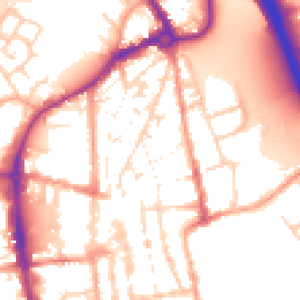
Daytime· 07:00 – 23:00
55.1dB
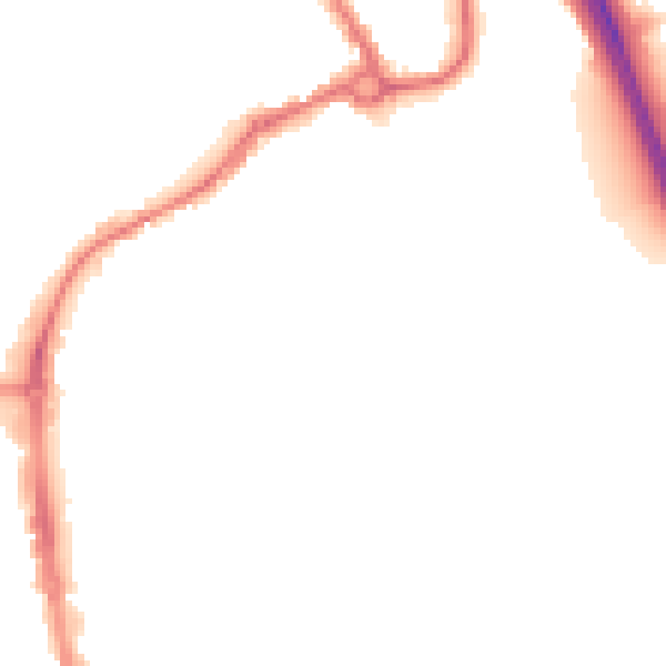
Night-time· 23:00 – 07:00
45.8dB