6 Brownswood Road, Beaconsfield, HP9 2NU
EPC B
About 6 Brownswood Road
A plain-English summary derived from public records, EPC certificates, sold prices and local data.
6 Brownswood Road is a four-bedroom detached house in Beaconsfield (HP9 2NU). It has a recorded floor area of 424 m² (around 4564 sq ft), construction records dating it to 1930-1949 and council tax band A. There is a swimming pool on the plot, uncommon for the area. The latest certificate (June 2019) returns a high B (score 85), putting the home a stone's throw from an A rating. When first surveyed in May 2009 the rating was F, the property has climbed 4 bands since. Between certificates, wall efficiency went from Poor to Very Good, roof efficiency went from Average to Good and window efficiency went from Average to Good.
Untraded for 17 years, with the last transfer in October 2009. That sale fell during the post-crash dip, which often skews comparisons against later neighbouring sales. Sale prices here have outpaced England HPI: 7.4% per year against 0% for the wider region. Today's modelled estimate of £3,530,000 sits 173.6% above the 2009 sale of £1,290,000. On a £-per-square-foot basis, the last sale (£283/sq ft) was about 36.5% below the postcode norm. At 424 m² the property is well over the postcode median (270 m² across 16 EPCs), placing it in the larger end of the local stock. Its energy rating outperforms most of the postcode (better than 81% of similar EPCs). One historical planning record sits against the property in 2010.
What this property has
Pulled from EPC certificates, claim submissions and our property model. Empty categories are hidden — we only show what's known.
Inside
- Bedrooms4
- Dining roomYes
- StudyYes
Outside
- Private garden
Energy performance
Every EPC certificate filed against this property — current rating, recorded improvements, and where there's headroom to reach a higher band.
Achieving this rating across a home of this size is uncommon — larger homes typically score lower.
Current Certificate(1 of 2)
Jun 2019
EPC Rating
A
B
B85
C
D
E
F
G
Main Heating
Gas
Main Fuel
Gas
Hot Water
Good
Windows
Good
CO2 Emissions
5.6 t/year
Occupancy
—
Planning history
Applications and permits filed against 6 Brownswood Road, Beaconsfield, HP9 2NU, sourced from the PlanIt planning register.
- Nov 2010ConditionsGranted
Variation of Condition 1 of planning permission 10/01014/FUL to allow an amended design in the form of an infill extension
Sales history & valuation
Recorded transactions, our model's current estimate, and a quick read on what neighbouring properties have sold for.
6 Brownswood Road has more than doubled in price since the earliest registered sale in 1998.
Current estimate
See how we calculated this£3,530,000
Modelled from EPC, postcode comparables and a sale-price growth of 7.4% per year over 12 years.
Last sold (2009)
£1,290,000
Growth on file: 7.4% per year over 12 years.
Sales timeline
Launch offer · 33% off
The complete analysis of 6 Brownswood Road, Beaconsfield, HP9 2NU
Everything we know about this property, compiled into one in-depth, downloadable report.
Detailed analysis
A written breakdown of everything that matters
Versus other Brownswood Road homes
Four headline reads against 16 similar houses on this street, drawn from the latest EPC and Land Registry data.
On price per m², 6 Brownswood Road runs well behind the street norm.
Price per m²
£3,042
Street avg £6,452
Floor Area
424 m²
Street avg 288 m²
CO₂ Emissions
5.6 t/year
Similar properties nearby
A handful of close matches in the same postcode area, ranked by likeness on bedrooms, type and floor area.
The neighbourhood at a glance
A condensed read of the local area. Each tile links through to the full breakdown on the Beaconsfield district page.
Rail-style transport is unusually close for this postcode.
Crime
2/mo
Steady year-on-year across the wider district.
Nearest stop
0.2 km
Sandleswood End H&R — bus stop.
Road noise across the postcode
Modelled day and night-time noise levels around HP9 2NU from Defra's strategic mapping. The pin marks this postcode's centroid.
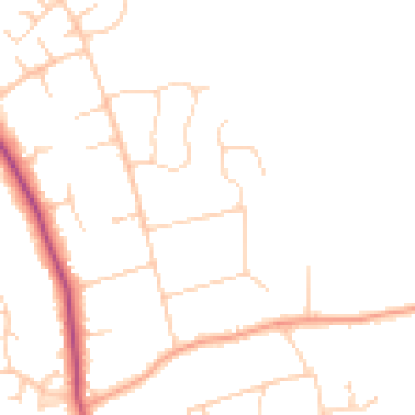
Daytime· 07:00 – 23:00
46.3dB

Everything within walking distance
Schools, transport stops and scenic spots near this property — 36 points of interest in total.
Common questions
The questions buyers, sellers and homeowners most often ask about 6 Brownswood Road, Beaconsfield, HP9 2NU. Each answer is also embedded as structured data for search engines.
