2a, Brownswood Road, Beaconsfield, HP9 2NU
4 sales on record
About 2a
A plain-English summary derived from public records, EPC certificates, sold prices and local data.
2a is a four-bedroom detached house in Beaconsfield (HP9 2NU). It has a recorded floor area of 326 m² (around 3509 sq ft), construction records dating it to 1996-2002 and council tax band H. The latest certificate (January 2022) shows a C (score 71).
Sale prices here have outpaced England HPI: 7.8% per year against 0% for the wider region. Today's modelled estimate of £2,657,000 is 17% below the 2025 sale of £3,200,000, an unusual pattern given regional price growth and worth checking against the EPC condition. On a £-per-square-foot basis, the last sale (£912/sq ft) was about 109.4% above the typical sold price in the postcode. Most recent transfer was August 2025 at £3,200,000 — fresh data. Across the public record there are 4 sales, relatively high churn for a single property. At 326 m² it's 20.7% larger than the typical home in the postcode (270 m² median across 16 EPCs). One historical planning record sits against the property in 2020.
What this property has
Pulled from EPC certificates, claim submissions and our property model. Empty categories are hidden — we only show what's known.
Inside
- Bedrooms4
- Bathrooms2
Energy performance
Every EPC certificate filed against this property — current rating, recorded improvements, and where there's headroom to reach a higher band.
2a's carbon output runs well above what efficient homes in the postcode produce.
EPC Rating
A
B
C
C71
D
E
F
G
Main Heating
Gas
Main Fuel
Gas
Hot Water
Good
Windows
Good
CO2 Emissions
7.8 t/year
Occupancy
Owner Occupied
Planning history
Applications and permits filed against 2a, Brownswood Road, Beaconsfield, HP9 2NU, sourced from the PlanIt planning register.
- Jan 2020ExtensionFullGranted
Extension: Single storey · Rear of property
Single storey rear extension
Sales history & valuation
Recorded transactions, our model's current estimate, and a quick read on what neighbouring properties have sold for.
Latest sale on 2a was the highest on Land Registry record across the postcode.
Current estimate
See how we calculated this£2,657,000
Modelled from EPC, postcode comparables and a sale-price growth of 7.8% per year over 25 years.
Last sold (2025)
£3,200,000
Growth on file: 7.8% per year over 25 years.
Sales timeline
Launch offer · 33% off
The complete analysis of 2a, Brownswood Road, Beaconsfield, HP9 2NU
Everything we know about this property, compiled into one in-depth, downloadable report.
Detailed analysis
A written breakdown of everything that matters
Versus other Brownswood Road homes
Four headline reads against 16 similar houses on this street, drawn from the latest EPC and Land Registry data.
On years held, 2a runs well behind the street norm.
Price per m²
£9,816
Street avg £6,000
Floor Area
326 m²
Street avg 294 m²
Habitable Rooms
11 rooms
Street avg 9 rooms
Similar properties nearby
A handful of close matches in the same postcode area, ranked by likeness on bedrooms, type and floor area.
The neighbourhood at a glance
A condensed read of the local area. Each tile links through to the full breakdown on the Beaconsfield district page.
Rail-style transport is unusually close for this postcode.
Crime
2/mo
Steady year-on-year across the wider district.
Nearest stop
0.2 km
Sandleswood End H&R — bus stop.
Road noise across the postcode
Modelled day and night-time noise levels around HP9 2NU from Defra's strategic mapping. The pin marks this postcode's centroid.
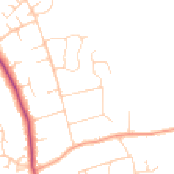
Daytime· 07:00 – 23:00
46.3dB

Everything within walking distance
Schools, transport stops and scenic spots near this property — 36 points of interest in total.
Common questions
The questions buyers, sellers and homeowners most often ask about 2a, Brownswood Road, Beaconsfield, HP9 2NU. Each answer is also embedded as structured data for search engines.
