12 Aspfield Row, Hemel Hempstead, HP1 3HE
About 12 Aspfield Row
12 Aspfield Row is a three-bedroom end-of-terrace house in Hemel Hempstead (HP1 3HE). It has a recorded floor area of 72 m² (around 775 sq ft), construction records dating it to 1950-1966 and council tax band C. The latest certificate (November 2021) shows a D (score 66), on the cusp of jumping into the C band. The recommended improvements would lift it to B (score 85), a 2-band jump. Records show the property has been extended at some point in its history.
Today's modelled estimate of £428,000 is 12.6% above the 2022 sale price. On a £-per-square-foot basis, the last sale (£490/sq ft) was about 45.9% above the typical sold price in the postcode. Most recent transfer: May 2022 at £380,000. That sale was during the post-pandemic price surge, when transactions cleared materially above pre-2020 trend.
What this property has
Inside
- Bedrooms3
- Bathrooms1
- Utility roomYes
- StudyYes
Outside
- Private gardenFront and rear
Building
- Previously extendedYes
- RefurbishedYes
Everything you need to know about 12 Aspfield Row
The true value, the hidden risks and the full sale history, in one report.
Pick your report · every report is £14.99
One time fee only - money back guarantee

The data behind every report


Energy performance
Recommended upgrades on file would lift this property by multiple EPC bands.
EPC Rating
Get a survey for this property
Level 2 HomeBuyer Report
We've checked 10 risk factors against the available data for this property and believe a Level 2 HomeBuyer Report could be a suitable option for you.
From £695 · Includes VAT
Planning history
12 Aspfield Row has no planning applications on record.
But the area is active
1 notable application nearby — larger schemes and conversions that could reshape the street. The report maps them all.
Sales history & valuation
The latest sale landed in the post-pandemic price surge — useful context when reading the figure.
£428,000
Modelled from EPC, postcode comparables.
£380,000
Recorded with HM Land Registry.
Sales timeline
17 May 2022Most recent
£380,000
Median price across the last 5 sales in HP1 3HE: £390,000 (2022–2017).
Nearby sales in HP1 3HE
7 Aspfield Row, Hemel Hempstead, HP1 3HE
Sold Aug 2022
£390,0008 Aspfield Row, Hemel Hempstead, HP1 3HE
Sold May 2022
£400,0003 Aspfield Row, Hemel Hempstead, HP1 3HE
Sold Jan 2022
£362,5006 Aspfield Row, Hemel Hempstead, HP1 3HE
Sold Oct 2018
£426,8002 Aspfield Row, Hemel Hempstead, HP1 3HE
Sold Apr 2017
£347,500
Versus other Aspfield Row homes
12 Aspfield Row outperforms the street on price per m² by a wide margin.
Price per m²
£5,278
Street avg £4,440
Floor Area
72 m²
Street avg 79 m²
Habitable Rooms
5 rooms
Street avg 4 rooms
CO₂ Emissions
3.3 t/year
Street avg 3.6 t/year
Everything you need to know about 12 Aspfield Row
The true value, the hidden risks and the full sale history, in one report.
Pick your report · every report is £14.99
One time fee only - money back guarantee
The data behind every report
Similar properties nearby
1 Fallowfield Walk
HP1 3NZ
1 Gade Valley Cottages, Dagnall Road, Great Gaddesden
HP1 3BW
1 Coulser Close
HP1 3NU
1 Bards Corner
HP1 3RR
1 Church Meadow, Great Gaddesden
HP1 3BS
1 Hasedines Road
HP1 3RA
1 Bodwell Close
HP1 3RG
1 Betjeman Way
HP1 3HH
The neighbourhood at a glance
Crime
16/mo
Steady year-on-year across the wider district.
Nearest stop
0.2 km
Marnham Rise — bus stop.
Closest school
0.4 km
Galley Hill Primary School and Nursery. 25 schools nearby.
Go deeper on the local area
A Local Area report breaks down crime, transport links, schools and air quality in depth.
Road noise across the postcode
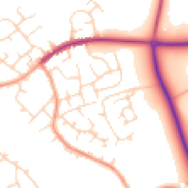
Daytime· 07:00 – 23:00
51.5dB

Night-time· 23:00 – 07:00
42.6dB