109 Marlowes, Hemel Hempstead, HP1 1BB
About 109 Marlowes
109 Marlowes is a property in Hemel Hempstead (HP1 1BB).
3 planning records sit against the property, 3 approved, 0 refused. Past consents include change of use to residential, meaningful when judging how the property has evolved.
Energy performance
No EPC on record
This property doesn't have an Energy Performance Certificate yet. An EPC is required to sell or let — and unlocks our automated valuation.
Get a survey for this property
Level 2 HomeBuyer Report
We've checked 10 risk factors against the available data for this property and believe a Level 2 HomeBuyer Report could be a suitable option for you.
Planning history
- Mar 2022ConditionsOutcome in report
Details required by Condition 2 (noise) attached to Planning permission 21/00251/FUL - Change of use of retail unit (A1) into ancillary residential community room and work from home office space
- Documents
- 4 docs on file
- Reference
- 21/04624/DRC
- Mar 2021Change of UseFullOutcome in report
Change of use of retail unit (A1) into ancillary residential community room and work from home office space
- Documents
- 6 docs on file
- Reference
- 21/00251/FUL
Sales history & valuation
No sales recorded with HM Land Registry
That can mean the property has never traded since the registry began publishing in 1995, was a new build that hasn't been registered yet, or is held in the same hands long-term.
Median price across the last 3 sales in HP1 1BB: £2,000,000 (2023–2014).
Similar properties nearby
The neighbourhood at a glance
Crime
16/mo
Steady year-on-year across the wider district.
Nearest stop
0.1 km
Bridge Street — bus stop.
Closest school
0.5 km
South Hill Primary School. 33 schools nearby.
Road noise across the postcode
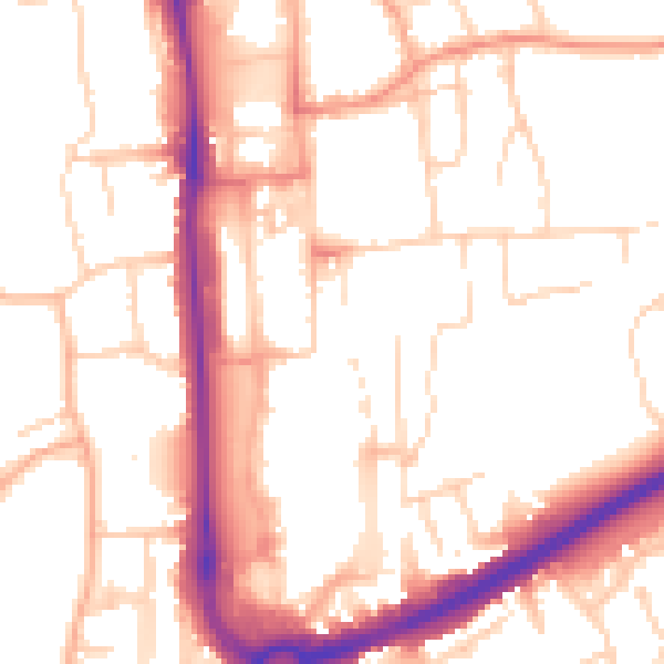
Daytime· 07:00 – 23:00
53.1dB

Night-time· 23:00 – 07:00
43.1dB