30 Uckfield Road, Enfield, EN3 6AT
About 30 Uckfield Road
30 Uckfield Road is a three-bedroom mid-terrace house in Enfield (EN3 6AT). It has a recorded floor area of 105 m² (around 1131 sq ft), construction records dating it to 1900-1929 and council tax band D. The latest certificate (August 2009) shows a D (score 62), on the cusp of jumping into the C band. The recommended improvements would push it to C (score 73). The latest certificate is from August 2009, so improvements made since then won't be reflected.
Held since January 2010 — that's 16 years off the open market, well above the local norm. Today's modelled estimate of £435,000 sits 93.3% above the 2010 sale of £225,000. One planning record on file: a loft conversion approved in 2016. Past consents include a loft conversion, meaningful when judging how the property has evolved. At 105 m² it's 15.5% larger than the typical home in the postcode (91 m² median across 35 EPCs).
What this property has
Inside
- Bedrooms3
Everything you need to know about 30 Uckfield Road
The true value, the hidden risks and the full sale history, in one report.
30-day money-back guarantee

The data behind every report


Energy performance
30 Uckfield Road's EPC is over a decade old — improvements since won't be reflected.
EPC Expired
This certificate is over 10 years old and is no longer valid.Expired 04 Aug 2019
EPC Rating
Planning history
- Jul 2016Loft ConversionOutlineIn report
Rear dormer with rooflights
- Documents
- 6 docs on file
- Reference
- 16/00628/CEA
We flagged 1 thing worth checking at 30 Uckfield Road
Independent checks surfaced things a buyer would want to understand before offering. The report explains each one in full, with the underlying data and what to ask.
- Signs of HMO activity in the area
30-day money-back guarantee
Sales history & valuation
30 Uckfield Road valuation sits well clear of the typical sold price in this postcode.
£435,000
Modelled from EPC, postcode comparables.
£225,000
Recorded with HM Land Registry.
Sales timeline
29 January 2010Most recent
£225,000
Median price across the last 5 sales in EN3 6AT: £390,000 (2024–2021).
Versus other Uckfield Road homes
On floor area, 30 Uckfield Road stands well clear of the street.
Price per m²
£2,142
Street avg £2,835
Floor Area
105 m²
Street avg 96 m²
Habitable Rooms
4 rooms
Street avg 5 rooms
CO₂ Emissions
4.4 t/year
Street avg 4.1 t/year
Everything you need to know about 30 Uckfield Road
The true value, the hidden risks and the full sale history, in one report.
30-day money-back guarantee
The data behind every report
Similar properties nearby
The neighbourhood at a glance
Rail-style transport is unusually close for this postcode.
Crime
8/mo
Rising year-on-year across the wider district.
Nearest stop
0.2 km
Titchfield Road — bus stop.
Closest school
0.2 km
Chesterfield Primary School. 33 schools nearby.
Go deeper on the local area
The full report breaks down crime, transport links, schools and air quality in depth.
Road noise across the postcode
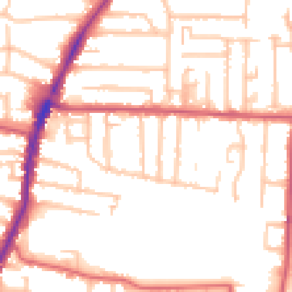
Daytime· 07:00 – 23:00
52.5dB
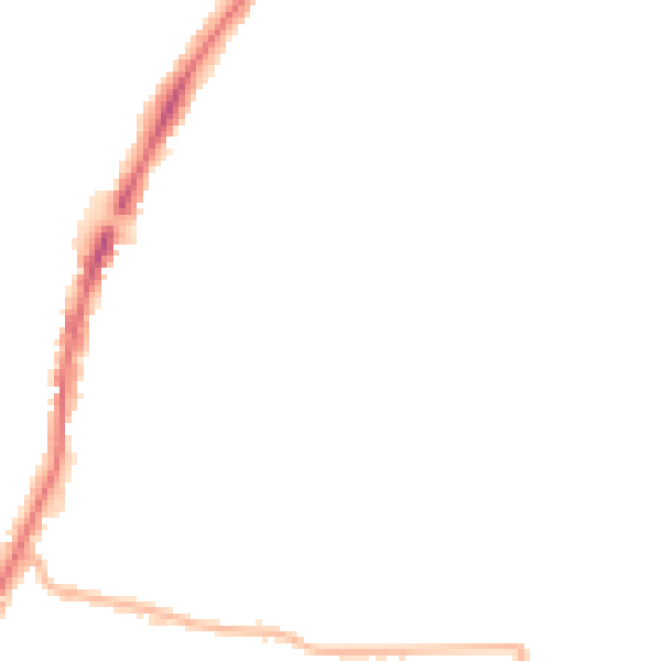
Night-time· 23:00 – 07:00
43.0dB