11 Gullane Drive, Warmsworth, Doncaster, DN4 9NW
About 11 Gullane Drive
11 Gullane Drive is a semi-detached house in Warmsworth, Doncaster, Doncaster (DN4 9NW). It has a recorded floor area of 73 m² (around 786 sq ft), construction records dating it to 1930-1949 and council tax band B. The latest certificate (July 2017) shows a D (score 66), on the cusp of jumping into the C band. The recommended improvements would lift it to B (score 81), a 2-band jump.
Today's modelled estimate of £159,000 sits 67.4% above the 2017 sale of £95,000. Last changed hands 9 years ago, in October 2017.
Everything you need to know about 11 Gullane Drive
The true value, the hidden risks and the full sale history, in one report.
30-day money-back guarantee

The data behind every report


Energy performance
Recommended upgrades on file would lift this property by multiple EPC bands.
EPC Rating
Planning history
11 Gullane Drive has no planning applications on record.
Notable planning nearby
5applications of note in the surrounding area
We flagged 1 thing worth checking at 11 Gullane Drive
Independent checks surfaced things a buyer would want to understand before offering. The report explains each one in full, with the underlying data and what to ask.
- Larger development activity nearby
30-day money-back guarantee
Sales history & valuation
11 Gullane Drive valuation sits well clear of the typical sold price in this postcode.
£159,000
Modelled from EPC, postcode comparables.
£95,000
Recorded with HM Land Registry.
Sales timeline
30 October 2017Most recent
£95,000
Median price across the last 5 sales in DN4 9NW: £148,000 (2024–2019).
Nearby sales in DN4 9NW
7 Gullane Drive, Warmsworth, Doncaster, DN4 9NW
Sold Aug 2024
£145,00013 Gullane Drive, Warmsworth, Doncaster, DN4 9NW
Sold Apr 2021
£150,0001 Gullane Drive, Warmsworth, Doncaster, DN4 9NW
Sold Apr 2021
£195,0005 Gullane Drive, Warmsworth, Doncaster, DN4 9NW
Sold May 2019
£148,0004 Gullane Drive, Warmsworth, Doncaster, DN4 9NW
Sold Apr 2019
£106,000
Versus other Gullane Drive homes
Years Held for 11 Gullane Drive runs comfortably ahead of the street norm.
Price per m²
£1,301
Street avg £1,520
Floor Area
73 m²
Street avg 90 m²
Habitable Rooms
5 rooms
Street avg 6 rooms
CO₂ Emissions
3.3 t/year
Street avg 3.5 t/year
Everything you need to know about 11 Gullane Drive
The true value, the hidden risks and the full sale history, in one report.
30-day money-back guarantee
The data behind every report
Similar properties nearby
The neighbourhood at a glance
Reported crime in the wider district is trending notably upward year-on-year.
Crime
5/mo
Rising year-on-year across the wider district.
Nearest stop
0.2 km
Tenter Lane/Church Lane — bus stop.
Closest school
0.4 km
Waverley Academy. 14 schools nearby.
Go deeper on the local area
The full report breaks down crime, transport links, schools and air quality in depth.
Road noise across the postcode
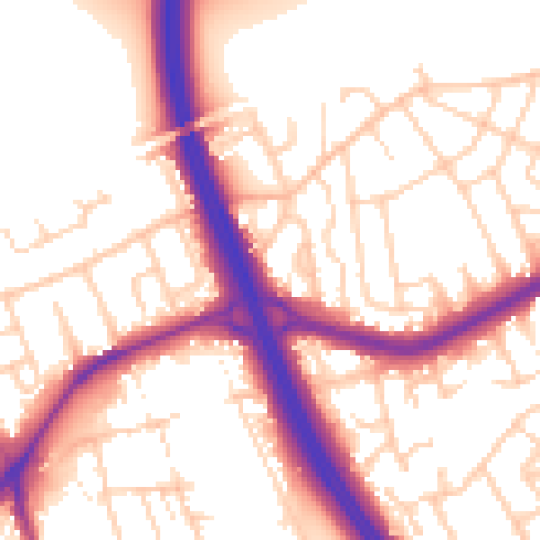
Daytime· 07:00 – 23:00
55.4dB

Night-time· 23:00 – 07:00
47.0dB