127 Hillfield Lane, Stretton, Burton On Trent, DE13 0BL
About 127 Hillfield Lane
127 Hillfield Lane is a three-bedroom semi-detached house in Stretton, Burton-On-Trent, Burton On Trent (DE13 0BL). It has a recorded floor area of 104 m² (around 1119 sq ft), construction records dating it to 1967-1975 and council tax band B. The latest certificate (February 2020) shows an E (score 48), well below the UK norm with real room to improve. The recommended improvements would lift it to B (score 83), a 3-band jump. Other recorded features include notable views. Our model identifies extension potential, subject to local planning policy.
Today's modelled estimate of £227,000 is 31.2% above the 2020 sale price. Sold November 2020 for £173,000.
What this property has
Inside
- Bedrooms3
- Bathrooms1
- Dining roomYes
Outside
- GarageSingle
- Notable viewsYes
Building
- Extension potentialPossible
Everything you need to know about 127 Hillfield Lane
The true value, the hidden risks and the full sale history, in one report.
Pick your report · every report is £14.99
One time fee only - money back guarantee

The data behind every report


Energy performance
127 Hillfield Lane's carbon output runs well above what efficient homes in the postcode produce.
EPC Rating
Get a survey for this property
Level 2 HomeBuyer Report
We've checked 10 risk factors against the available data for this property and believe a Level 2 HomeBuyer Report could be a suitable option for you.
From £545 · Includes VAT
Planning history
127 Hillfield Lane has no planning applications on record.
But the area is active
13 notable applications nearby — larger schemes and conversions that could reshape the street. The report maps them all.
Sales history & valuation
The latest sale landed in the post-pandemic price surge — useful context when reading the figure.
£227,000
Modelled from EPC, postcode comparables.
£173,000
Recorded with HM Land Registry.
Sales timeline
6 November 2020Most recent
£173,000
Median price across the last 4 sales in DE13 0BL: £141,500 (2021–2004).
Everything you need to know about 127 Hillfield Lane
The true value, the hidden risks and the full sale history, in one report.
Pick your report · every report is £14.99
One time fee only - money back guarantee
The data behind every report
Similar properties nearby
1 Beech Lane, Stretton
DE13 0DU
1 Bamborough Close, Stretton
DE13 0WD
1 Barrington Close, Stretton
DE13 0YD
1 Balata Way
DE13 0TY
1 Beam Close
DE13 0AH
1 Bladon View, Stretton
DE13 0JE
1 Ashford Road
DE13 0QG
1 Beaconsfield Road
DE13 0NP
The neighbourhood at a glance
Crime
5/mo
Steady year-on-year across the wider district.
Nearest stop
0.6 km
Thornewill Drive — bus stop.
Closest school
0.7 km
William Shrewsbury Primary School. 18 schools nearby.
Go deeper on the local area
A Local Area report breaks down crime, transport links, schools and air quality in depth.
Road noise across the postcode
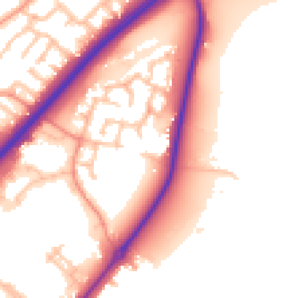
Daytime· 07:00 – 23:00
55.3dB

Night-time· 23:00 – 07:00
47.5dB