33 Fletchamstead Highway, Coventry, CV4 7AW
About 33 Fletchamstead Highway
33 Fletchamstead Highway is a four-bedroom detached house in Coventry (CV4 7AW). It has a recorded floor area of 95 m² (around 1023 sq ft), construction records dating it to 1976-1982 and council tax band E. The latest certificate (January 2017) shows a D (score 63), on the cusp of jumping into the C band. The recommended improvements would lift it to B (score 85), a 2-band jump.
One planning record on file: an extension approved in 2017. Past consents include an extension, meaningful when judging how the property has evolved. Across 2017–2021, sale prices on this property compounded at 13.5% per year. Today's modelled estimate of £540,000 is 16.1% above the 2021 sale price. On a £-per-square-foot basis, the last sale (£455/sq ft) was about 183.6% above the typical sold price in the postcode. At 95 m² it's 29.1% smaller than the typical home in the postcode (134 m² median across 10 EPCs). Most recent transfer: June 2021 at £465,000. That sale was during the post-pandemic price surge, when transactions cleared materially above pre-2020 trend.
Know exactly what you're buying at 33 Fletchamstead Highway
Before you offer, see what the listing won't tell you, the true value, the red flags and the full history.
Already flagged here
Valuation
against the asking price
Risks
planning & flood
Sold prices
similar homes nearby
Trends
the local market
What this property has
Inside
- Bedrooms4
- Bathrooms2
- Dining roomYes
- CloakroomYes
- EnsuiteYes
Outside
- Private gardenSouth-west-facing
Energy performance
Recommended upgrades on file would lift this property by multiple EPC bands.
EPC Rating
Planning history
33 Fletchamstead Highway has an approved side and rear extension on the planning record.
- Nov 2017ExtensionFullIn report
Extension: Side and rear of property
Erection of two storey side and single storey rear extension
- Documents
- 10 docs on file
- Reference
- HH/2017/2321
We flagged 1 thing worth checking at 33 Fletchamstead Highway
Independent checks surfaced things a buyer would want to understand before offering. The report explains each one in full, with the underlying data and what to ask.
- Signs of HMO activity in the area
30-day money-back guarantee
Sales history & valuation
The latest sale landed in the post-pandemic price surge — useful context when reading the figure.
£540,000
Modelled from EPC, postcode comparables and a sale-price growth of 13.5% per year over 4 years.
£465,000
Growth on file: 13.5% per year over 4 years.
Sales timeline
29 June 2021Most recent
£465,000
+63.2%over 3 years17 August 2017
£285,000
Median price across the last 5 sales in CV4 7AW: £368,000 (2022–2014).
Nearby sales in CV4 7AW
31 Fletchamstead Highway, Coventry, CV4 7AW
Sold Jul 2022
£500,00041 Fletchamstead Highway, Coventry, CV4 7AW
Sold Feb 2022
£368,00037 Fletchamstead Highway, Coventry, CV4 7AW
Sold Jun 2020
£265,00021 Fletchamstead Highway, Coventry, CV4 7AW
Sold Mar 2018
£320,0009 Fletchamstead Highway, Coventry, CV4 7AW
Sold Feb 2014
£375,000
Everything we know about 33 Fletchamstead Highway, in one report
What it's really worth, what could be wrong, and the planning, sales and area data in full.
What we flagged
- Signs of HMO activity in the area

Versus other Fletchamstead Highway homes
On price per m², 33 Fletchamstead Highway stands well clear of the street.
Price per m²
£4,895
Street avg £2,126
Floor Area
95 m²
Street avg 139 m²
Habitable Rooms
4 rooms
Street avg 6 rooms
CO₂ Emissions
4.4 t/year
Street avg 6.4 t/year
Similar properties nearby
The neighbourhood at a glance
Crime
7/mo
Steady year-on-year across the wider district.
Nearest stop
1.5 km
Canley Rail Station — railway station.
Closest school
0.7 km
Cannon Park Primary School. 20 schools nearby.
Go deeper on the local area
The full report breaks down crime, transport links, schools and air quality in depth.
Road noise across the postcode
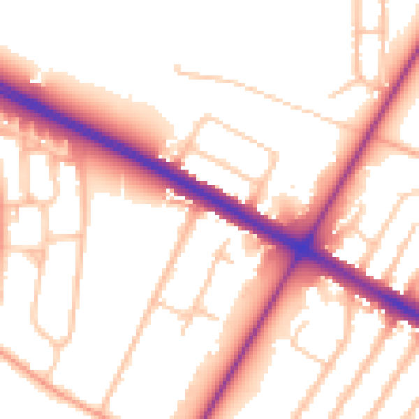
Daytime· 07:00 – 23:00
53.6dB

Night-time· 23:00 – 07:00
45.6dB