Are you a property professional?Get qualified leads from motivated homeowners.
Get started2 Foreland Heights, Ramsgate, CT11 0FF
EPC B
About 2 Foreland Heights
A plain-English summary derived from public records, EPC certificates, sold prices and local data.
2 Foreland Heights is a detached house in Ramsgate (CT11 0FF). It has a recorded floor area of 184 m² (around 1981 sq ft) and construction records dating it to 2021. The latest certificate (April 2022) returns a high B (score 87), putting the home a stone's throw from an A rating. The recommended improvements would push it to A (score 93).
Last sale on file: £590,000 in May 2022. That sale was during the post-pandemic price surge, when transactions cleared materially above pre-2020 trend.
Energy performance
Every EPC certificate filed against this property — current rating, recorded improvements, and where there's headroom to reach a higher band.
EPC Rating
A
B
B87
C
D
E
F
G
Main Heating
Gas
Main Fuel
Gas
Hot Water
Good
Windows
Very Good
CO2 Emissions
2.2 t/year
Occupancy
—
Sales history & valuation
Recorded transactions, our model's current estimate, and a quick read on what neighbouring properties have sold for.
The latest sale landed in the post-pandemic price surge — useful context when reading the figure.
Current estimate
See how we calculated this£629,000
Modelled from EPC, postcode comparables.
Last sold (2022)
£590,000
Recorded with HM Land Registry.
Sales timeline
Versus other Foreland Heights homes
Four headline reads against 13 similar houses on this street, drawn from the latest EPC and Land Registry data.
Price per m²
£3,207
Street avg £3,314
Floor Area
184 m²
Street avg 188 m²
CO₂ Emissions
2.2 t/year
Street avg 2.2 t/year
Similar properties nearby
A handful of close matches in the same postcode area, ranked by likeness on bedrooms, type and floor area.
The neighbourhood at a glance
A condensed read of the local area. Each tile links through to the full breakdown on the Ramsgate district page.
Crime
4/mo
Steady year-on-year across the wider district.
Nearest stop
0.1 km
Nethercourt Circus Canterbury Road — bus stop.
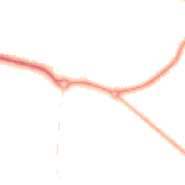
Road noise across the postcode
Modelled day and night-time noise levels around CT11 0FF from Defra's strategic mapping. The pin marks this postcode's centroid.
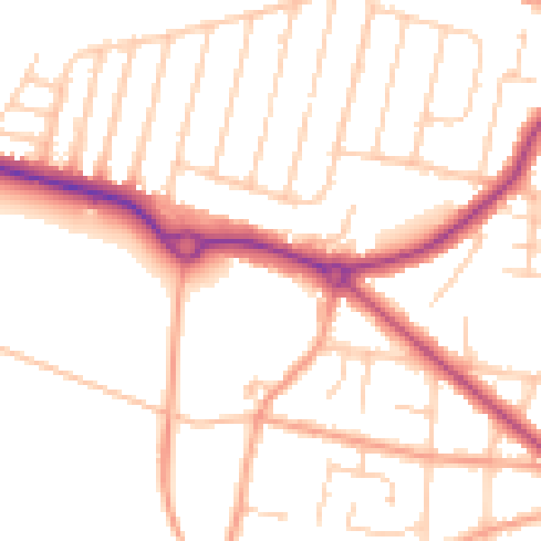
Daytime· 07:00 – 23:00
51.7dB
Everything within walking distance
Schools, transport stops and scenic spots near this property — 42 points of interest in total.
Beautiful places to visit nearby
Curated scenic spots within reach of this postcode, served by Beautifulplaces.ai. Photography and tagging come from their open dataset.
Common questions
The questions buyers, sellers and homeowners most often ask about 2 Foreland Heights, Ramsgate, CT11 0FF. Each answer is also embedded as structured data for search engines.