22 Foundry Lane, Earls Colne, Colchester, CO6 2SB
About 22 Foundry Lane
22 Foundry Lane is a three-bedroom semi-detached house in Earls Colne, Colchester, Colchester (CO6 2SB). It has a recorded floor area of 79 m² (around 850 sq ft), construction records dating it to before 1900 and council tax band B. The latest certificate (September 2017) shows an E (score 52), well below the UK norm with real room to improve. Earlier certificates rated it D (June 2014); the latest reading is one band lower. Between certificates, lighting went from Very Poor to Very Good; while roof efficiency dropped from Very Good to Very Poor. The recommended improvements would lift it to C (score 76), a 2-band jump. Period features are noted in the property record.
Last sale on file: £290,000 in September 2021. Across the public record there are 5 sales, relatively high churn for a single property. That sale was during the post-pandemic price surge, when transactions cleared materially above pre-2020 trend. It lags the bulk of the postcode on energy efficiency (less efficient than 78% of similar EPCs). Across 2001–2021, sale prices on this property compounded at 6.1% per year. Today's modelled estimate of £328,000 is 13.1% above the 2021 sale price. On a £-per-square-foot basis, the last sale (£341/sq ft) was about 89.2% above the typical sold price in the postcode.
Know exactly what you're buying at 22 Foundry Lane
Before you offer, see what the listing won't tell you, the true value, the red flags and the full history.
Valuation
against the asking price
Risks
planning & flood
Sold prices
similar homes nearby
Trends
the local market
What this property has
Inside
- Bedrooms3
- Bathrooms1
Outside
- ParkingOff road
Building
- Central heatingYes
- Period featuresYes
- RefurbishedYes
Energy performance
Recommended upgrades on file would lift this property by multiple EPC bands.
EPC Rating
Property Improvements
Changes detected from historical EPC data
Heating controls upgraded for better temperature management
More low energy lighting installed
Planning history
22 Foundry Lane has no planning applications on record.
The full report still covers planning activity across the surrounding area.
Sales history & valuation
Sale price has grown by over 3x since 2001.
£328,000
Modelled from EPC, postcode comparables and a sale-price growth of 6.1% per year over 20 years.
£290,000
Growth on file: 6.1% per year over 20 years.
Sales timeline
21 September 2021Most recent
£290,000
+16.0%over 3 years22 February 2018
£250,000
+8.7%over 3 years25 November 2014
£230,000
+42.9%over 10 years4 April 2004
£161,000
+81.9%over 2 years23 August 2001
£88,500
Median price across the last 5 sales in CO6 2SB: £305,000 (2025–2023).
Nearby sales in CO6 2SB
41 Foundry Lane, Earls Colne, Colchester, CO6 2SB
Sold Jan 2025
£305,00028 Foundry Lane, Earls Colne, Colchester, CO6 2SB
Sold Dec 2024
£315,00024 Foundry Lane, Earls Colne, Colchester, CO6 2SB
Sold Jul 2023
£201,0003 The Millstore, Foundry Lane, Earls Colne, Colchester, CO6 2SB
Sold May 2023
£1,100,00014 Foundry Lane, Earls Colne, Colchester, CO6 2SB
Sold Apr 2023
£295,000
Everything we know about 22 Foundry Lane, in one report
What it's really worth, what could be wrong, and the planning, sales and area data in full.
- Am I paying too much?
- Is something wrong with it?
- Is the agent's story true?
- Will it hold its value?

Versus other Foundry Lane homes
22 Foundry Lane is notably below the street on years held.
Price per m²
£3,671
Street avg £3,941
Floor Area
79 m²
Street avg 87 m²
Habitable Rooms
5 rooms
Street avg 5 rooms
CO₂ Emissions
5.0 t/year
Street avg 4.3 t/year
Similar properties nearby
1 Atlas Road, Earls Colne
CO6 2LU
1 Bridgewick Cottages, Chappel Hill, Chappel
CO6 2DT
1 Burrows Road, Earls Colne
CO6 2RZ
1 Crepping Hall Cottages, Crepping Hall Road, Wakes Colne
CO6 2AL
1 Countess Cross Cottages, Countess Cross, Colne Engaine
CO6 2HT
1 Church Street, Colne Engaine
CO6 2EX
1 Chappel Hill, Chappel
CO6 2DX
1 Crossways, Colne Engaine
CO6 2JA
The neighbourhood at a glance
Daytime road noise here sits well below conversation level — a quiet pocket of the postcode.
Crime
3/mo
Steady year-on-year across the wider district.
Nearest stop
0.2 km
The Lion — bus stop.
Closest school
0.4 km
Earls Colne Primary School and Nursery. 2 schools nearby.
Go deeper on the local area
The full report breaks down crime, transport links, schools and air quality in depth.
Road noise across the postcode
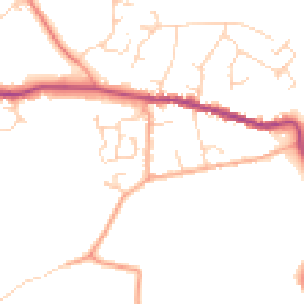
Daytime· 07:00 – 23:00
46.9dB
Night-time· 23:00 – 07:00
38.7dB