8 Sparks Lane, Heswall, Wirral, CH61 7XG
About 8 Sparks Lane
8 Sparks Lane is a three-bedroom semi-detached house in Heswall, Wirral, Wirral (CH61 7XG). It has a recorded floor area of 102 m² (around 1098 sq ft), construction records dating it to 1950-1966 and council tax band D. The latest certificate (September 2024) shows a D (score 60), on the cusp of jumping into the C band. The recommended improvements would lift it to B (score 83), a 2-band jump. The home occupies a corner plot.
Most recent transfer was February 2025 at £276,500 — fresh data. Today's modelled estimate of £309,000 is 11.8% above the 2025 sale price. On a £-per-square-foot basis, the last sale (£252/sq ft) was about 34.5% above the typical sold price in the postcode.
What this property has
Inside
- Bedrooms3
- Bathrooms1
- Dining roomYes
Outside
- Private gardenRear
- GarageYes
- Corner plotYes
Building
- Central heatingYes
Everything you need to know about 8 Sparks Lane
The true value, the hidden risks and the full sale history, in one report.
30-day money-back guarantee

The data behind every report


Energy performance
Recommended upgrades on file would lift this property by multiple EPC bands.
EPC Rating
Planning history
8 Sparks Lane has no planning applications on record.
The full report still covers planning activity across the surrounding area.
Sales history & valuation
8 Sparks Lane valuation sits well clear of the typical sold price in this postcode.
£309,000
Modelled from EPC, postcode comparables.
£276,500
Recorded with HM Land Registry.
Sales timeline
14 February 2025Most recent
£276,500
Median price across the last 5 sales in CH61 7XG: £275,000 (2024–2022).
Nearby sales in CH61 7XG
30 Sparks Lane, Heswall, Wirral, CH61 7XG
Sold Nov 2024
£260,00010 Sparks Lane, Heswall, Wirral, CH61 7XG
Sold Apr 2024
£275,0006 Sparks Lane, Heswall, Wirral, CH61 7XG
Sold Dec 2023
£130,00016 Sparks Lane, Heswall, Wirral, CH61 7XG
Sold Oct 2023
£305,00012 Sparks Lane, Heswall, Wirral, CH61 7XG
Sold Sept 2022
£410,000
Versus other Sparks Lane homes
Years Held for 8 Sparks Lane lags the street by a wide margin.
Price per m²
£2,711
Street avg £2,500
Floor Area
102 m²
Street avg 114 m²
Habitable Rooms
5 rooms
Street avg 6 rooms
CO₂ Emissions
5.1 t/year
Street avg 5.5 t/year
Everything you need to know about 8 Sparks Lane
The true value, the hidden risks and the full sale history, in one report.
30-day money-back guarantee
The data behind every report
Similar properties nearby
1 Colemere Drive
CH61 7XS
10 Beverley Gardens
CH61 7XU
1 Berwyn Avenue, Thingwall
CH61 7UN
1 Ainsdale Close, Thingwall
CH61 7UJ
1 Milton Green
CH61 7YQ
1 Penrhyn Avenue
CH61 7UP
1 Hazeldene Way
CH61 7XL
1 Turmar Avenue
CH61 7XB
The neighbourhood at a glance
Daytime road noise here sits well below conversation level — a quiet pocket of the postcode.
Crime
2/mo
Steady year-on-year across the wider district.
Nearest stop
0.2 km
Sparks Lane — bus stop.
Closest school
0.5 km
Thingwall Primary School. 15 schools nearby.
Go deeper on the local area
The full report breaks down crime, transport links, schools and air quality in depth.
Road noise across the postcode
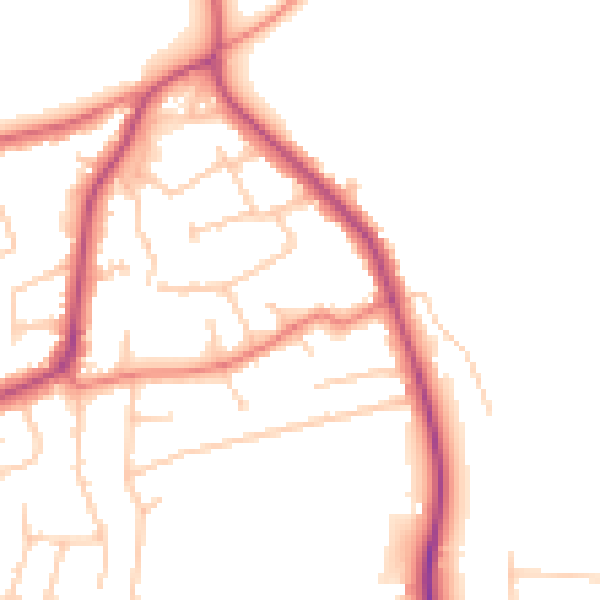
Daytime· 07:00 – 23:00
49.5dB

Night-time· 23:00 – 07:00
40.5dB