54 Witley Avenue, Wirral, CH46 8UT
About 54 Witley Avenue
54 Witley Avenue is a three-bedroom mid-terrace house in Wirral (CH46 8UT). It has a recorded floor area of 87 m² (around 936 sq ft), construction records dating it to 1976-1982 and council tax band A. The latest certificate (September 2017) shows a C (score 76), near the top of the C band. The recommended improvements would push it to B (score 89).
Today's modelled estimate of £168,000 sits 86.7% above the 2018 sale of £90,000. Last sale on file: £90,000 in September 2018.
Know exactly what you're buying at 54 Witley Avenue
Before you offer, see what the listing won't tell you, the true value, the red flags and the full history.
Valuation
against the asking price
Risks
planning & flood
Sold prices
similar homes nearby
Trends
the local market
What this property has
Inside
- Bedrooms3
- Bathrooms2
- Dining roomYes
- CloakroomYes
Outside
- Private gardenYes
- GarageYes
Building
- Heating systemGas
- RefurbishedYes
Energy performance
EPC Rating
Planning history
54 Witley Avenue has no planning applications on record.
The full report still covers planning activity across the surrounding area.
Sales history & valuation
54 Witley Avenue valuation sits well clear of the typical sold price in this postcode.
£168,000
Modelled from EPC, postcode comparables.
£90,000
Recorded with HM Land Registry.
Sales timeline
9 September 2018Most recent
£90,000
Median price across the last 5 sales in CH46 8UT: £105,000 (2023–2019).
Everything we know about 54 Witley Avenue, in one report
What it's really worth, what could be wrong, and the planning, sales and area data in full.
- Am I paying too much?
- Is something wrong with it?
- Is the agent's story true?
- Will it hold its value?

Versus other Witley Avenue homes
54 Witley Avenue outperforms the street on epc rating by a wide margin.
Price per m²
£1,034
Street avg £1,094
Floor Area
87 m²
Street avg 90 m²
Habitable Rooms
5 rooms
Street avg 5 rooms
CO₂ Emissions
2.3 t/year
Street avg 3.4 t/year
Similar properties nearby
The neighbourhood at a glance
Rail-style transport is unusually close for this postcode.
Crime
4/mo
Rising year-on-year across the wider district.
Nearest stop
0.2 km
Ivy Lane — bus stop.
Closest school
0.3 km
Eastway Primary School. 17 schools nearby.
Go deeper on the local area
The full report breaks down crime, transport links, schools and air quality in depth.
Road noise across the postcode
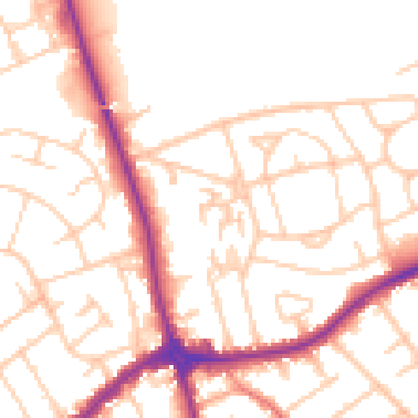
Daytime· 07:00 – 23:00
52.5dB

Night-time· 23:00 – 07:00
42.3dB