Flat 4, 4 Derby Street, Bristol, BS5 9BZ
About Flat 4
Flat 4 is a one-bedroom semi-detached house in Bristol (BS5 9BZ). It has a recorded floor area of 40 m² (around 431 sq ft), construction records dating it to 2003-2006 and council tax band A. At 40 m² this is the 3rd smallest of 5 units on EPC record in the building, where floor areas span 35–42 m². The building's EPC ratings span C to B, with this unit at the bottom. The latest certificate (February 2021) shows a C (score 77), near the top of the C band. Earlier certificates rated it B (February 2010); the latest reading is one band lower. Between certificates, hot-water efficiency dropped from Very Good to Good and main heating dropped from Very Good to Good.
Across 2011–2024, sale prices on this property compounded at 8.2% per year. On a £-per-square-foot basis, the last sale (£336/sq ft) was about 149.1% above the typical sold price in the postcode. Sold August 2024 for £144,500.
What this property has
Inside
- Bedrooms1
- Bathrooms1
Everything you need to know about Flat 4
The true value, the hidden risks and the full sale history, in one report.
30-day money-back guarantee

The data behind every report


Energy performance
Flat 4's carbon output is low for the local stock.
EPC Rating
Planning history
Flat 4 has no planning applications on record.
Notable planning nearby
23applications of note in the surrounding area
We flagged 1 thing worth checking at Flat 4
Independent checks surfaced things a buyer would want to understand before offering. The report explains each one in full, with the underlying data and what to ask.
- Signs of HMO activity in the area
30-day money-back guarantee
Sales history & valuation
Sale price has at least doubled since 2011.
£156,000
Modelled from EPC, postcode comparables and a sale-price growth of 8.2% per year over 13 years.
£144,500
Growth on file: 8.2% per year over 13 years.
Sales timeline
1 August 2024Most recent
£144,500
+177.9%over 12 years15 August 2011
£52,000
Median price across the last 5 sales in BS5 9BZ: £65,000 (2018–2008).
Nearby sales in BS5 9BZ
Versus other Derby Street homes
Years Held for Flat 4 lags the street by a wide margin.
Price per m²
£3,613
Street avg £3,486
Floor Area
40 m²
Street avg 46 m²
Habitable Rooms
2 rooms
Street avg 3 rooms
CO₂ Emissions
1.0 t/year
Street avg 1.2 t/year
Everything you need to know about Flat 4
The true value, the hidden risks and the full sale history, in one report.
30-day money-back guarantee
The data behind every report
Similar properties nearby
110a, Flat, Church Road, Redfield
BS5 9LJ
176 180, Flat 15, Church Road, Redfield
BS5 9HX
176 180, Flat 8, Church Road, Redfield
BS5 9HX
176 180, Flat 6, Church Road, Redfield
BS5 9HX
133 135, Flat 1, Hayward Road, Barton Hill
BS5 9PY
176 180, Flat 13, Church Road, Redfield
BS5 9HX
19 21, Flat 3, Albert Parade
BS5 9EH
19 21, Flat 4, Albert Parade
BS5 9EH
The neighbourhood at a glance
Rail-style transport is unusually close for this postcode.
Crime
11/mo
Steady year-on-year across the wider district.
Nearest stop
0.1 km
Blackswarth Road — bus stop.
Closest school
0.2 km
Redfield Educate Together Primary Academy. 43 schools nearby.
Go deeper on the local area
The full report breaks down crime, transport links, schools and air quality in depth.
Road noise across the postcode
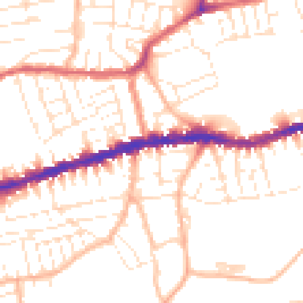
Daytime· 07:00 – 23:00
51.6dB

Night-time· 23:00 – 07:00
41.3dB