14 Charlton Avenue, Bristol, BS34 7QX
About 14 Charlton Avenue
14 Charlton Avenue is a three-bedroom semi-detached house in Bristol (BS34 7QX). It has a recorded floor area of 100 m² (around 1076 sq ft), construction records dating it to 1900-1929 and council tax band C. The latest certificate (August 2024) shows a D (score 65), on the cusp of jumping into the C band. When first surveyed in July 2012 the rating was E, the property has climbed 1 band since. Between certificates, window efficiency went from Average to Good and lighting went from Good to Very Good. The recommended improvements would lift it to B (score 87), a 2-band jump. Period features are noted in the property record. Records show the property has been extended at some point in its history.
Across 1997–2024, sale prices on this property compounded at 7.5% per year. On a £-per-square-foot basis, the last sale (£418/sq ft) was about 99% above the typical sold price in the postcode. Last sale on file: £450,000 in November 2024.
What this property has
Inside
- Bedrooms3
Outside
- Private gardenYes
- GarageYes
Building
- Period featuresYes
- Previously extendedYes
- RefurbishedYes
Everything you need to know about 14 Charlton Avenue
The true value, the hidden risks and the full sale history, in one report.
Pick your report · every report is £14.99
One time fee only - money back guarantee

The data behind every report


Energy performance
Recommended upgrades on file would lift this property by multiple EPC bands.
EPC Rating
Property Improvements
Changes detected from historical EPC data
Heating controls upgraded for better temperature management
Windows upgraded, improving insulation
More low energy lighting installed
Get a survey for this property
Level 3 Building Survey
Because the property was built before 1919 and has solid (non-cavity) walls, we believe a Level 3 building survey should be considered.
From £1,020 · Includes VAT
Planning history
14 Charlton Avenue has no planning applications on record.
But the area is active
130 notable applications nearby — larger schemes and conversions that could reshape the street. The report maps them all.
Sales history & valuation
14 Charlton Avenue has more than quadrupled in price since its earliest registered sale in 1997.
£478,000
Modelled from EPC, postcode comparables and a sale-price growth of 7.5% per year over 27 years.
£450,000
Growth on file: 7.5% per year over 27 years.
Sales timeline
11 November 2024Most recent
£450,000
+105.9%over 11 years16 June 2013
£218,500
+246.8%over 15 years18 September 1997
£63,000
Median price across the last 5 sales in BS34 7QX: £420,000 (2025–2021).
Nearby sales in BS34 7QX
Versus other Charlton Avenue homes
14 Charlton Avenue outperforms the street on price per m² by a wide margin.
Price per m²
£4,500
Street avg £3,160
Floor Area
100 m²
Street avg 110 m²
Habitable Rooms
5 rooms
Street avg 5 rooms
CO₂ Emissions
4.0 t/year
Street avg 5.2 t/year
Everything you need to know about 14 Charlton Avenue
The true value, the hidden risks and the full sale history, in one report.
Pick your report · every report is £14.99
One time fee only - money back guarantee
The data behind every report
Similar properties nearby
1 Charlton Avenue
BS34 7QX
1 Glebelands Road, Filton
BS34 7AD
1 Concorde House, Bevan Court, Filton
BS34 7QN
1 Blenheim Drive, Filton
BS34 7AX
1 Canberra Grove, Filton
BS34 7DH
1 Clyde Grove, Filton
BS34 7RL
1 Elm Park, Filton
BS34 7PR
1 Dunkeld Avenue, Filton
BS34 7RH
The neighbourhood at a glance
Daytime road noise here sits well below conversation level — a quiet pocket of the postcode.
Crime
6/mo
Steady year-on-year across the wider district.
Nearest stop
0.1 km
Golf Course Lane — bus stop.
Closest school
0.2 km
Charborough Road Primary School. 24 schools nearby.
Go deeper on the local area
A Local Area report breaks down crime, transport links, schools and air quality in depth.
Road noise across the postcode
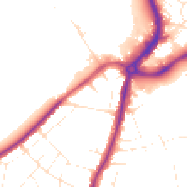
Daytime· 07:00 – 23:00
49.8dB

Night-time· 23:00 – 07:00
41.8dB