9 Midwood Avenue, Bournemouth, BH8 9LX
About 9 Midwood Avenue
9 Midwood Avenue is a three-bedroom detached house in Bournemouth (BH8 9LX). It has a recorded floor area of 94 m² (around 1012 sq ft), construction records dating it to 1930-1949 and council tax band E. The latest certificate (April 2011) shows an F (score 33), near the bottom of the EPC scale. The recommended improvements would push it to E (score 40). The latest certificate is from April 2011, so improvements made since then won't be reflected.
At 94 m² it's 20.3% smaller than the typical home in the postcode (118 m² median across 11 EPCs). On energy efficiency it sits in the bottom 10% of properties in this postcode — significant headroom for improvement. Today's modelled estimate of £400,000 sits 86% above the 2012 sale of £215,000. On a £-per-square-foot basis, the last sale (£212/sq ft) was about 15.2% below the postcode norm. On the market in March 2012 and unlisted since — roughly 14 years.
What this property has
Inside
- Bedrooms3
Everything you need to know about 9 Midwood Avenue
The true value, the hidden risks and the full sale history, in one report.
Pick your report · every report is £14.99
One time fee only - money back guarantee

The data behind every report


Energy performance
9 Midwood Avenue sits at the bottom of the postcode for energy efficiency — meaningful headroom to improve.
EPC Expired
This certificate is over 10 years old and is no longer valid.Expired 17 Apr 2021
EPC Rating
Get a survey for this property
Level 2 HomeBuyer Report
We've checked 10 risk factors against the available data for this property and believe a Level 2 HomeBuyer Report could be a suitable option for you.
From £595 · Includes VAT
Planning history
9 Midwood Avenue has no planning applications on record.
But the area is active
7 notable applications nearby — larger schemes and conversions that could reshape the street. The report maps them all.
Sales history & valuation
£400,000
Modelled from EPC, postcode comparables.
£215,000
Recorded with HM Land Registry.
Sales timeline
23 March 2012Most recent
£215,000
Median price across the last 5 sales in BH8 9LX: £385,500 (2024–2015).
Nearby sales in BH8 9LX
Versus other Midwood Avenue homes
EPC Rating for 9 Midwood Avenue lags the street by a wide margin.
Price per m²
£2,287
Street avg £2,757
Floor Area
94 m²
Street avg 116 m²
Habitable Rooms
5 rooms
Street avg 6 rooms
CO₂ Emissions
10.0 t/year
Street avg 6.1 t/year
Everything you need to know about 9 Midwood Avenue
The true value, the hidden risks and the full sale history, in one report.
Pick your report · every report is £14.99
One time fee only - money back guarantee
The data behind every report
Similar properties nearby
The neighbourhood at a glance
Crime
14/mo
Steady year-on-year across the wider district.
Nearest stop
0.2 km
Mount Pleasant Drive — bus stop.
Closest school
0.7 km
Jewell Academy Bournemouth. 23 schools nearby.
Go deeper on the local area
A Local Area report breaks down crime, transport links, schools and air quality in depth.
Road noise across the postcode
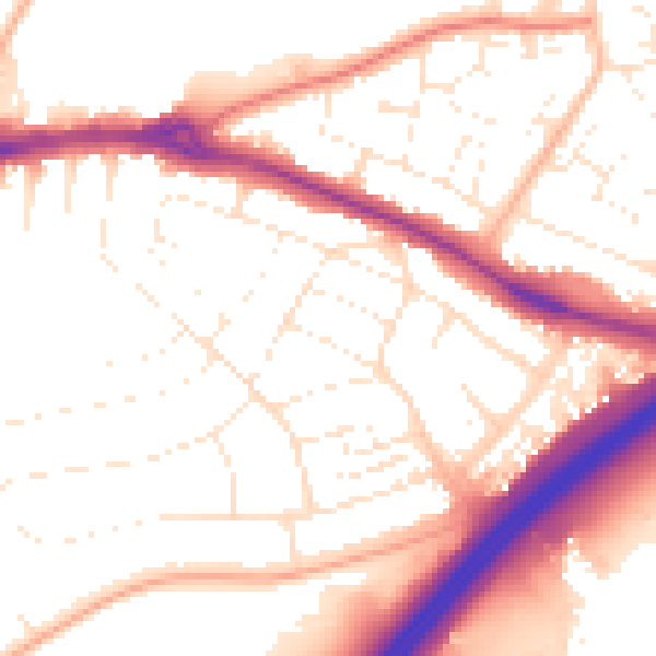
Daytime· 07:00 – 23:00
54.0dB

Night-time· 23:00 – 07:00
44.7dB