4 Longbarrow Close, Bournemouth, BH8 9LL
About 4 Longbarrow Close
4 Longbarrow Close is a two-bedroom detached house in Bournemouth (BH8 9LL). It has a recorded floor area of 85 m² (around 915 sq ft), construction records dating it to 1950-1966 and council tax band D. The latest certificate (May 2018) shows an E (score 53), well below the UK norm with real room to improve. The recommended improvements would lift it to C (score 79), a 2-band jump.
On energy efficiency it sits in the bottom 10% of properties in this postcode — significant headroom for improvement. Today's modelled estimate of £418,000 is 21.2% above the 2018 sale price. On a £-per-square-foot basis, the last sale (£377/sq ft) was about 94.5% above the typical sold price in the postcode. Most recent transfer: October 2018 at £345,000.
What this property has
Inside
- Bedrooms2
- Bathrooms1
- Dining roomYes
- CloakroomYes
Outside
- Private gardenYes
- GarageDetached
Everything you need to know about 4 Longbarrow Close
The true value, the hidden risks and the full sale history, in one report.
Pick your report · every report is £14.99
One time fee only - money back guarantee

The data behind every report


Energy performance
4 Longbarrow Close sits at the bottom of the postcode for energy efficiency — meaningful headroom to improve.
EPC Rating
Get a survey for this property
Level 2 HomeBuyer Report
We've checked 10 risk factors against the available data for this property and believe a Level 2 HomeBuyer Report could be a suitable option for you.
From £695 · Includes VAT
Planning history
4 Longbarrow Close has no planning applications on record.
But the area is active
7 notable applications nearby — larger schemes and conversions that could reshape the street. The report maps them all.
Sales history & valuation
4 Longbarrow Close valuation sits well clear of the typical sold price in this postcode.
£418,000
Modelled from EPC, postcode comparables.
£345,000
Recorded with HM Land Registry.
Sales timeline
17 October 2018Most recent
£345,000
Median price across the last 5 sales in BH8 9LL: £346,000 (2022–2007).
Nearby sales in BH8 9LL
8 Longbarrow Close, Bournemouth, BH8 9LL
Sold Dec 2022
£462,0005 Longbarrow Close, Bournemouth, BH8 9LL
Sold Nov 2015
£415,0003 Longbarrow Close, Bournemouth, BH8 9LL
Sold Jun 2010
£346,0001 Longbarrow Close, Bournemouth, BH8 9LL
Sold Jun 2010
£179,0009 Longbarrow Close, Bournemouth, BH8 9LL
Sold Apr 1999
£65,500
Versus other Longbarrow Close homes
EPC Rating for 4 Longbarrow Close lags the street by a wide margin.
Price per m²
£4,059
Street avg £4,216
Floor Area
85 m²
Street avg 90 m²
Habitable Rooms
3 rooms
Street avg 4 rooms
CO₂ Emissions
4.6 t/year
Street avg 3.6 t/year
Everything you need to know about 4 Longbarrow Close
The true value, the hidden risks and the full sale history, in one report.
Pick your report · every report is £14.99
One time fee only - money back guarantee
The data behind every report
Similar properties nearby
1 Midwood Avenue
BH8 9LX
1 Cromer Road
BH8 9BW
1 Longbarrow Close
BH8 9LL
1 Cooper Dean Drive
BH8 9LN
1 Chigwell Road
BH8 9HW
1 Chapel Gardens
BH8 9BS
1 Castle Gate Close
BH8 9UH
1 Copsewood Avenue
BH8 9NG
The neighbourhood at a glance
Crime
14/mo
Steady year-on-year across the wider district.
Nearest stop
0.1 km
Cooper Dean — bus stop.
Closest school
0.5 km
Jewell Academy Bournemouth. 21 schools nearby.
Go deeper on the local area
A Local Area report breaks down crime, transport links, schools and air quality in depth.
Road noise across the postcode
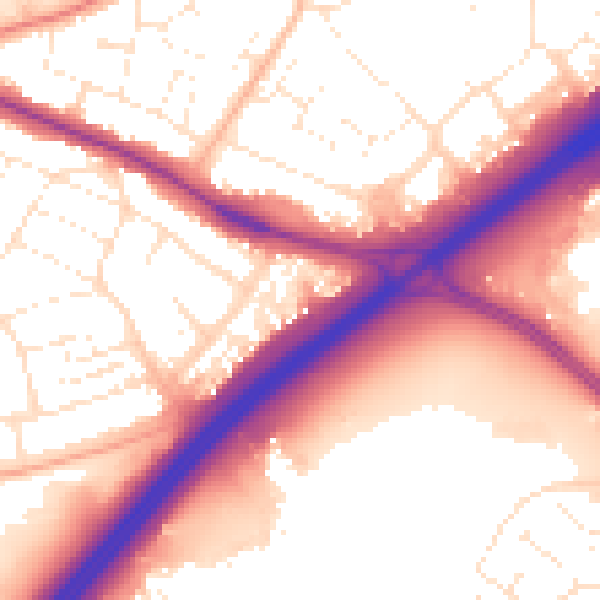
Daytime· 07:00 – 23:00
56.8dB

Night-time· 23:00 – 07:00
48.1dB