Flat D, 41 Throop Road, Bournemouth, BH8 0DE
About Flat D
Flat D is an end-of-terrace house in Bournemouth (BH8 0DE). It has a recorded floor area of 57 m² (around 614 sq ft), construction records dating it to 1967-1975 and council tax band B. The latest certificate (April 2015) shows a D (score 63), on the cusp of jumping into the C band. The recommended improvements would push it to C (score 78). The latest certificate is from April 2015, so improvements made since then won't be reflected.
Untraded for 24 years, with the last transfer in April 2002. Today's modelled estimate of £168,000 sits 211.1% above the 2002 sale of £54,000. On a £-per-square-foot basis, the last sale (£88/sq ft) was about 35.2% above the typical sold price in the postcode.
Everything you need to know about Flat D
The true value, the hidden risks and the full sale history, in one report.
Pick your report · every report is £14.99
One time fee only - money back guarantee

The data behind every report


Energy performance
Flat D's EPC is over a decade old — improvements since won't be reflected.
EPC Expired
This certificate is over 10 years old and is no longer valid.Expired 20 Apr 2025
EPC Rating
Get a survey for this property
Level 2 HomeBuyer Report
We've checked 10 risk factors against the available data for this property and believe a Level 2 HomeBuyer Report could be a suitable option for you.
From £495 · Includes VAT
Planning history
Flat D has no planning applications on record.
A planning report still maps activity across the surrounding area and reads this property's extension & conversion potential.
Sales history & valuation
Flat D's estimated value is more than triple its earliest registered sale price (2002).
£168,000
Modelled from EPC, postcode comparables.
£54,000
Recorded with HM Land Registry.
Sales timeline
15 April 2002Most recent
£54,000
Median price across the last 5 sales in BH8 0DE: £106,000 (2010–2004).
Versus other Throop Road homes
EPC Rating
63 (D)
Street avg 61 (D)
Floor Area
57 m²
Street avg 59 m²
CO₂ Emissions
2.8 t/year
Street avg 3.0 t/year
Habitable Rooms
3 rooms
Street avg 3 rooms
Everything you need to know about Flat D
The true value, the hidden risks and the full sale history, in one report.
Pick your report · every report is £14.99
One time fee only - money back guarantee
The data behind every report
Similar properties nearby
Flat 1, 74 Jewell Road
BH8 0JH
Flat 11, 74 Jewell Road
BH8 0JH
Castledean, Flat 6, 31 Throop Road
BH8 0BY
Flat 1, 63 Seagrim Road
BH8 0BB
Flat 3, 74 Jewell Road
BH8 0JH
Castledean, Flat 13, 31 Throop Road
BH8 0BY
Castledean, Flat 2, 31 Throop Road
BH8 0BY
Castledean, Flat 5, 31 Throop Road
BH8 0BY
The neighbourhood at a glance
Crime
14/mo
Steady year-on-year across the wider district.
Nearest stop
0.2 km
Jewell Academy — bus stop.
Closest school
0.1 km
Jewell Academy Bournemouth. 20 schools nearby.
Go deeper on the local area
A Local Area report breaks down crime, transport links, schools and air quality in depth.
Road noise across the postcode
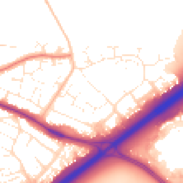
Daytime· 07:00 – 23:00
54.6dB

Night-time· 23:00 – 07:00
46.1dB