4 Bobbin Lane, Bradford, BD2 3FW
About 4 Bobbin Lane
4 Bobbin Lane is a two-bedroom semi-detached house in Bradford (BD2 3FW). It has a recorded floor area of 78 m² (around 840 sq ft) and construction records dating it to 2020. The latest certificate (December 2022) returns a B (score 84), comfortably above the UK average. The recommended improvements would push it to A (score 96).
At 78 m² the property is well over the postcode median (59 m² across 9 EPCs), placing it in the larger end of the local stock. Last sale on file: £239,995 in August 2023.
What this property has
Inside
- Bedrooms2
- EnsuiteYes
Building
- Heating systemGas
Everything you need to know about 4 Bobbin Lane
The true value, the hidden risks and the full sale history, in one report.
Pick your report · every report is £14.99
One time fee only - money back guarantee

The data behind every report


Energy performance
4 Bobbin Lane's carbon output is low for the local stock.
EPC Rating
Get a survey for this property
Level 2 HomeBuyer Report
We've checked 10 risk factors against the available data for this property and believe a Level 2 HomeBuyer Report could be a suitable option for you.
From £545 · Includes VAT
Planning history
4 Bobbin Lane has no planning applications on record.
But the area is active
3 notable applications nearby — larger schemes and conversions that could reshape the street. The report maps them all.
Sales history & valuation
£244,000
Modelled from EPC, postcode comparables.
£239,995
Recorded with HM Land Registry.
Sales timeline
17 August 2023Most recent
£239,995
Median price across the last 3 sales in BD2 3FW: £228,100 (2023–2022).
Versus other Bobbin Lane homes
4 Bobbin Lane is notably below the street on years held.
Price per m²
£3,077
Street avg £4,061
Floor Area
78 m²
Street avg 65 m²
CO₂ Emissions
1.3 t/year
Street avg 1.1 t/year
Years Held
3 years
Street avg 3 years
Everything you need to know about 4 Bobbin Lane
The true value, the hidden risks and the full sale history, in one report.
Pick your report · every report is £14.99
One time fee only - money back guarantee
The data behind every report
Similar properties nearby
1 Cameron Grove, Eccleshill
BD2 3DG
1 Cherry Tree Place
BD2 3FB
1 Charnwood Grove
BD2 3EB
1 Blakehill Terrace
BD2 3JS
1 Ashfield Place, Fagley
BD2 3JB
1 Alexandra Terrace
BD2 3EH
1 Bank Row
BD2 3FT
1 Billets Avenue
BD2 3FD
The neighbourhood at a glance
Crime
3/mo
Steady year-on-year across the wider district.
Nearest stop
0.2 km
Eccleshill Co-op — bus stop.
Closest school
0.2 km
St Luke's CofE Primary School. 36 schools nearby.
Go deeper on the local area
A Local Area report breaks down crime, transport links, schools and air quality in depth.
Road noise across the postcode
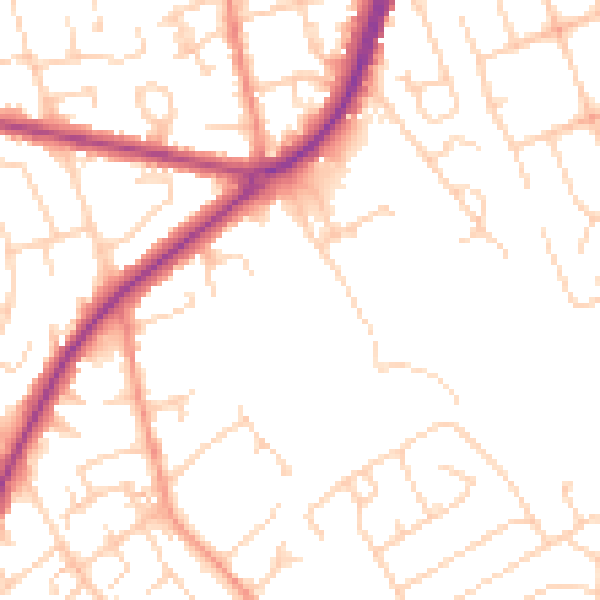
Daytime· 07:00 – 23:00
50.5dB

Night-time· 23:00 – 07:00
40.1dB