Are you a property professional?Get qualified leads from motivated homeowners.
Get startedDetached
1 Chapel Court, Camblesforth, Selby, YO8 8RF
This 296 square metre property in Camblesforth, Selby, Selby carries an energy performance rating of C, which is above the national average. It is heated by a gas central heating system and is currently listed as owner-occupied. The property last sold for £13,000 in 2017, down from £355,000 in an earlier transaction.
Property Type
Detached House
Bedrooms
7
Floor Area
296 m²
Council Tax
Band F
Property Features
Built 2007 Onwards
Get started
Ready to take the next step? Find the right professionals for your property journey.
Energy Performance
EPC rating and efficiency details
EPC Expired
This certificate is over 10 years old and is no longer valid.Expired 23 Jul 2025
EPC Rating
A
B
C
C79
D
E
F
G
Main Heating
Electric & Gas
Main Fuel
Gas
Hot Water
Good
Windows
Good
CO2 Emissions
6.4 t/year
Tenure
Owner Occupied
Price & History
Transactions and market trends
Estimated value
£502,000
How our AI predicts property prices · Accurate to within 10%
Automated estimate only. For an accurate valuation, consult a surveyor or estate agent.
Transaction history
-96.3%(0y)
£13,000Latest
Sept 2017£355,000
Jun 2017£350,000
Jul 2016Source: HM Land Registry
Nearby in YO8 8RF
House Price Index
England+1.5%
101.6
Jan 26
UK HPI from HM Land Registry. Baseline: Jan 2015 = 100.
How This Property Compares on Chapel Court
See how this property stacks up against others nearby
Not enough similar properties in this postcode to make meaningful comparisons.
Get alerts for YO8 8RF
New sales, price changes, and market updates in this area
About Camblesforth, Selby
This property is located in Camblesforth, a village and civil parish in North Yorkshire, situated about five miles south of Selby and seven miles west of Goole, within the YO 8 postal district.
Camblesforth is a village and civil parish in the county of North Yorkshire, England. According to the 2001 Census the civil parish had a population of 1,526, increasing to 1,568 at the 2011 Census. The village is 5 miles (8 km) south of Selby and 7 miles (11 km) west of Goole.
Places to visit
Road Noise
Average road noise levels for this postcode
Daytime
07:00 – 23:00
48.4dB
Low
Night-time
23:00 – 07:00
40.3dB
Low55 dB
60 dB
65 dB
70 dB
75 dB
80 dB
Defra Road Noise Strategic Mapping, Round 4Crime Analysis
8 months of data for Selby
Total Crimes
24
Monthly Avg
3
Recent Trend
Stable
Most Common
Violence & Sexual
Crime by Category
Violence & Sexual12(50%)
Criminal Damage & Arson5(21%)
Public Order4(17%)
Other Theft1(4%)
Robbery1(4%)
Vehicle Crime1(4%)
Recent Incidents
Criminal Damage & Arson
Dec 2025On or near The Crescent
Violence & Sexual
Dec 2025On or near The Crescent
Other Theft
Nov 2025On or near Nightclub
Violence & Sexual
Nov 2025On or near Nightclub
Public Order
Oct 2025On or near The Crescent
Violence & Sexual
Oct 2025On or near Pasture Way
Data from Police UK • Updated monthly
Local Amenities
Schools and transport links nearby
Nearby Schools
3 within 3kmP
Camblesforth Community Primary Academy
384m
5 mins
P
Carlton Primary School
1.8km
21 mins
P
Barlow Church of England Primary School
2.6km
31 mins
Transport Links
30 within 3kmCamela Lane
Bus Stop66m
1 min
Mill Lane
Bus Stop152m
2 mins
Croft Road
Bus Stop237m
3 mins
Grove House
Bus Stop238m
3 mins
Village Hall
Bus Stop238m
3 mins
Comus Inn
Bus Stop362m
4 mins
School data from Dept. for Education • Transport data from NaPTAN
Nearby Property Businesses
Local professionals serving this area
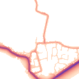
Map
33 points of interest nearby
Map data from OpenStreetMap • Transport data from NaPTAN • School data from Dept. for Education • Scenic data from Beautifulplaces.ai
Frequently Asked Questions
Common questions about this property