Are you a property professional?Get qualified leads from motivated homeowners.
Get startedFlat 2, 137 Holland Park Avenue, London, W11 4UT
1 planning record
About Flat 2
A plain-English summary derived from public records, EPC certificates, sold prices and local data.
Flat 2 is a mid-terrace house in London (W11 4UT). It has a recorded floor area of 75 m² (around 807 sq ft), construction records dating it to before 1900 and council tax band F. At 75 m² this is the 2nd smallest of 5 units on EPC record in the building, where floor areas span 61–96 m². The building's EPC ratings span D to C, with this unit at the bottom. The latest certificate (February 2016) shows a D (score 65), on the cusp of jumping into the C band. The recommended improvements would push it to C (score 79). Main heating runs on electricity. The latest certificate is from February 2016, so improvements made since then won't be reflected.
Untraded for 27 years, with the last transfer in May 1999. Sale prices here have outpaced London HPI: 19.4% per year against 0% for the wider region. Today's modelled estimate of £781,000 sits 212.4% above the 1999 sale of £249,999. On a £-per-square-foot basis, the last sale (£310/sq ft) was about 54.1% below the postcode norm. One planning record on file: an extension approved in 2012. Past consents include an extension, meaningful when judging how the property has evolved. It lags the bulk of the postcode on energy efficiency (less efficient than 73% of similar EPCs).
Energy performance
Every EPC certificate filed against this property — current rating, recorded improvements, and where there's headroom to reach a higher band.
EPC Expired
This certificate is over 10 years old and is no longer valid.Expired 24 Feb 2026
EPC Rating
A
B
C
D
D65
E
F
G
Main Heating
Electric
Main Fuel
Electric
Hot Water
Good
Windows
Average
CO2 Emissions
2.3 t/year
Occupancy
Owner Occupied
Planning history
Applications and permits filed against Flat 2, 137 Holland Park Avenue, London, W11 4UT, sourced from the PlanIt planning register.
Flat 2 has an approved single-storey side extension on the planning record.
- Dec 2012ExtensionFullGrant Planning Permission/Consent
Extension: Single storey · Side of property
Erection of single-storey side extension to ground floor flat to south side of building
Sales history & valuation
Recorded transactions, our model's current estimate, and a quick read on what neighbouring properties have sold for.
Flat 2's modelled value sits at over four times its earliest registered sale price (1997).
Current estimate
See how we calculated this£781,000
Modelled from EPC, postcode comparables and a sale-price growth of 19.4% per year over 2 years.
Last sold (1999)
£249,999
Growth on file: 19.4% per year over 2 years.
Sales timeline
Versus other Holland Park Avenue homes
Four headline reads against 15 similar flats on this street, drawn from the latest EPC and Land Registry data.
Price per m² for Flat 2 lags the street by a wide margin.
Price per m²
£3,333
Street avg £11,380
Floor Area
75 m²
Street avg 70 m²
Habitable Rooms
3 rooms
Street avg 3 rooms
Similar properties nearby
A handful of close matches in the same postcode area, ranked by likeness on bedrooms, type and floor area.
The neighbourhood at a glance
A condensed read of the local area. Each tile links through to the full breakdown on the London district page.
Rail-style transport is unusually close for this postcode.
Crime
18/mo
Rising year-on-year across the wider district.
Nearest stop
0.1 km
Norland Square — bus stop.
Road noise across the postcode
Modelled day and night-time noise levels around W11 4UT from Defra's strategic mapping. The pin marks this postcode's centroid.
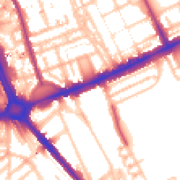
Daytime· 07:00 – 23:00
56.0dB

Everything within walking distance
Schools, transport stops and scenic spots near this property — 109 points of interest in total.
Beautiful places to visit nearby
Curated scenic spots within reach of this postcode, served by Beautifulplaces.ai. Photography and tagging come from their open dataset.
Common questions
The questions buyers, sellers and homeowners most often ask about Flat 2, 137 Holland Park Avenue, London, W11 4UT. Each answer is also embedded as structured data for search engines.