Are you a property professional?Get qualified leads from motivated homeowners.
Get startedPenmullin, School Hill, Shortlanesend, Truro, TR4 9DU
This property in Shortlanesend, Truro, Truro. The property last sold for £425,000 in 2019.
Property Type
Property
Bedrooms
3
Bathrooms
3
Floor Area
— m²
Council Tax
Band N/A
Get started
Ready to take the next step? Find the right professionals for your property journey.
Energy Performance
EPC rating and efficiency details
A
B
C
D
E
F
G
No EPC on record
This property doesn't have an Energy Performance Certificate yet. An EPC helps us give a more accurate valuation and is required to sell or let.
Price & History
Transactions and market trends
Transaction history
+1.2%(2y)
£425,000Latest
Jun 2019£419,950
Apr 2017Source: HM Land Registry
Nearby in TR4 9DU
Cornelly School Hill Shortlanesend Truro TR4 9DU
Apr 2025
£66,574
6 School Hill Shortlanesend Truro TR4 9DU
Sept 2024
£240,000
1 School Hill Shortlanesend Truro TR4 9DU
Aug 2022
£385,500
9 School Hill Shortlanesend Truro TR4 9DU
Dec 2020
£210,000
The Elms School Hill Shortlanesend Truro TR4 9DU
May 2020
£170,000
Bosvean School Hill Shortlanesend Truro TR4 9DU
Jan 2019
£270,000
1 / 3
House Price Index
England+1.5%
101.6
Jan 26
UK HPI from HM Land Registry. Baseline: Jan 2015 = 100.
How This Property Compares on School Hill
See how this property stacks up against others nearby
Not enough similar properties in this postcode to make meaningful comparisons.
Get alerts for TR4 9DU
New sales, price changes, and market updates in this area
About Shortlanesend, Truro
This property is located in Shortlanesend, a locality north of Truro in the TR 4 postal district, within the Cornwall Council area of the former Carrick District.
Shortlanesend is situated miles north of the city of Truro at grid reference SW 805 475. The name was recorded as Penfounder in 1547. It is part of the former Carrick District and now falls within the electoral division Gloweth, Malabar and Shortlanesend, which returns one member to sit on Cornwall Council. The division was created at the 2021 local elections from the former divisions of Chacewater, Kenwyn and Baldhu, and Truro Trehaverne. The current councillor is Karen Margaret La Borde of the Green Party. The locality is included in the postal district TR 4, indicating its proximity to Truro and the surrounding area.
Places to visit
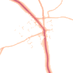
Road Noise
Average road noise levels for this postcode
Daytime
07:00 – 23:00
45.8dB
Low
Night-time
23:00 – 07:00
37.9dB
Low55 dB
60 dB
65 dB
70 dB
75 dB
80 dB
Defra Road Noise Strategic Mapping, Round 4Crime Analysis
4 months of data for Truro
Total Crimes
20
Monthly Avg
5
Recent Trend
Stable
Most Common
Violence & Sexual
Crime by Category
Violence & Sexual15(75%)
Drugs3(15%)
Criminal Damage & Arson1(5%)
Vehicle Crime1(5%)
Recent Incidents
Violence & Sexual
Nov 2025On or near The Pastures
Violence & Sexual
Nov 2025On or near The Pastures
Drugs
Nov 2025On or near Bank Terrace
Violence & Sexual
Nov 2025On or near Bank Terrace
Violence & Sexual
Nov 2025On or near Penhall Lane
Drugs
Nov 2025On or near Bank Terrace
Data from Police UK • Updated monthly
Local Amenities
Schools and transport links nearby
Nearby Schools
4 within 3kmP
Shortlanesend School
129m
2 mins
P
St Mary's CofE School, Truro
2.5km
30 mins
P
Truro Learning Academy
2.7km
32 mins
Transport Links
30 within 3kmPost Office
Bus Stop192m
2 mins
Forge Way
Bus Stop291m
4 mins
Five Acres
Bus Stop1.6km
20 mins
Nursing Home
Bus Stop1.9km
23 mins
Springfield Farm
Bus Stop2.1km
26 mins
Chain Walk Drive
Bus Stop2.3km
28 mins
School data from Dept. for Education • Transport data from NaPTAN
Nearby Property Businesses
Local professionals serving this area
Surveyor
Ward Williams Holdings Limited
Truro
RICS
Surveyor
Stirling Ackroyd Surveyors
Truro
RICSResidential
Surveyor
Ward Williams Associates
Cornwall
RICSResidential
Surveyor
Stratton Creber Commercial
Truro
RICSResidential
Surveyor
Ed Crossley & Associates Limited
Truro
RICS

Cockrams Surveyors Limited
Newham
RICSResidential

Brik Surveyors Ltd
Cornwall
RICSResidential
Surveyor
Alder King LLP
Truro
RICS
Map
34 points of interest nearby
Map data from OpenStreetMap • Transport data from NaPTAN • School data from Dept. for Education • Scenic data from Beautifulplaces.ai
Frequently Asked Questions
Common questions about this property