1 Blackberry Lane, Charing, Ashford, TN27 0BQ
About 1 Blackberry Lane
1 Blackberry Lane is a detached house in Charing, Ashford, Ashford (TN27 0BQ). It has a recorded floor area of 120 m² (around 1292 sq ft). The latest certificate (November 2017) returns a B (score 84), comfortably above the UK average. The recommended improvements would push it to A (score 110).
Today's modelled estimate of £481,000 is 14.5% above the 2018 sale price. Sold June 2018 for £420,000.
Everything you need to know about 1 Blackberry Lane
The true value, the hidden risks and the full sale history, in one report.
30-day money-back guarantee

The data behind every report


Energy performance
EPC Rating
Planning history
1 Blackberry Lane has no planning applications on record.
The full report still covers planning activity across the surrounding area.
Sales history & valuation
£481,000
Modelled from EPC, postcode comparables.
£420,000
Recorded with HM Land Registry.
Sales timeline
11 June 2018Most recent
£420,000
Median price across the last 5 sales in TN27 0BQ: £445,000 (2025–2017).
Nearby sales in TN27 0BQ
6 Blackberry Lane, Charing, Ashford, TN27 0BQ
Sold Feb 2025
£445,0005 Blackberry Lane, Charing, Ashford, TN27 0BQ
Sold Jan 2022
£515,0002 Blackberry Lane, Charing, Ashford, TN27 0BQ
Sold Jan 2018
£450,0004 Blackberry Lane, Charing, Ashford, TN27 0BQ
Sold Nov 2017
£425,0003 Blackberry Lane, Charing, Ashford, TN27 0BQ
Sold Nov 2017
£405,000
Versus other Blackberry Lane homes
1 Blackberry Lane is notably below the street on co₂ emissions.
Price per m²
£3,500
Street avg £3,716
Floor Area
120 m²
Street avg 125 m²
CO₂ Emissions
1.9 t/year
Street avg 1.7 t/year
Years Held
8 years
Street avg 6 years
Everything you need to know about 1 Blackberry Lane
The true value, the hidden risks and the full sale history, in one report.
30-day money-back guarantee
The data behind every report
Similar properties nearby
1 Chambers Green Cottage, Chambers Green Road, Pluckley
TN27 0RJ
1 Bowl Cottages, Bowl Road, Charing
TN27 0HB
1 Brook Cottages, Charing Heath Road, Charing
TN27 0AL
1 High Street, Charing
TN27 0HU
1 Cherry Tree Road, Charing Heath
TN27 0BB
1 Bankwood, Warren Street Road, Charing
TN27 0HL
1 Brenchley Mews, Charing
TN27 0JQ
1 Dering Terrace, Station Road, Pluckley
TN27 0RP
The neighbourhood at a glance
Rail-style transport is unusually close for this postcode.
Crime
2/mo
Steady year-on-year across the wider district.
Nearest stop
0.2 km
Charing (Kent) Rail Station — railway station.
Closest school
0.5 km
Charing Church of England Primary School. 1 school nearby.
Go deeper on the local area
The full report breaks down crime, transport links, schools and air quality in depth.
Road noise across the postcode
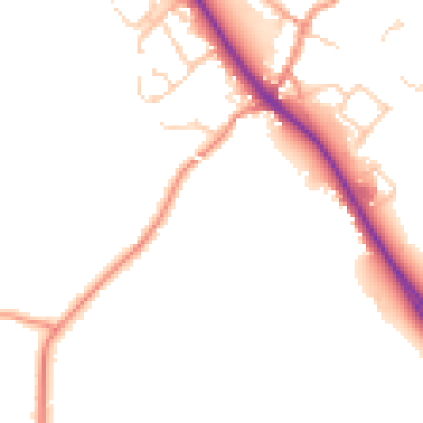
Daytime· 07:00 – 23:00
49.8dB

Night-time· 23:00 – 07:00
41.5dB