1a, Emu Road, Wandsworth, London, SW8 3PS
4 sales on record
About 1a
A plain-English summary derived from public records, EPC certificates, sold prices and local data.
1a is a two-bedroom semi-detached house in Wandsworth, London, London (SW8 3PS). It has a recorded floor area of 98 m² (around 1055 sq ft), construction records dating it to 1900-1929 and council tax band D. The latest certificate (April 2021) shows an E (score 52), well below the UK norm with real room to improve. Earlier certificates rated it C (February 2011); the latest reading is 2 bands lower. Between certificates, roof efficiency dropped from Good to Very Poor and hot-water efficiency dropped from Good to Average. The recommended improvements would lift it to B (score 85), a 3-band jump.
Sale prices here have outpaced London HPI: 6% per year against 0% for the wider region. Today's modelled estimate of £895,000 is 16.2% above the 2021 sale price. On a £-per-square-foot basis, the last sale (£730/sq ft) was about 32.5% above the typical sold price in the postcode. At 98 m² the property is well over the postcode median (62 m² across 11 EPCs), placing it in the larger end of the local stock. On energy efficiency it sits in the bottom 10% of properties in this postcode — significant headroom for improvement. Last sale on file: £770,000 in September 2021. Across the public record there are 4 sales, relatively high churn for a single property. That sale was during the post-pandemic price surge, when transactions cleared materially above pre-2020 trend.
What this property has
Pulled from EPC certificates, claim submissions and our property model. Empty categories are hidden — we only show what's known.
Inside
- Bedrooms2
- Bathrooms1
Outside
- Private gardenYes
Energy performance
Every EPC certificate filed against this property — current rating, recorded improvements, and where there's headroom to reach a higher band.
1a sits at the bottom of the postcode for energy efficiency — meaningful headroom to improve.
Current Certificate(1 of 2)
Apr 2021
EPC Rating
A
B
C
D
E
E52
F
G
Main Heating
Gas
Main Fuel
Gas
Hot Water
Average
Windows
Average
CO2 Emissions
5.3 t/year
Occupancy
Owner Occupied
Planning history
Applications and permits filed against 1a, Emu Road, Wandsworth, London, SW8 3PS, sourced from the PlanIt planning register.
No planning applications are recorded against 1a, Emu Road, Wandsworth, London, SW8 3PS. The full report also covers planning activity across the surrounding area.
Full planning data for 1a, Emu Road, Wandsworth, London, SW8 3PS
Every application and decision on this property and nearby, in full, in the report.
Sales history & valuation
Recorded transactions, our model's current estimate, and a quick read on what neighbouring properties have sold for.
1a has more than doubled in price since the earliest registered sale in 2007.
Current estimate
See how we calculated this£895,000
Modelled from EPC, postcode comparables and a sale-price growth of 6.0% per year over 14 years.
Last sold (2021)
£770,000
Growth on file: 6.0% per year over 14 years.
Sales timeline
Launch offer · 33% off
The complete analysis of 1a, Emu Road, Wandsworth, London, SW8 3PS
Everything we know about this property, compiled into one in-depth, downloadable report.
Detailed analysis
A written breakdown of everything that matters
Similar properties nearby
A handful of close matches in the same postcode area, ranked by likeness on bedrooms, type and floor area.
The neighbourhood at a glance
A condensed read of the local area. Each tile links through to the full breakdown on the London district page.
Rail-style transport is unusually close for this postcode.
Crime
12/mo
Rising year-on-year across the wider district.
Nearest stop
0.1 km
Prairie Street — bus stop.
Road noise across the postcode
Modelled day and night-time noise levels around SW8 3PS from Defra's strategic mapping. The pin marks this postcode's centroid.
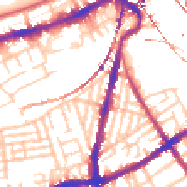
Daytime· 07:00 – 23:00
54.7dB

Everything within walking distance
Schools, transport stops and scenic spots near this property — 107 points of interest in total.
Common questions
The questions buyers, sellers and homeowners most often ask about 1a, Emu Road, Wandsworth, London, SW8 3PS. Each answer is also embedded as structured data for search engines.
