Are you a property professional?Get qualified leads from motivated homeowners.
Get started1 Ponsonby Road, Wandsworth, London, SW15 4LA
3 planning records
About 1 Ponsonby Road
A plain-English summary derived from public records, EPC certificates, sold prices and local data.
1 Ponsonby Road is a three-bedroom semi-detached house in Wandsworth, London, London (SW15 4LA). It has a recorded floor area of 151 m² (around 1625 sq ft), construction records dating it to before 1900 and council tax band F. The latest certificate (January 2022) shows a D (score 59), a step below the typical UK home. When first surveyed in March 2020 the rating was G, the property has climbed 3 bands since. Between certificates, wall efficiency went from Very Poor to Poor, roof efficiency went from Very Poor to Good and window efficiency went from Very Poor to Good. The recommended improvements would push it to C (score 79).
Sale prices here have outpaced London HPI: 13.1% per year against 0% for the wider region. On a £-per-square-foot basis, the last sale (£744/sq ft) was about 52% above the typical sold price in the postcode. 3 planning records sit against the property, 1 approved, 1 refused. Past consents include an extension and new windows, meaningful when judging how the property has evolved. Sold March 2023 for £1,210,000.
What this property has
Pulled from EPC certificates, claim submissions and our property model. Empty categories are hidden — we only show what's known.
Inside
- Bedrooms3
- Bathrooms2
Energy performance
Every EPC certificate filed against this property — current rating, recorded improvements, and where there's headroom to reach a higher band.
1 Ponsonby Road's carbon output runs well above what efficient homes in the postcode produce.
Current Certificate(1 of 2)
Jan 2022
EPC Rating
A
B
C
D
D59
E
F
G
Main Heating
Gas
Main Fuel
Gas
Hot Water
Average
Windows
Good
CO2 Emissions
6.9 t/year
Occupancy
Owner Occupied
Planning history
Applications and permits filed against 1 Ponsonby Road, Wandsworth, London, SW15 4LA, sourced from the PlanIt planning register.
1 Ponsonby Road has an approved side and rear extension on the planning record.
- Feb 2021ExtensionFullApprove with Conditions
Extension: Side and rear of property
Erection of a rear/side extension. Alterations to include the replacement of double hung sash windows; hard landscaping and reroofing original roof.
Sales history & valuation
Recorded transactions, our model's current estimate, and a quick read on what neighbouring properties have sold for.
1 Ponsonby Road valuation sits well clear of the typical sold price in this postcode.
Current estimate
See how we calculated this£1,096,000
Modelled from EPC, postcode comparables and a sale-price growth of 13.1% per year over 3 years.
Last sold (2023)
£1,210,000
Growth on file: 13.1% per year over 3 years.
Sales timeline
Versus other Ponsonby Road homes
Four headline reads against 5 similar houses on this street, drawn from the latest EPC and Land Registry data.
On years held, 1 Ponsonby Road runs well behind the street norm.
Price per m²
£8,013
Street avg £6,925
Floor Area
151 m²
Street avg 186 m²
Habitable Rooms
6 rooms
Street avg 7 rooms
Similar properties nearby
A handful of close matches in the same postcode area, ranked by likeness on bedrooms, type and floor area.
The neighbourhood at a glance
A condensed read of the local area. Each tile links through to the full breakdown on the London district page.
Reported crime in the wider district is trending notably upward year-on-year.
Crime
7/mo
Rising year-on-year across the wider district.
Nearest stop
0.1 km
Roehampton Lane / Danebury Ave — bus stop.
Road noise across the postcode
Modelled day and night-time noise levels around SW15 4LA from Defra's strategic mapping. The pin marks this postcode's centroid.
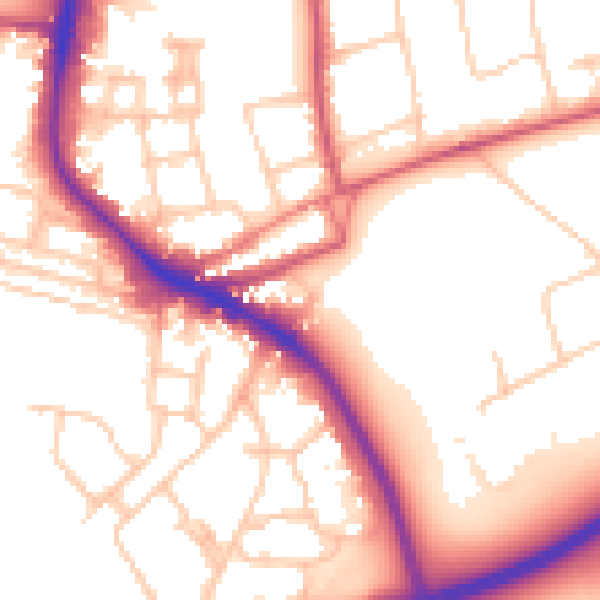
Daytime· 07:00 – 23:00
54.4dB

Everything within walking distance
Schools, transport stops and scenic spots near this property — 63 points of interest in total.
Beautiful places to visit nearby
Curated scenic spots within reach of this postcode, served by Beautifulplaces.ai. Photography and tagging come from their open dataset.
Common questions
The questions buyers, sellers and homeowners most often ask about 1 Ponsonby Road, Wandsworth, London, SW15 4LA. Each answer is also embedded as structured data for search engines.