Are you a property professional?Get qualified leads from motivated homeowners.
Get started4 Burkal Drive, Andover, SP10 4NA
4 sales on record
About 4 Burkal Drive
A plain-English summary derived from public records, EPC certificates, sold prices and local data.
4 Burkal Drive is a four-bedroom detached house in Andover (SP10 4NA). It has a recorded floor area of 135 m² (around 1454 sq ft), construction records dating it to 1996-2002 and council tax band F. The latest certificate (July 2011) shows a D (score 66), on the cusp of jumping into the C band. The recommended improvements would push it to C (score 70). The latest certificate is from July 2011, so improvements made since then won't be reflected. Other recorded features include a conservatory.
Sale prices here have outpaced England HPI: 5.1% per year against 0% for the wider region. On a £-per-square-foot basis, the last sale (£335/sq ft) was about 102.4% above the typical sold price in the postcode. Last sale on file: £487,000 in June 2021. Across the public record there are 4 sales, relatively high churn for a single property. That sale was during the post-pandemic price surge, when transactions cleared materially above pre-2020 trend.
What this property has
Pulled from EPC certificates, claim submissions and our property model. Empty categories are hidden — we only show what's known.
Inside
- Bedrooms4
- Bathrooms2
- Dining roomYes
- CloakroomYes
Energy performance
Every EPC certificate filed against this property — current rating, recorded improvements, and where there's headroom to reach a higher band.
4 Burkal Drive's EPC is over a decade old — improvements since won't be reflected.
EPC Expired
This certificate is over 10 years old and is no longer valid.Expired 27 Jul 2021
Sales history & valuation
Recorded transactions, our model's current estimate, and a quick read on what neighbouring properties have sold for.
4 Burkal Drive has more than tripled in price since its earliest registered sale in 1999.
Current estimate
See how we calculated this£526,000
Modelled from EPC, postcode comparables and a sale-price growth of 5.1% per year over 22 years.
Last sold (2021)
£487,000
Growth on file: 5.1% per year over 22 years.
Sales timeline
Launch offer · 33% off
Buying 4 Burkal Drive, Andover, SP10 4NA? Know what you're getting into
Everything a buyer needs to know about this property, compiled into one in-depth report so there are no surprises after you offer.
Spot red flags before you buy
An AI-written breakdown of everything that matters
Versus other Burkal Drive homes
Four headline reads against 6 similar houses on this street, drawn from the latest EPC and Land Registry data.
4 Burkal Drive is notably below the street on years held.
Price per m²
£3,606
Street avg £2,790
Floor Area
135 m²
Street avg 132 m²
Habitable Rooms
8 rooms
Street avg 7 rooms
Similar properties nearby
A handful of close matches in the same postcode area, ranked by likeness on bedrooms, type and floor area.
The neighbourhood at a glance
A condensed read of the local area. Each tile links through to the full breakdown on the Andover district page.
Daytime road noise here sits well below conversation level — a quiet pocket of the postcode.
Crime
4/mo
Steady year-on-year across the wider district.
Nearest stop
0.1 km
Road noise across the postcode
Modelled day and night-time noise levels around SP10 4NA from Defra's strategic mapping. The pin marks this postcode's centroid.
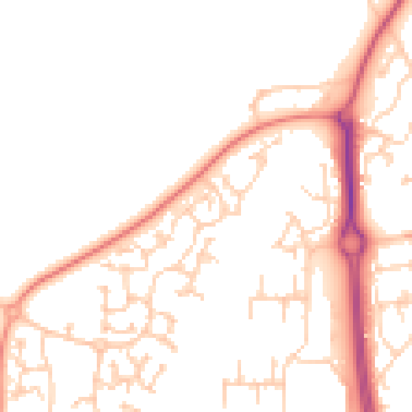
Daytime· 07:00 – 23:00
49.1dB

Everything within walking distance
Schools, transport stops and scenic spots near this property — 44 points of interest in total.
Common questions
The questions buyers, sellers and homeowners most often ask about 4 Burkal Drive, Andover, SP10 4NA. Each answer is also embedded as structured data for search engines.
