Are you a property professional?Get qualified leads from motivated homeowners.
Get started27 Bishops Way, Andover, SP10 3EH
3 sales on record
About 27 Bishops Way
A plain-English summary derived from public records, EPC certificates, sold prices and local data.
27 Bishops Way is a four-bedroom semi-detached house in Andover (SP10 3EH). It has a recorded floor area of 170 m² (around 1830 sq ft), construction records dating it to 1930-1949 and council tax band D. The latest certificate (May 2016) shows a D (score 57), a step below the typical UK home. The recommended improvements would push it to C (score 78). The latest certificate is from May 2016, so improvements made since then won't be reflected. Records show the property has been extended at some point in its history.
Sale prices here have outpaced England HPI: 5.5% per year against 0% for the wider region. At 170 m² the property is well over the postcode median (119 m² across 30 EPCs), placing it in the larger end of the local stock. 2 planning records sit against the property, 0 approved, 0 refused. Most recent transfer: October 2022 at £575,000. That sale was during the post-pandemic price surge, when transactions cleared materially above pre-2020 trend.
What this property has
Pulled from EPC certificates, claim submissions and our property model. Empty categories are hidden — we only show what's known.
Inside
- Bedrooms4
- Bathrooms3
Outside
- Private gardenrear
- Garage
Energy performance
Every EPC certificate filed against this property — current rating, recorded improvements, and where there's headroom to reach a higher band.
27 Bishops Way's carbon output runs well above what efficient homes in the postcode produce.
EPC Expired
This certificate is over 10 years old and is no longer valid.Expired 16 May 2026
Planning history
Applications and permits filed against 27 Bishops Way, Andover, SP10 3EH, sourced from the PlanIt planning register.
Council records include a part-single-part-two-storey extension at 27 Bishops Way.
- Jun 2006ExtensionFullPERMISSION subject to conditions & notes
Extension: Part single, part two storey
Erection of single, two storey and first floor extensions to provide additional living accommodation
Sales history & valuation
Recorded transactions, our model's current estimate, and a quick read on what neighbouring properties have sold for.
27 Bishops Way has more than doubled in price since the earliest registered sale in 2005.
Current estimate
See how we calculated this£607,000
Modelled from EPC, postcode comparables and a sale-price growth of 5.5% per year over 17 years.
Last sold (2022)
£575,000
Growth on file: 5.5% per year over 17 years.
Sales timeline
Launch offer · 33% off
Buying 27 Bishops Way, Andover, SP10 3EH? Know what you're getting into
Everything a buyer needs to know about this property, compiled into one in-depth report so there are no surprises after you offer.
Spot red flags before you buy
An AI-written breakdown of everything that matters
Versus other Bishops Way homes
Four headline reads against 30 similar houses on this street, drawn from the latest EPC and Land Registry data.
CO₂ Emissions for 27 Bishops Way lags the street by a wide margin.
Price per m²
£3,382
Street avg £3,690
Floor Area
170 m²
Street avg 124 m²
Habitable Rooms
7 rooms
Similar properties nearby
A handful of close matches in the same postcode area, ranked by likeness on bedrooms, type and floor area.
The neighbourhood at a glance
A condensed read of the local area. Each tile links through to the full breakdown on the Andover district page.
Rail-style transport is unusually close for this postcode.
Crime
4/mo
Steady year-on-year across the wider district.
Nearest stop
0.2 km
Temp - Andover Station — bus stop.
Road noise across the postcode
Modelled day and night-time noise levels around SP10 3EH from Defra's strategic mapping. The pin marks this postcode's centroid.
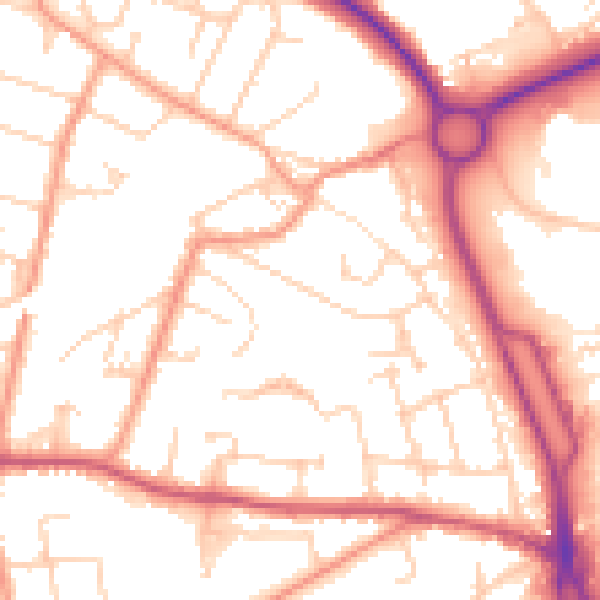
Daytime· 07:00 – 23:00
53.2dB

Everything within walking distance
Schools, transport stops and scenic spots near this property — 46 points of interest in total.
Common questions
The questions buyers, sellers and homeowners most often ask about 27 Bishops Way, Andover, SP10 3EH. Each answer is also embedded as structured data for search engines.
