11 Cromwell Gardens, Marlow, SL7 1BG
About 11 Cromwell Gardens
11 Cromwell Gardens is a five-bedroom detached house in Marlow (SL7 1BG). It has a recorded floor area of 241 m² (around 2594 sq ft), construction records dating it to 1991-1995 and council tax band G. The latest certificate (March 2022) shows a C (score 75), near the top of the C band. Other recorded features include a basement. Records show the property has been extended at some point in its history.
Untraded for 19 years, with the last transfer in April 2007. That sale landed at the peak of the pre-credit-crunch market, which is a useful reference point when interpreting the price. At 241 m² the property is well over the postcode median (143 m² across 5 EPCs), placing it in the larger end of the local stock. 5 bedrooms is on the larger side for this postcode, where 3 is the typical count. Across 1997–2007, sale prices on this property compounded at 13% per year. Today's modelled estimate of £1,700,000 sits 86.8% above the 2007 sale of £910,000. 11 planning records sit against the property, 6 approved, 3 refused. Past consents include tree works, an extension and a loft conversion, meaningful when judging how the property has evolved.
Know exactly what you're buying at 11 Cromwell Gardens
Before you offer, see what the listing won't tell you, the true value, the red flags and the full history.
Valuation
against the asking price
Risks
planning & flood
Sold prices
similar homes nearby
Trends
the local market
What this property has
Inside
- Bedrooms5
- Bathrooms4
- Open-plan layoutYes
- BasementYes
Building
- Previously extendedYes
- RefurbishedYes
Energy performance
EPC Rating
Planning history
Planning history includes recorded demolition works, indicating a major rebuild phase at this address.
- Mar 2016Tree WorksTreesIn report
Lightly reduce overall crown dimensions of mature Beech T1 by no more than 1.5 metres (height and lateral spread) pruning back to appropriate growth points, crown clean removing broken, damaged, crossing and rubbing branches, and install anti-pigeon spikes.
- Documents
- 4 docs on file
- Reference
- 16/05260/TPO
- Jan 2015ExtensionAmendmentIn report
Extension: Rear of property
Proposed non-material amendment to permission for Householder application for demolition of existing conservatory and erection of single storey rear extension, insertion of rear dormer window in connection with loft conversion and associated external and internal alterations granted under 12/05123/FUL
- Documents
- 1 doc on file
- Reference
- 14/08265/MINAMD
What's in 11 Cromwell Gardens, Marlow, SL7 1BG's planning history?
9 more on this property, plus refusals, disputes and full decisions nearby, in the report.
Sales history & valuation
11 Cromwell Gardens has more than tripled in price since its earliest registered sale in 1997.
£1,700,000
Modelled from EPC, postcode comparables and a sale-price growth of 13.0% per year over 9 years.
£910,000
Growth on file: 13.0% per year over 9 years.
Sales timeline
4 April 2007Most recent
£910,000
+216.5%over 9 years31 October 1997
£287,500
Median price across the last 5 sales in SL7 1BG: £915,000 (2025–2013).
Nearby sales in SL7 1BG
Everything we know about 11 Cromwell Gardens, in one report
What it's really worth, what could be wrong, and the planning, sales and area data in full.
- Am I paying too much?
- Is something wrong with it?
- Is the agent's story true?
- Will it hold its value?

Versus other Cromwell Gardens homes
11 Cromwell Gardens is notably below the street on co₂ emissions.
Price per m²
£3,776
Street avg £7,467
Floor Area
241 m²
Street avg 154 m²
Habitable Rooms
7 rooms
Street avg 5 rooms
CO₂ Emissions
5.8 t/year
Street avg 3.2 t/year
Similar properties nearby
1 Beaumont Rise
SL7 1EF
1 Davis Close
SL7 1SY
1 Carlton Place
SL7 1AL
1 Archers Court, Station Road
SL7 1PT
1 Claremont Gardens
SL7 1BP
1 Dedmere Rise
SL7 1PQ
1 Beaufort Close
SL7 1EN
1 Allanson Road
SL7 1LE
The neighbourhood at a glance
Rail-style transport is unusually close for this postcode.
Crime
3/mo
Steady year-on-year across the wider district.
Nearest stop
0.1 km
High Street — bus stop.
Closest school
0.5 km
Holy Trinity Church of England (Aided) School. 11 schools nearby.
Go deeper on the local area
The full report breaks down crime, transport links, schools and air quality in depth.
Road noise across the postcode
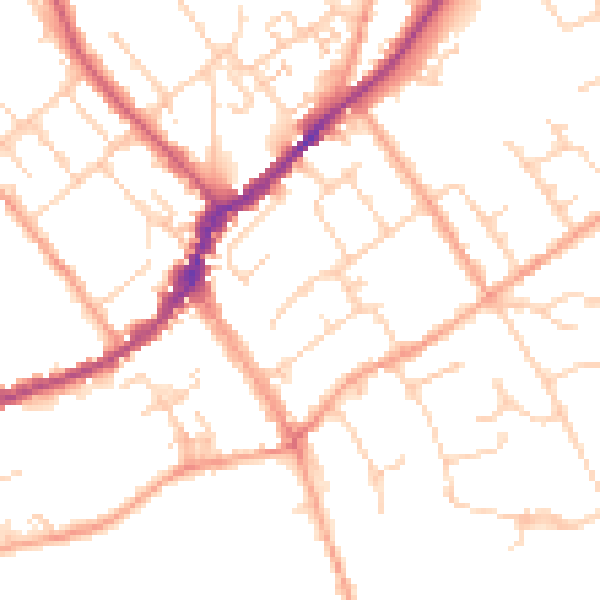
Daytime· 07:00 – 23:00
50.9dB

Night-time· 23:00 – 07:00
41.0dB