Are you a property professional?Get qualified leads from motivated homeowners.
Get started4 Broad Walk, Wilmslow, SK9 5PJ
4 sales on record6 planning records
About 4 Broad Walk
A plain-English summary derived from public records, EPC certificates, sold prices and local data.
4 Broad Walk is a detached house in Wilmslow (SK9 5PJ). It has a recorded floor area of 411 m² (around 4424 sq ft), construction records dating it to 1930-1949 and council tax band G. The latest certificate (December 2019) shows a C (score 71). When first surveyed in January 2010 the rating was D, the property has climbed 1 band since. Between certificates, wall efficiency went from Poor to Average and lighting went from Very Poor to Very Good; while window efficiency dropped from Good to Average and hot-water efficiency dropped from Very Good to Good.
Sale prices here have outpaced England HPI: 6.4% per year against 0% for the wider region. Today's modelled estimate of £1,640,000 is 32.8% above the 2020 sale price. On a £-per-square-foot basis, the last sale (£279/sq ft) was about 92.3% above the typical sold price in the postcode. At 411 m² the property is well over the postcode median (190 m² across 16 EPCs), placing it in the larger end of the local stock. Sold November 2020 for £1,235,000. Across the public record there are 4 sales, relatively high churn for a single property. 6 planning records sit against the property, 5 approved, 1 refused. Past consents include an extension, a loft conversion, a porch and a conservatory, meaningful when judging how the property has evolved.
Energy performance
Every EPC certificate filed against this property — current rating, recorded improvements, and where there's headroom to reach a higher band.
4 Broad Walk's carbon output runs well above what efficient homes in the postcode produce.
Current Certificate(1 of 2)
Dec 2019
EPC Rating
A
B
C
C71
D
E
F
G
Main Heating
Gas
Main Fuel
Gas
Hot Water
Good
Windows
Average
CO2 Emissions
11.0 t/year
Occupancy
Owner Occupied
Planning history
Applications and permits filed against 4 Broad Walk, Wilmslow, SK9 5PJ, sourced from the PlanIt planning register.
A recent planning application at 4 Broad Walk was refused — worth checking the council file.
- Jul 2023ConditionsGranted
Variation of condition 1 and removal of condition 3 on approval 22/0646M.
Sales history & valuation
Recorded transactions, our model's current estimate, and a quick read on what neighbouring properties have sold for.
4 Broad Walk has more than quadrupled in price since its earliest registered sale in 1996.
Current estimate
See how we calculated this£1,640,000
Modelled from EPC, postcode comparables and a sale-price growth of 6.4% per year over 24 years.
Last sold (2020)
£1,235,000
Growth on file: 6.4% per year over 24 years.
Sales timeline
Versus other Broad Walk homes
Four headline reads against 16 similar houses on this street, drawn from the latest EPC and Land Registry data.
On co₂ emissions, 4 Broad Walk runs well behind the street norm.
Price per m²
£3,005
Street avg £4,194
Floor Area
411 m²
Street avg 254 m²
Habitable Rooms
8 rooms
Street avg 8 rooms
Similar properties nearby
A handful of close matches in the same postcode area, ranked by likeness on bedrooms, type and floor area.
The neighbourhood at a glance
A condensed read of the local area. Each tile links through to the full breakdown on the Wilmslow district page.
Rail-style transport is unusually close for this postcode.
Crime
3/mo
Rising year-on-year across the wider district.
Nearest stop
0.3 km
Park Road — bus stop.
Road noise across the postcode
Modelled day and night-time noise levels around SK9 5PJ from Defra's strategic mapping. The pin marks this postcode's centroid.
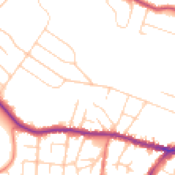
Daytime· 07:00 – 23:00
48.6dB

Everything within walking distance
Schools, transport stops and scenic spots near this property — 41 points of interest in total.
Beautiful places to visit nearby
Curated scenic spots within reach of this postcode, served by Beautifulplaces.ai. Photography and tagging come from their open dataset.
Common questions
The questions buyers, sellers and homeowners most often ask about 4 Broad Walk, Wilmslow, SK9 5PJ. Each answer is also embedded as structured data for search engines.