9 Arlington Drive, Macclesfield, SK11 8QL
About 9 Arlington Drive
9 Arlington Drive is a three-bedroom semi-detached house in Macclesfield (SK11 8QL). It has a recorded floor area of 98 m² (around 1050 sq ft), construction records dating it to 1930-1949 and council tax band C. The latest certificate (November 2010) shows a C (score 71). The latest certificate is from November 2010, so improvements made since then won't be reflected.
Untraded for 15 years, with the last transfer in March 2011. Across 1995–2011, sale prices on this property compounded at 8.1% per year. Today's modelled estimate of £314,000 sits 71.3% above the 2011 sale of £183,350. Its energy rating outperforms most of the postcode (better than 83% of similar EPCs).
What this property has
Inside
- Bedrooms3
- Dining roomYes
Outside
- Private gardenYes
- GarageYes
Everything you need to know about 9 Arlington Drive
The true value, the hidden risks and the full sale history, in one report.
30-day money-back guarantee

The data behind every report


Energy performance
9 Arlington Drive's EPC is over a decade old — improvements since won't be reflected.
EPC Expired
This certificate is over 10 years old and is no longer valid.Expired 10 Nov 2020
EPC Rating
Planning history
9 Arlington Drive has no planning applications on record.
Notable planning nearby
3applications of note in the surrounding area
Sales history & valuation
Sale price has grown by over 3x since 1995.
£314,000
Modelled from EPC, postcode comparables and a sale-price growth of 8.1% per year over 16 years.
£183,350
Growth on file: 8.1% per year over 16 years.
Sales timeline
4 March 2011Most recent
£183,350
+56.7%over 8 years17 October 2002
£117,000
+112.7%over 7 years24 August 1995
£55,000
Median price across the last 5 sales in SK11 8QL: £356,000 (2025–2024).
Nearby sales in SK11 8QL
76 Arlington Drive, Macclesfield, SK11 8QL
Sold Oct 2025
£356,00033 Arlington Drive, Macclesfield, SK11 8QL
Sold Jul 2025
£415,00012 Arlington Drive, Macclesfield, SK11 8QL
Sold Mar 2025
£334,50052 Arlington Drive, Macclesfield, SK11 8QL
Sold Jan 2025
£343,00054 Arlington Drive, Macclesfield, SK11 8QL
Sold Dec 2024
£380,000
Versus other Arlington Drive homes
On co₂ emissions, 9 Arlington Drive stands well clear of the street.
Price per m²
£1,880
Street avg £2,565
Floor Area
98 m²
Street avg 93 m²
Habitable Rooms
5 rooms
Street avg 5 rooms
CO₂ Emissions
3.3 t/year
Street avg 4.9 t/year
Everything you need to know about 9 Arlington Drive
The true value, the hidden risks and the full sale history, in one report.
30-day money-back guarantee
The data behind every report
Similar properties nearby
1 Cambridge Avenue
SK11 8JN
1 Alderney Close
SK11 8SP
1 Birchinall Close
SK11 8QS
1 Beeston Terrace
SK11 8TJ
1 Baker Street
SK11 8EU
1 Barnard Close
SK11 8PH
1 Alma Close
SK11 8QQ
1 Acton Place
SK11 8RB
The neighbourhood at a glance
Crime
6/mo
Steady year-on-year across the wider district.
Nearest stop
0.1 km
Earlsway — bus stop.
Closest school
0.2 km
St John the Evangelist CofE Primary School Macclesfield. 18 schools nearby.
Go deeper on the local area
The full report breaks down crime, transport links, schools and air quality in depth.
Road noise across the postcode
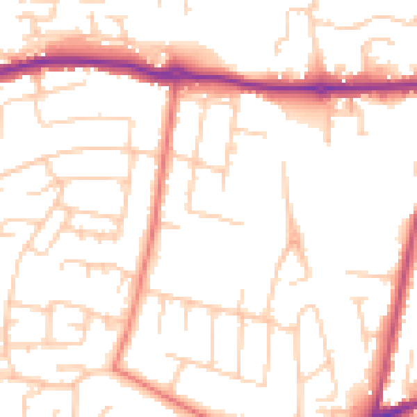
Daytime· 07:00 – 23:00
51.0dB

Night-time· 23:00 – 07:00
40.6dB