4 Sussex Avenue, Gawsworth, Macclesfield, SK11 7UT
About 4 Sussex Avenue
4 Sussex Avenue is a four-bedroom property in Gawsworth, Macclesfield, Macclesfield (SK11 7UT). It has council tax band C. The home occupies a corner plot.
Untraded for 29 years, with the last transfer in May 1997. Only one transfer is on record with HM Land Registry, suggesting it has stayed in the same hands for a long time.
What this property has
Inside
- Bedrooms4
- Bathrooms1
- Open-plan layoutYes
- Dining roomYes
Outside
- Private gardenRear
- Corner plotYes
Building
- RefurbishedYes
Everything you need to know about 4 Sussex Avenue
The true value, the hidden risks and the full sale history, in one report.
30-day money-back guarantee

The data behind every report


Energy performance
No EPC on record
This property doesn't have an Energy Performance Certificate yet. An EPC is required to sell or let — and unlocks our automated valuation.
Planning history
4 Sussex Avenue has no planning applications on record.
Notable planning nearby
3applications of note in the surrounding area
We flagged 1 thing worth checking at 4 Sussex Avenue
Independent checks surfaced things a buyer would want to understand before offering. The report explains each one in full, with the underlying data and what to ask.
- Larger development activity nearby
30-day money-back guarantee
Sales history & valuation
4 Sussex Avenue has been held in the same hands since before 2000.
£69,950
Recorded with HM Land Registry.
Sales timeline
26 May 1997Most recent
£69,950
Median price across the last 5 sales in SK11 7UT: £305,000 (2025–2021).
Nearby sales in SK11 7UT
54 Sussex Avenue, Gawsworth, Macclesfield, SK11 7UT
Sold Mar 2025
£437,50034 Sussex Avenue, Gawsworth, Macclesfield, SK11 7UT
Sold Dec 2022
£317,50050 Sussex Avenue, Gawsworth, Macclesfield, SK11 7UT
Sold Jun 2022
£270,00025 Sussex Avenue, Gawsworth, Macclesfield, SK11 7UT
Sold May 2021
£300,00023 Sussex Avenue, Gawsworth, Macclesfield, SK11 7UT
Sold Mar 2021
£305,000
Everything you need to know about 4 Sussex Avenue
The true value, the hidden risks and the full sale history, in one report.
30-day money-back guarantee
The data behind every report
Similar properties nearby
1 Buckingham Drive
SK11 7GN
1 Coniston Way
SK11 7XR
1 Albion Way
SK11 7ZD
1 Buckingham Rise
SK11 7GL
1 Buxton Old Road
SK11 7EL
1 Black Road
SK11 7BZ
1 Bradley Street
SK11 7LG
1 Broken Banks
SK11 7NL
The neighbourhood at a glance
Crime
6/mo
Steady year-on-year across the wider district.
Nearest stop
0.2 km
Thornton Square — bus stop.
Closest school
0.2 km
Ivy Bank Primary School. 18 schools nearby.
Go deeper on the local area
The full report breaks down crime, transport links, schools and air quality in depth.
Road noise across the postcode
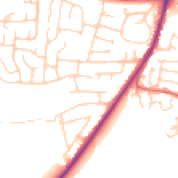
Daytime· 07:00 – 23:00
50.2dB

Night-time· 23:00 – 07:00
40.7dB