10 Cardinals Gate, Royston, SG8 5XD
4 sales on record
About 10 Cardinals Gate
A plain-English summary derived from public records, EPC certificates, sold prices and local data.
10 Cardinals Gate is a two-bedroom semi-detached house in Royston (SG8 5XD). It has a recorded floor area of 43 m² (around 463 sq ft), construction records dating it to 1996-2002 and council tax band C. At 43 m² this is the 2nd smallest of 12 units on EPC record in the building, where floor areas span 36–63 m². The building's EPC ratings span D to C, with this unit at the bottom. On EPC score it ranks last in the building (68 versus a best of 79). The latest certificate (August 2019) shows a D (score 68), on the cusp of jumping into the C band. The recommended improvements would push it to C (score 75).
Sale prices here have outpaced England HPI: 6.2% per year against 0% for the wider region. On a £-per-square-foot basis, the last sale (£475/sq ft) was about 141% above the typical sold price in the postcode. At 43 m² it's 25.9% smaller than the typical home in the postcode (58 m² median across 11 EPCs). On energy efficiency it sits in the bottom 10% of properties in this postcode — significant headroom for improvement. Sold February 2020 for £220,000. Across the public record there are 4 sales, relatively high churn for a single property.
Before you offer
Know exactly what you're buying at 10 Cardinals Gate
Before you offer, see what the listing won't tell you, the true value, the red flags and the full history.
£9.99£14.99
Launch offer · save £5
What this property has
Pulled from EPC certificates, claim submissions and our property model. Empty categories are hidden — we only show what's known.
Inside
- Bedrooms2
- Bathrooms1
- Dining roomYes
Outside
- Parking
Energy performance
Every EPC certificate filed against this property — current rating, recorded improvements, and where there's headroom to reach a higher band.
10 Cardinals Gate sits at the bottom of the postcode for energy efficiency — meaningful headroom to improve.
EPC Rating
A
B
C
D
D68
E
F
G
Main Heating
Gas
Main Fuel
Gas
Hot Water
Good
Windows
Average
CO2 Emissions
2.0 t/year
Occupancy
Owner Occupied
Planning history
Applications and permits filed against 10 Cardinals Gate, Royston, SG8 5XD, sourced from the PlanIt planning register.
10 Cardinals Gate has no planning applications on record.
The full report still covers planning activity across the surrounding area.
Sales history & valuation
Recorded transactions, our model's current estimate, and a quick read on what neighbouring properties have sold for.
Price for 10 Cardinals Gate has grown more than fourfold since the 1996 starting point.
Current estimate
See how we calculated this£240,000
Modelled from EPC, postcode comparables and a sale-price growth of 6.2% per year over 23 years.
Last sold (2020)
£220,000
Growth on file: 6.2% per year over 23 years.
Sales timeline
Before you offerLaunch offer · save £5
Everything we know about 10 Cardinals Gate, in one report
What it's really worth, what could be wrong, and the planning, sales and area data in full.
- Am I paying too much?
- Is something wrong with it?
Versus other Cardinals Gate homes
Four headline reads against 11 similar flats on this street, drawn from the latest EPC and Land Registry data.
10 Cardinals Gate outperforms the street on price per m² by a wide margin.
Price per m²
£5,116
Street avg £3,429
Floor Area
43 m²
Street avg 56 m²
Habitable Rooms
3 rooms
Similar properties nearby
A handful of close matches in the same postcode area, ranked by likeness on bedrooms, type and floor area.
The neighbourhood at a glance
A condensed read of the local area. Each tile links through to the full breakdown on the Royston district page.
Rail-style transport is unusually close for this postcode.
Crime
3/mo
Steady year-on-year across the wider district.
Nearest stop
0.0 km
Princes Mews — bus stop.
Road noise across the postcode
Modelled day and night-time noise levels around SG8 5XD from Defra's strategic mapping. The pin marks this postcode's centroid.
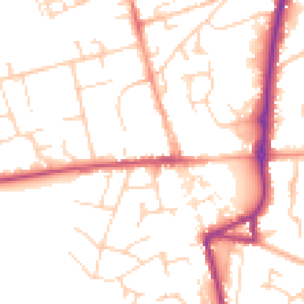
Daytime· 07:00 – 23:00
51.3dB

Everything within walking distance
Schools, transport stops and scenic spots near this property — 37 points of interest in total.
Common questions
The questions buyers, sellers and homeowners most often ask about 10 Cardinals Gate, Royston, SG8 5XD. Each answer is also embedded as structured data for search engines.
