Are you a property professional?Get qualified leads from motivated homeowners.
Get started28 Ermine Street, Thundridge, Ware, SG12 0SY
About 28 Ermine Street
A plain-English summary derived from public records, EPC certificates, sold prices and local data.
28 Ermine Street is a five-bedroom semi-detached house in Thundridge, Ware, Ware (SG12 0SY). It has a recorded floor area of 129 m² (around 1389 sq ft), construction records dating it to 1950-1966 and council tax band E. The latest certificate (February 2023) shows a C (score 72). The recommended improvements would push it to B (score 83).
At 129 m² the property is well over the postcode median (99 m² across 20 EPCs), placing it in the larger end of the local stock. Its energy rating outperforms most of the postcode (better than 75% of similar EPCs). 5 bedrooms is on the larger side for this postcode, where 3 is the typical count. On a £-per-square-foot basis, the last sale (£459/sq ft) was about 52.1% above the typical sold price in the postcode. Sold June 2023 for £637,500.
What this property has
Pulled from EPC certificates, claim submissions and our property model. Empty categories are hidden — we only show what's known.
Inside
- Bedrooms5
Energy performance
Every EPC certificate filed against this property — current rating, recorded improvements, and where there's headroom to reach a higher band.
EPC Rating
A
B
C
C72
D
E
F
G
Main Heating
Gas
Main Fuel
Gas
Hot Water
Good
Windows
Average
CO2 Emissions
3.8 t/year
Occupancy
Owner Occupied
Sales history & valuation
Recorded transactions, our model's current estimate, and a quick read on what neighbouring properties have sold for.
28 Ermine Street valuation sits well clear of the typical sold price in this postcode.
Current estimate
See how we calculated this£674,000
Modelled from EPC, postcode comparables.
Last sold (2023)
£637,500
Recorded with HM Land Registry.
Sales timeline
Full property reportLaunch offer · 33% off
The complete analysis of 28 Ermine Street, Thundridge, Ware, SG12 0SY
Everything we know about this property, compiled into one in-depth, downloadable report.
Detailed AI analysis
Versus other Ermine Street homes
Four headline reads against 20 similar houses on this street, drawn from the latest EPC and Land Registry data.
EPC Rating for 28 Ermine Street runs comfortably ahead of the street norm.
Price per m²
£4,942
Street avg £4,885
Floor Area
129 m²
Street avg 121 m²
Habitable Rooms
8 rooms
Similar properties nearby
A handful of close matches in the same postcode area, ranked by likeness on bedrooms, type and floor area.
The neighbourhood at a glance
A condensed read of the local area. Each tile links through to the full breakdown on the Ware district page.
Crime
4/mo
Steady year-on-year across the wider district.
Nearest stop
0.1 km
Village Hall — bus stop.
Road noise across the postcode
Modelled day and night-time noise levels around SG12 0SY from Defra's strategic mapping. The pin marks this postcode's centroid.
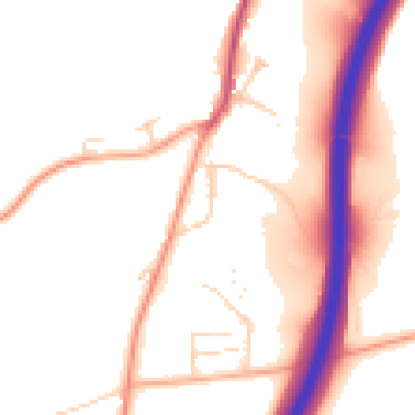
Daytime· 07:00 – 23:00
52.3dB

Everything within walking distance
Schools, transport stops and scenic spots near this property — 39 points of interest in total.
Common questions
The questions buyers, sellers and homeowners most often ask about 28 Ermine Street, Thundridge, Ware, SG12 0SY. Each answer is also embedded as structured data for search engines.