27 Bloomhall Road, Lambeth, London, SE19 1JH
1 planning record
About 27 Bloomhall Road
A plain-English summary derived from public records, EPC certificates, sold prices and local data.
27 Bloomhall Road is a two-bedroom end-of-terrace house in Lambeth, London, London (SE19 1JH). It has a recorded floor area of 72 m² (around 775 sq ft), construction records dating it to 1930-1949 and council tax band C. The latest certificate (April 2022) shows a D (score 62), on the cusp of jumping into the C band. When first surveyed in April 2012 the rating was E, the property has climbed 1 band since. Between certificates, lighting dropped from Good to Average. The recommended improvements would lift it to B (score 87), a 2-band jump.
Sale prices here have outpaced London HPI: 8.3% per year against 0% for the wider region. On a £-per-square-foot basis, the last sale (£720/sq ft) was about 229.8% above the typical sold price in the postcode. One planning record on file: a loft conversion approved in 2025. Past consents include a loft conversion, meaningful when judging how the property has evolved. Most recent transfer: July 2022 at £558,000. That sale was during the post-pandemic price surge, when transactions cleared materially above pre-2020 trend.
Before you offer
Know exactly what you're buying at 27 Bloomhall Road
Before you offer, see what the listing won't tell you, the true value, the red flags and the full history.
Already flagged here
Signs of HMO activity in the areaLarger development activity nearby
£9.99£14.99
Launch offer · save £5
What this property has
Pulled from EPC certificates, claim submissions and our property model. Empty categories are hidden — we only show what's known.
Inside
- Bedrooms2
- Bathrooms1
- Dining roomYes
Outside
- Private garden
Energy performance
Every EPC certificate filed against this property — current rating, recorded improvements, and where there's headroom to reach a higher band.
Recommended upgrades on file would lift this property by multiple EPC bands.
Current Certificate(1 of 2)
Apr 2022
EPC Rating
A
B
C
D
D62
E
F
G
Main Heating
Gas
Main Fuel
Gas
Hot Water
Good
Windows
Average
CO2 Emissions
3.2 t/year
Occupancy
Owner Occupied
Planning history
Applications and permits filed against 27 Bloomhall Road, Lambeth, London, SE19 1JH, sourced from the PlanIt planning register.
- Apr 2025Loft ConversionOutlineIn report
Application for a Certificate of Lawfulness (Proposed) with respect to a hip to gable and rear dormer loft conversion
Before you offer
We flagged 2 things worth checking at 27 Bloomhall Road
Independent checks surfaced things a buyer would want to understand before offering. The report explains each one in full, with the underlying data and what to ask.
- Signs of HMO activity in the area
- Larger development activity nearby
Sales history & valuation
Recorded transactions, our model's current estimate, and a quick read on what neighbouring properties have sold for.
Sale price has at least doubled since 2012.
Current estimate
See how we calculated this£597,000
Modelled from EPC, postcode comparables and a sale-price growth of 8.3% per year over 10 years.
Last sold (2022)
£558,000
Growth on file: 8.3% per year over 10 years.
Sales timeline
Before you offerLaunch offer · save £5
Everything we know about 27 Bloomhall Road, in one report
What it's really worth, what could be wrong, and the planning, sales and area data in full.
What we flagged
- Signs of HMO activity in the area
- Larger development activity nearby
£9.99£14.99
Versus other Bloomhall Road homes
Four headline reads against 18 similar houses on this street, drawn from the latest EPC and Land Registry data.
Price per m² for 27 Bloomhall Road runs comfortably ahead of the street norm.
Price per m²
£7,750
Street avg £3,754
Floor Area
72 m²
Street avg 77 m²
Habitable Rooms
3 rooms
Similar properties nearby
A handful of close matches in the same postcode area, ranked by likeness on bedrooms, type and floor area.
The neighbourhood at a glance
A condensed read of the local area. Each tile links through to the full breakdown on the London district page.
Rail-style transport is unusually close for this postcode.
Crime
5/mo
Steady year-on-year across the wider district.
Nearest stop
0.2 km
Hermitage Road — bus stop.
Road noise across the postcode
Modelled day and night-time noise levels around SE19 1JH from Defra's strategic mapping. The pin marks this postcode's centroid.
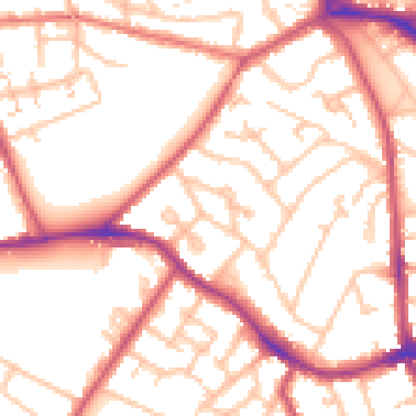
Daytime· 07:00 – 23:00
53.6dB

Everything within walking distance
Schools, transport stops and scenic spots near this property — 80 points of interest in total.
Common questions
The questions buyers, sellers and homeowners most often ask about 27 Bloomhall Road, Lambeth, London, SE19 1JH. Each answer is also embedded as structured data for search engines.
