1 Everthorpe Road, Southwark, London, SE15 4DA
About 1 Everthorpe Road
1 Everthorpe Road is a four-bedroom property in Southwark, London, London (SE15 4DA). It has council tax band D.
It hasn't traded since November 2003, a hold of 23 years that's notably long for the area. Across 1997–2003, sale prices on this property compounded at 29% per year. One historical planning record sits against the property in 2008.
Know exactly what you're buying at 1 Everthorpe Road
Before you offer, see what the listing won't tell you, the true value, the red flags and the full history.
Already flagged here
Launch offer · save £5
Valuation
against the asking price
Risks
planning & flood
Sold prices
similar homes nearby
Trends
the local market
What this property has
Inside
- Bedrooms4
- Dining roomYes
- EnsuiteYes
- StudyYes
Outside
- Private gardenrear
Building
- RefurbishedYes
Energy performance
No EPC on record
This property doesn't have an Energy Performance Certificate yet. An EPC is required to sell or let — and unlocks our automated valuation.
Planning history
- Mar 2008OutlineIn report
Raise hip roof to gable and erect rear roof dormer
- Agent
- Classic Lofts
- Documents
- 3 docs on file
- Reference
- 07/AP/2765
We flagged 1 thing worth checking at 1 Everthorpe Road
Independent checks surfaced things a buyer would want to understand before offering. The report explains each one in full, with the underlying data and what to ask.
- Larger development activity nearby
30-day money-back guarantee
Sales history & valuation
1 Everthorpe Road has more than quadrupled in price since its earliest registered sale in 1997.
£345,000
Growth on file: 29.0% per year over 7 years.
Sales timeline
28 November 2003Most recent
£345,000
+213.8%over 6 years10 July 1997
£109,950
+83.4%10 January 1997
£59,950
Median price across the last 5 sales in SE15 4DA: £1,000,000 (2025–2022).
Nearby sales in SE15 4DA
8 Everthorpe Road, Southwark, London, SE15 4DA
Sold Sept 2025
£1,425,00011 Everthorpe Road, Southwark, London, SE15 4DA
Sold Nov 2024
£915,00010 Everthorpe Road, Southwark, London, SE15 4DA
Sold Aug 2023
£1,250,0006 Everthorpe Road, Southwark, London, SE15 4DA
Sold May 2022
£1,000,0007 Everthorpe Road, Southwark, London, SE15 4DA
Sold Sept 2021
£1,355,000
Everything we know about 1 Everthorpe Road, in one report
What it's really worth, what could be wrong, and the planning, sales and area data in full.
What we flagged
- Larger development activity nearby

Similar properties nearby
1 Fenwick Road, Southwark
SE15 4HS
1 Draymans Mews, Southwark
SE15 4PW
1 Fenwick Grove, Southwark
SE15 4HT
1 Amott Road, Southwark
SE15 4HU
1 Nigel Road, Southwark
SE15 4NP
1 Ashleigh Mews, Southwark
SE15 4BF
1 Adys Road, Southwark
SE15 4DX
1 Chadwick Road, Southwark
SE15 4RA
The neighbourhood at a glance
Rail-style transport is unusually close for this postcode.
Crime
11/mo
Rising year-on-year across the wider district.
Nearest stop
0.2 km
Ondine Road — bus stop.
Closest school
0.2 km
Goose Green Primary and Nursery School. 75 schools nearby.
Go deeper on the local area
The full report breaks down crime, transport links, schools and air quality in depth.
Road noise across the postcode
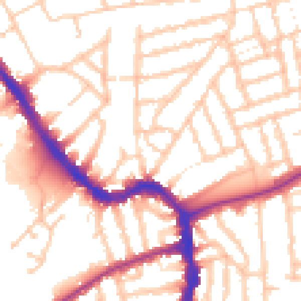
Daytime· 07:00 – 23:00
53.2dB

Night-time· 23:00 – 07:00
42.8dB