17 Ledbury Street, Southwark, London, SE15 1BA
About 17 Ledbury Street
17 Ledbury Street is a property in Southwark, London, London (SE15 1BA). It has council tax band C.
Energy performance
No EPC on record
This property doesn't have an Energy Performance Certificate yet. An EPC is required to sell or let — and unlocks our automated valuation.
Planning history
No planning applications are recorded against 17 Ledbury Street, Southwark, London, SE15 1BA. The full report also covers planning activity across the surrounding area.
Sales history & valuation
No sales recorded with HM Land Registry
That can mean the property has never traded since the registry began publishing in 1995, was a new build that hasn't been registered yet, or is held in the same hands long-term.
Median price across the last 2 sales in SE15 1BA: £415,000 (2017–2014).
Similar properties nearby
1 Albert Way, Southwark
SE15 1DG
1 Barnaby House, Manor Grove, Southwark
SE15 1AN
1 Bewick Mews, Southwark
SE15 1QR
1 Canal Grove, Southwark
SE15 1LB
1 Cardine Mews, Southwark
SE15 1AY
1 Clotelle Court, Fenham Road, Southwark
SE15 1AE
1 Elcot Avenue, Southwark
SE15 1QB
1 Ethnard Road, Southwark
SE15 1RY
The neighbourhood at a glance
Rail-style transport is unusually close for this postcode.
Crime
11/mo
Rising year-on-year across the wider district.
Nearest stop
0.2 km
Bird In Bush Road — bus stop.
Closest school
0.2 km
Bird In Bush School. 92 schools nearby.
Road noise across the postcode
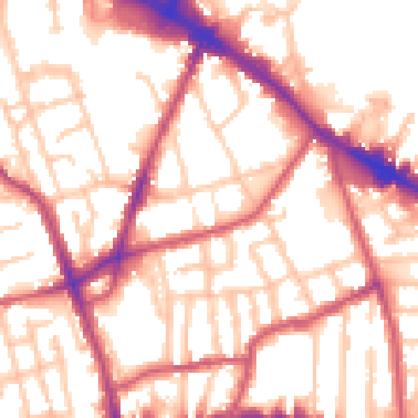
Daytime· 07:00 – 23:00
55.0dB

Night-time· 23:00 – 07:00
44.5dB