2 Boswell Close, High Green, Sheffield, S35 4FD
About 2 Boswell Close
2 Boswell Close is a four-bedroom detached house in High Green, Sheffield, Sheffield (S35 4FD). It has a recorded floor area of 123 m² (around 1324 sq ft), construction records dating it to 1967-1975 and council tax band E. The latest certificate (April 2013) shows a D (score 58), a step below the typical UK home. The recommended improvements would push it to C (score 74). The latest certificate is from April 2013, so improvements made since then won't be reflected. Other recorded features include attached land beyond the plot. Records show the property has been extended at some point in its history.
One planning record on file: an extension approved in 2005. Past consents include an extension, a porch and a conservatory, meaningful when judging how the property has evolved. At 123 m² it's 18.8% larger than the typical home in the postcode (104 m² median across 6 EPCs). Across 2004–2016, sale prices on this property compounded at 5.4% per year. Today's modelled estimate of £414,000 is 33.5% above the 2016 sale price. On a £-per-square-foot basis, the last sale (£234/sq ft) was about 41.9% above the typical sold price in the postcode. 10 years since the last transfer (May 2016).
Know exactly what you're buying at 2 Boswell Close
Before you offer, see what the listing won't tell you, the true value, the red flags and the full history.
Already flagged here
Valuation
against the asking price
Risks
planning & flood
Sold prices
similar homes nearby
Trends
the local market
What this property has
Inside
- Bedrooms4
- EnsuiteYes
Outside
- GarageDouble
- LandYes
Building
- Previously extendedYes
Energy performance
2 Boswell Close's carbon output runs well above what efficient homes in the postcode produce.
EPC Expired
This certificate is over 10 years old and is no longer valid.Expired 22 Apr 2023
EPC Rating
Planning history
- Feb 2005PorchFullIn report
Extension: Single storey
First-floor side extension to dwellinghouse, erection of rear conservatory and front porch
ExtensionConservatory- Reference
- 04/05017/FUL
We flagged 1 thing worth checking at 2 Boswell Close
Independent checks surfaced things a buyer would want to understand before offering. The report explains each one in full, with the underlying data and what to ask.
- Recent ownership pattern worth a look
30-day money-back guarantee
Sales history & valuation
Latest sale on 2 Boswell Close was the highest on Land Registry record across the postcode.
£414,000
Modelled from EPC, postcode comparables and a sale-price growth of 5.4% per year over 12 years.
£310,000
Growth on file: 5.4% per year over 12 years.
Sales timeline
4 May 2016Most recent
£310,000
+29.2%over 1 year5 December 2014
£240,000
+43.3%over 10 years19 August 2004
£167,500
Median price across the last 5 sales in S35 4FD: £225,000 (2020–2008).
Nearby sales in S35 4FD
9 Boswell Close, High Green, Sheffield, S35 4FD
Sold Jul 2020
£227,0003 Boswell Close, High Green, Sheffield, S35 4FD
Sold Jul 2018
£202,5001 Boswell Close, High Green, Sheffield, S35 4FD
Sold Nov 2014
£240,0004 Boswell Close, High Green, Sheffield, S35 4FD
Sold Mar 2008
£225,00012 Boswell Close, High Green, Sheffield, S35 4FD
Sold Jul 2007
£190,000
Everything we know about 2 Boswell Close, in one report
What it's really worth, what could be wrong, and the planning, sales and area data in full.
What we flagged
- Recent ownership pattern worth a look

Versus other Boswell Close homes
Price per m² for 2 Boswell Close runs comfortably ahead of the street norm.
Price per m²
£2,520
Street avg £1,999
Floor Area
123 m²
Street avg 107 m²
Habitable Rooms
7 rooms
Street avg 6 rooms
CO₂ Emissions
6.1 t/year
Street avg 4.9 t/year
Similar properties nearby
1 Boswell Close, High Green
S35 4FD
1 Dowland Close, High Green
S35 4DX
1 Chapel Road, High Green
S35 4GH
1 Ashwood Road, High Green
S35 4EY
1 Blackthorn Close, High Green
S35 4FL
1 Dowland Court, High Green
S35 4LB
1 Bellamy Close, High Green
S35 4AD
1 Eagleton Rise, High Green
S35 4DR
The neighbourhood at a glance
Crime
2/mo
Steady year-on-year across the wider district.
Nearest stop
0.2 km
Wortley Road/Westwood New Road — bus stop.
Closest school
0.6 km
Angram Bank Primary School. 9 schools nearby.
Go deeper on the local area
The full report breaks down crime, transport links, schools and air quality in depth.
Road noise across the postcode
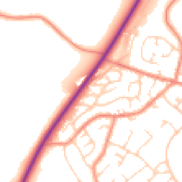
Daytime· 07:00 – 23:00
52.3dB

Night-time· 23:00 – 07:00
42.6dB