4 Alison Drive, Swallownest, Sheffield, S26 4RP
About 4 Alison Drive
4 Alison Drive is a three-bedroom mid-terrace house in Swallownest, Sheffield, Sheffield (S26 4RP). It has a recorded floor area of 85 m² (around 911 sq ft), construction records dating it to 1967-1975 and council tax band A. The latest certificate (December 2011) shows a C (score 76), near the top of the C band. The latest certificate is from December 2011, so improvements made since then won't be reflected.
It hasn't traded since April 2006, a hold of 20 years that's notably long for the area. Today's modelled estimate of £131,000 sits 63.9% above the 2006 sale of £79,950. On a £-per-square-foot basis, the last sale (£88/sq ft) was about 40.4% below the postcode norm.
What this property has
Inside
- Bedrooms3
Outside
- Private gardenYes
Building
- Heating systemGas
- RefurbishedYes
Everything you need to know about 4 Alison Drive
The true value, the hidden risks and the full sale history, in one report.
30-day money-back guarantee

The data behind every report


Energy performance
4 Alison Drive's EPC is over a decade old — improvements since won't be reflected.
EPC Expired
This certificate is over 10 years old and is no longer valid.Expired 09 Dec 2021
EPC Rating
Planning history
4 Alison Drive has no planning applications on record.
The full report still covers planning activity across the surrounding area.
Sales history & valuation
£131,000
Modelled from EPC, postcode comparables.
£79,950
Recorded with HM Land Registry.
Sales timeline
27 April 2006Most recent
£79,950
Median price across the last 5 sales in S26 4RP: £160,000 (2024–2020).
Nearby sales in S26 4RP
33 Alison Drive, Swallownest, Sheffield, S26 4RP
Sold Jan 2024
£157,50036 Alison Drive, Swallownest, Sheffield, S26 4RP
Sold Apr 2023
£160,00048 Alison Drive, Swallownest, Sheffield, S26 4RP
Sold Nov 2020
£165,00035 Alison Drive, Swallownest, Sheffield, S26 4RP
Sold Mar 2020
£130,00021 Alison Drive, Swallownest, Sheffield, S26 4RP
Sold Mar 2020
£225,000
Versus other Alison Drive homes
4 Alison Drive outperforms the street on epc rating by a wide margin.
Price per m²
£944
Street avg £1,682
Floor Area
85 m²
Street avg 75 m²
Habitable Rooms
5 rooms
Street avg 4 rooms
CO₂ Emissions
2.2 t/year
Street avg 3.3 t/year
Everything you need to know about 4 Alison Drive
The true value, the hidden risks and the full sale history, in one report.
30-day money-back guarantee
The data behind every report
Similar properties nearby
1 Arcubus Avenue, Swallownest
S26 4TD
1 Fane Crescent, Swallownest
S26 4TS
1 Camelia Mews, Swallownest
S26 4QB
1 Bedale Close, Swallownest
S26 4NF
1 Holly Terrace, Swallownest
S26 4SQ
1 Alpina Way, Swallownest
S26 4QA
1 Alexandra Road, Swallownest
S26 4TA
1 Aysgarth Rise, Swallownest
S26 4SS
The neighbourhood at a glance
Crime
4/mo
Steady year-on-year across the wider district.
Nearest stop
0.1 km
Worksop Road/Wesley Avenue — bus stop.
Closest school
0.3 km
Aston Lodge Primary School. 12 schools nearby.
Go deeper on the local area
The full report breaks down crime, transport links, schools and air quality in depth.
Road noise across the postcode
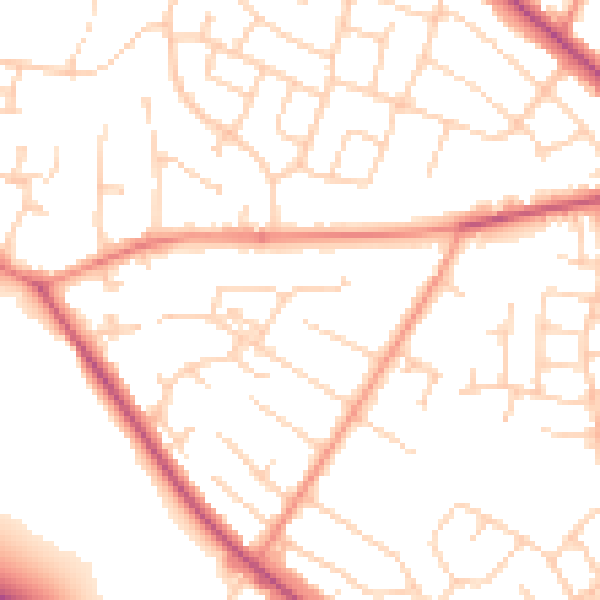
Daytime· 07:00 – 23:00
50.9dB

Night-time· 23:00 – 07:00
40.4dB