90a, Southgate, Eckington, Sheffield, S21 4FT
About 90a
90a is a detached house in Eckington, Sheffield, Sheffield (S21 4FT). It has a recorded floor area of 165 m² (around 1776 sq ft), construction records dating it to 1950-1966 and council tax band E. The latest certificate (October 2020) shows a D (score 65), on the cusp of jumping into the C band. The recommended improvements would push it to C (score 76).
It hasn't traded since April 2001, a hold of 25 years that's notably long for the area. At 165 m² the property is well over the postcode median (83 m² across 38 EPCs), placing it in the larger end of the local stock. It lags the bulk of the postcode on energy efficiency (less efficient than 71% of similar EPCs). Across 1997–2001, sale prices on this property compounded at 25.8% per year. Today's modelled estimate of £506,000 sits 135.3% above the 2001 sale of £215,000. On a £-per-square-foot basis, the last sale (£121/sq ft) was about 30.6% above the typical sold price in the postcode. 2 planning records sit against the property, 2 approved, 0 refused. Past consents include tree works, meaningful when judging how the property has evolved. The record references conservation-area consent, which constrain future alterations.
Know exactly what you're buying at 90a
Before you offer, see what the listing won't tell you, the true value, the red flags and the full history.
Already flagged here
Launch offer · save £5
Valuation
against the asking price
Risks
planning & flood
Sold prices
similar homes nearby
Trends
the local market
Energy performance
90a's carbon output runs well above what efficient homes in the postcode produce.
EPC Rating
Planning history
Planning history at 90a is exclusively tree-management applications — typical for a property with mature trees on or near the plot.
- Dec 2024Tree WorksTreesIn report
Notification of intention to remove 3 large Conifer trees to the rear within Eckington and Renishaw Park Conservation Area
Conservation Area- Documents
- 3 docs on file
- Reference
- 24/00918/CATPO
- Dec 2006Tree WorksTreesIn report
Application for consent to fell one Willow tree within Eckington and Renishaw Park Conservation Area
Conservation Area- Documents
- 12 docs on file
- Reference
- 06/01186/CATPO
We flagged 1 thing worth checking at 90a
Independent checks surfaced things a buyer would want to understand before offering. The report explains each one in full, with the underlying data and what to ask.
- Larger development activity nearby
30-day money-back guarantee
Sales history & valuation
Sale price has at least doubled since 1997.
£506,000
Modelled from EPC, postcode comparables and a sale-price growth of 25.8% per year over 4 years.
£215,000
Growth on file: 25.8% per year over 4 years.
Sales timeline
11 April 2001Most recent
£215,000
-10.4%over 6 months4 October 2000
£240,000
+152.6%over 3 years18 September 1997
£95,000
Median price across the last 5 sales in S21 4FT: £138,500 (2020–2017).
Nearby sales in S21 4FT
94 Southgate, Eckington, Sheffield, S21 4FT
Sold Sept 2020
£570,00056 Southgate, Eckington, Sheffield, S21 4FT
Sold Mar 2020
£138,50058 Southgate, Eckington, Sheffield, S21 4FT
Sold Dec 2019
£139,00070 Southgate, Eckington, Sheffield, S21 4FT
Sold Aug 2018
£104,00078 Southgate, Eckington, Sheffield, S21 4FT
Sold Sept 2015
£90,000
Everything we know about 90a, in one report
What it's really worth, what could be wrong, and the planning, sales and area data in full.
What we flagged
- Larger development activity nearby

Versus other Southgate homes
Floor Area for 90a runs comfortably ahead of the street norm.
Price per m²
£1,303
Street avg £1,392
Floor Area
165 m²
Street avg 109 m²
Habitable Rooms
8 rooms
Street avg 5 rooms
CO₂ Emissions
6.6 t/year
Street avg 5.2 t/year
Similar properties nearby
1 Aintree Avenue, Eckington
S21 4JA
1 Chester Court, Eckington
S21 4JF
1 Broomhall Court, High Street, Eckington
S21 4BL
1 Berrisford Avenue, Eckington
S21 4LJ
1 Bramley Mews, Eckington
S21 4JJ
1 Ash Mews, Eckington
S21 4LQ
1 Ashmore Avenue, Eckington
S21 4AH
1 Cary Road, Eckington
S21 4AW
The neighbourhood at a glance
Crime
3/mo
Steady year-on-year across the wider district.
Nearest stop
0.0 km
Station Road — bus stop.
Closest school
0.5 km
Camms CofE (Aided) Primary School. 12 schools nearby.
Go deeper on the local area
The full report breaks down crime, transport links, schools and air quality in depth.
Road noise across the postcode
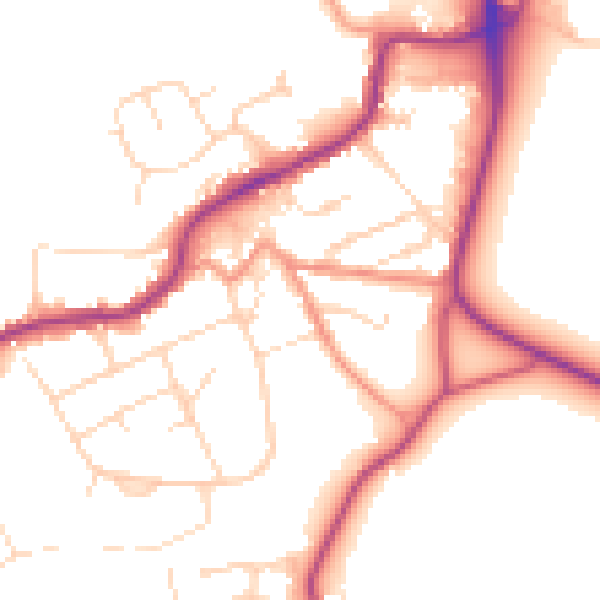
Daytime· 07:00 – 23:00
51.7dB

Night-time· 23:00 – 07:00
42.8dB