22 Loundes Road, Unstone, Dronfield, S18 4DE
About 22 Loundes Road
22 Loundes Road is a semi-detached house in Unstone, Dronfield, Dronfield (S18 4DE). It has a recorded floor area of 81 m² (around 872 sq ft), construction records dating it to 1967-1975 and council tax band A. The latest certificate (January 2014) shows an E (score 54), well below the UK norm with real room to improve. Earlier certificates rated it D (January 2013); the latest reading is one band lower. Between certificates, lighting went from Very Poor to Poor; while wall efficiency dropped from Good to Very Poor and roof efficiency dropped from Average to Very Poor. The recommended improvements would lift it to C (score 70), a 2-band jump. The latest certificate is from January 2014, so improvements made since then won't be reflected.
On energy efficiency it sits in the bottom 10% of properties in this postcode — significant headroom for improvement. One planning record on file: an extension approved in 2021. Past consents include an extension, meaningful when judging how the property has evolved. Across 2014–2022, sale prices on this property compounded at 10.5% per year. Today's modelled estimate of £186,000 is 12.7% above the 2022 sale price. On a £-per-square-foot basis, the last sale (£189/sq ft) was about 53.5% above the typical sold price in the postcode. Most recent transfer: October 2022 at £165,000. That sale was during the post-pandemic price surge, when transactions cleared materially above pre-2020 trend.
Know exactly what you're buying at 22 Loundes Road
Before you offer, see what the listing won't tell you, the true value, the red flags and the full history.
Valuation
against the asking price
Risks
planning & flood
Sold prices
similar homes nearby
Trends
the local market
Energy performance
22 Loundes Road sits at the bottom of the postcode for energy efficiency — meaningful headroom to improve.
EPC Expired
This certificate is over 10 years old and is no longer valid.Expired 30 Jan 2024
EPC Rating
Planning history
- Feb 2021ExtensionFullIn report
Extension: Two storey · Side of property
Demolition of existing outbuilding and construction of two-storey side extension
- Agent
- D.WALSHAM DESIGN
- Documents
- 8 docs on file
- Reference
- 20/01312/FLH
What's in 22 Loundes Road, Unstone, Dronfield, S18 4DE's planning history?
Refusals, disputes and full decisions on this property and nearby, in the report.
Sales history & valuation
22 Loundes Road has more than doubled in price since the earliest registered sale in 2014.
£186,000
Modelled from EPC, postcode comparables and a sale-price growth of 10.5% per year over 8 years.
£165,000
Growth on file: 10.5% per year over 8 years.
Sales timeline
6 October 2022Most recent
£165,000
+40.4%over 6 years22 September 2016
£117,500
+63.2%over 2 years17 June 2014
£72,000
Median price across the last 5 sales in S18 4DE: £147,250 (2022–2017).
Nearby sales in S18 4DE
36 Loundes Road, Unstone, Dronfield, S18 4DE
Sold Aug 2022
£175,00045 Loundes Road, Unstone, Dronfield, S18 4DE
Sold Jun 2021
£147,25038 Loundes Road, Unstone, Dronfield, S18 4DE
Sold Jun 2020
£150,0002 Loundes Road, Unstone, Dronfield, S18 4DE
Sold Nov 2017
£122,00047 Loundes Road, Unstone, Dronfield, S18 4DE
Sold Oct 2014
£115,000
Everything we know about 22 Loundes Road, in one report
What it's really worth, what could be wrong, and the planning, sales and area data in full.
- Am I paying too much?
- Is something wrong with it?
- Is the agent's story true?
- Will it hold its value?

Versus other Loundes Road homes
On years held, 22 Loundes Road runs well behind the street norm.
Price per m²
£2,037
Street avg £1,389
Floor Area
81 m²
Street avg 85 m²
Habitable Rooms
5 rooms
Street avg 5 rooms
CO₂ Emissions
4.4 t/year
Street avg 3.4 t/year
Similar properties nearby
1 Birch Holt Grove, Unstone
S18 4DH
10 Birch Holt Grove, Unstone
S18 4DH
1 Moorland View, Apperknowle
S18 4BL
1 North Close, Unstone
S18 4DX
1 Sylvia Road, Unstone
S18 4DP
1 Loundes Road, Unstone
S18 4DE
1 Whittington Lane, Unstone
S18 4DQ
1 Robert Close, Unstone
S18 4DJ
The neighbourhood at a glance
Daytime road noise here sits well below conversation level — a quiet pocket of the postcode.
Crime
5/mo
Steady year-on-year across the wider district.
Nearest stop
0.2 km
Whittington Lane — bus stop.
Closest school
0.6 km
Unstone Junior School. 13 schools nearby.
Go deeper on the local area
The full report breaks down crime, transport links, schools and air quality in depth.
Road noise across the postcode
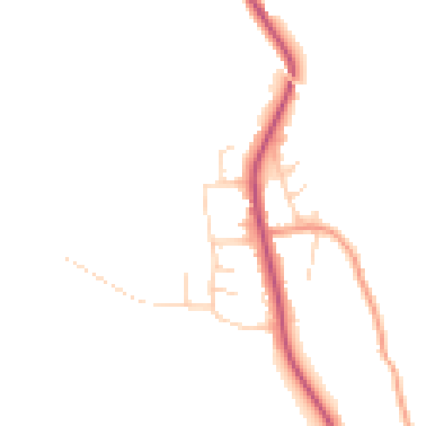
Daytime· 07:00 – 23:00
44.8dB

Night-time· 23:00 – 07:00
37.7dB