8 Dene Place, Sheffield, S13 9DN
About 8 Dene Place
8 Dene Place is a semi-detached house in Sheffield (S13 9DN). It has a recorded floor area of 75 m² (around 807 sq ft), construction records dating it to 2007-2011 and council tax band B. The latest certificate (March 2021) shows a C (score 77), near the top of the C band. The rating has held steady at C across 2 certificates since April 2010. Between certificates, roof efficiency went from Good to Very Good and lighting went from Average to Very Good; while window efficiency dropped from Very Good to Good and hot-water efficiency dropped from Very Good to Good. The recommended improvements would push it to B (score 91).
Across 2010–2021, sale prices on this property compounded at 1.4% per year. Today's modelled estimate of £232,000 is 21.1% above the 2021 sale price. On a £-per-square-foot basis, the last sale (£237/sq ft) was about 23.3% above the typical sold price in the postcode. Sold August 2021 for £191,500. That sale was during the post-pandemic price surge, when transactions cleared materially above pre-2020 trend.
Everything you need to know about 8 Dene Place
The true value, the hidden risks and the full sale history, in one report.
30-day money-back guarantee

The data behind every report


Energy performance
EPC Rating
Property Improvements
Changes detected from historical EPC data
Hot water efficiency decreased
Wall insulation upgraded
Loft insulation upgraded to recommended levels
Floor insulation added or improved
More low energy lighting installed
Planning history
8 Dene Place has no planning applications on record.
The full report still covers planning activity across the surrounding area.
Sales history & valuation
8 Dene Place's sale-price growth has lagged the wider UK trajectory across its history on file.
£232,000
Modelled from EPC, postcode comparables and a sale-price growth of 1.4% per year over 11 years.
£191,500
Growth on file: 1.4% per year over 11 years.
Sales timeline
30 August 2021Most recent
£191,500
+29.4%over 4 years8 June 2017
£148,000
-9.3%over 6 years24 June 2010
£163,150
Median price across the last 5 sales in S13 9DN: £200,000 (2025–2019).
Versus other Dene Place homes
Floor Area for 8 Dene Place lags the street by a wide margin.
Price per m²
£2,553
Street avg £2,115
Floor Area
75 m²
Street avg 90 m²
Habitable Rooms
5 rooms
Street avg 5 rooms
CO₂ Emissions
1.9 t/year
Street avg 2.3 t/year
Everything you need to know about 8 Dene Place
The true value, the hidden risks and the full sale history, in one report.
30-day money-back guarantee
The data behind every report
Similar properties nearby
The neighbourhood at a glance
Crime
6/mo
Steady year-on-year across the wider district.
Nearest stop
0.4 km
Handsworth Road/Richmond Park Road — bus stop.
Closest school
0.7 km
St Joseph's Primary School. 23 schools nearby.
Go deeper on the local area
The full report breaks down crime, transport links, schools and air quality in depth.
Road noise across the postcode
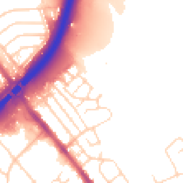
Daytime· 07:00 – 23:00
53.4dB
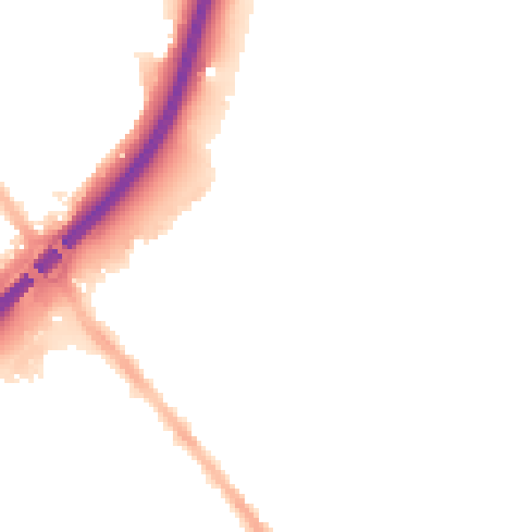
Night-time· 23:00 – 07:00
45.3dB