Westbrook Apartments, 2, 84 Porter Brook View, Sheffield, S11 8ZJ
About Westbrook Apartments
Westbrook Apartments is a three-bedroom property in Sheffield (S11 8ZJ). It has a recorded floor area of 129 m² (around 1389 sq ft). At 129 m² this is the 2nd smallest of 3 units on EPC record in Westbrook Apartments, where floor areas span 112–159 m². On EPC score it ranks last in the building (76 versus a best of 80). The latest certificate (February 2015) shows a C (score 76), near the top of the C band. The latest certificate is from February 2015, so improvements made since then won't be reflected.
At 129 m² the property is well over the postcode median (48 m² across 66 EPCs), placing it in the larger end of the local stock. 3 planning records sit against the property, 3 approved, 0 refused. Past consents include tree works and an extension, meaningful when judging how the property has evolved. The record references conservation-area consent, which constrain future alterations. Across 2015–2016, sale prices on this property compounded at 8.1% per year. Today's modelled estimate of £411,000 is 10.3% above the 2016 sale price. On a £-per-square-foot basis, the last sale (£268/sq ft) was about 28.5% above the typical sold price in the postcode. Last changed hands 10 years ago, in December 2016.
Know exactly what you're buying at Westbrook Apartments
Before you offer, see what the listing won't tell you, the true value, the red flags and the full history.
Already flagged here
Launch offer · save £5
Valuation
against the asking price
Risks
planning & flood
Sold prices
similar homes nearby
Trends
the local market
What this property has
Inside
- Bedrooms3
- Bathrooms3
- Open-plan layoutYes
- EnsuiteYes
Outside
- Private gardenYes
- Parkingallocated
Energy performance
Westbrook Apartments's carbon output is low for the local stock.
EPC Expired
This certificate is over 10 years old and is no longer valid.Expired 19 Feb 2025
EPC Rating
Planning history
Westbrook Apartments has an approved extension on the planning record.
- Mar 2025Tree WorksTreesIn report
Pruning and removal of trees (Porter Brook Conservation Area)
Conservation Area- Documents
- 4 docs on file
- Reference
- 25/00177/TCA
- Aug 2019Tree WorksTreesIn report
Pruning of trees (Porter Brook Conservation Area)
- Documents
- 4 docs on file
- Reference
- 19/02482/TCA
We flagged 2 things worth checking at Westbrook Apartments
Independent checks surfaced things a buyer would want to understand before offering. The report explains each one in full, with the underlying data and what to ask.
- Signs of HMO activity in the area
- Larger development activity nearby
30-day money-back guarantee
Sales history & valuation
Westbrook Apartments valuation sits well clear of the typical sold price in this postcode.
£411,000
Modelled from EPC, postcode comparables and a sale-price growth of 8.1% per year over 2 years.
£372,500
Growth on file: 8.1% per year over 2 years.
Sales timeline
1 December 2016Most recent
£372,500
+14.6%over 1 year4 March 2015
£325,000
Median price across the last 5 sales in S11 8ZJ: £178,000 (2024–2019).
Nearby sales in S11 8ZJ
21 Porter Brook View, Sheffield, S11 8ZJ
Sold Oct 2024
£178,00085 Porter Brook View, Sheffield, S11 8ZJ
Sold Jun 2024
£390,000Westbrook Apartments, 1, 84 Porter Brook View, Sheffield, S11 8ZJ
Sold Jul 2022
£750,00025 Porter Brook View, Sheffield, S11 8ZJ
Sold Aug 2019
£110,00078 Porter Brook View, Sheffield, S11 8ZJ
Sold May 2019
£108,000
Everything we know about Westbrook Apartments, in one report
What it's really worth, what could be wrong, and the planning, sales and area data in full.
What we flagged
- Signs of HMO activity in the area
- Larger development activity nearby

Versus other Porter Brook View homes
On co₂ emissions, Westbrook Apartments stands well clear of the street.
Price per m²
£2,888
Street avg £1,993
Floor Area
129 m²
Street avg 60 m²
CO₂ Emissions
0.5 t/year
Street avg 1.6 t/year
Years Held
10 years
Street avg 12 years
Similar properties nearby
Apartment 1, 1 Newington Road
S11 8RZ
Apartment 1, 116 Ecclesall Road
S11 8JB
45a, Flat 2, Stalker Lees Road
S11 8NP
45a, Flat 6, Stalker Lees Road
S11 8NP
45a, Flat 4, Stalker Lees Road
S11 8NP
341 343, Flat 1a, Sharrow Vale Road
S11 8ZG
289a, First Floor Flat, Ecclesall Road
S11 8NX
341 343, Flat 2b, Sharrow Vale Road
S11 8ZG
The neighbourhood at a glance
Crime
2/mo
Steady year-on-year across the wider district.
Nearest stop
0.1 km
Cemetery Road/Sharrow Vale Road — bus stop.
Closest school
0.4 km
Porter Croft Church of England Primary Academy. 38 schools nearby.
Go deeper on the local area
The full report breaks down crime, transport links, schools and air quality in depth.
Road noise across the postcode
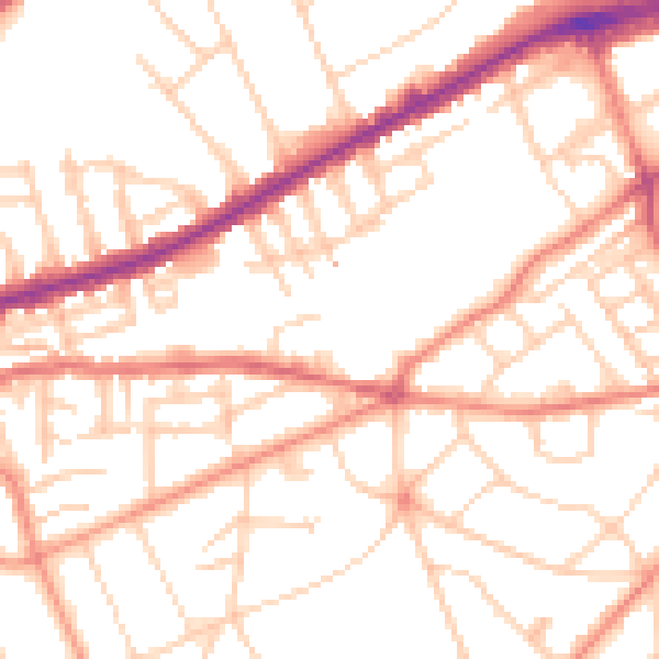
Daytime· 07:00 – 23:00
51.8dB

Night-time· 23:00 – 07:00
40.7dB