2 Acton House, Bolton Crescent, Basingstoke, RG22 6AY
About 2 Acton House
2 Acton House is an end-of-terrace house in Basingstoke (RG22 6AY). It has a recorded floor area of 21 m² (around 226 sq ft), construction records dating it to 1976-1982 and council tax band A. The latest certificate (October 2014) shows a D (score 68), on the cusp of jumping into the C band. Earlier certificates rated it C (January 2011); the latest reading is one band lower. Between certificates, wall efficiency dropped from Good to Average and hot-water efficiency dropped from Very Good to Good. The recommended improvements would push it to C (score 74). The latest certificate is from October 2014, so improvements made since then won't be reflected.
At 21 m² it's 25% smaller than the typical home in the postcode (28 m² median across 11 EPCs). It lags the bulk of the postcode on energy efficiency (less efficient than 82% of similar EPCs).
Everything you need to know about 2 Acton House
The true value, the hidden risks and the full sale history, in one report.
30-day money-back guarantee

The data behind every report


Energy performance
2 Acton House's carbon output is low for the local stock.
EPC Expired
This certificate is over 10 years old and is no longer valid.Expired 14 Oct 2024
EPC Rating
Property Improvements
Changes detected from historical EPC data
Hot water efficiency decreased
Mechanical ventilation installed
Planning history
2 Acton House has no planning applications on record.
The full report still covers planning activity across the surrounding area.
Sales history & valuation
2 Acton House has no Land Registry sales on file, suggesting it has stayed in the same hands since registration began.
£122,000
Modelled from EPC, postcode comparables.
No sales recorded with HM Land Registry
That can mean the property has never traded since the registry began publishing in 1995, was a new build that hasn't been registered yet, or is held in the same hands long-term.
Versus other Bolton Crescent homes
2 Acton House is notably below the street on floor area.
EPC Rating
68 (D)
Street avg 73 (C)
Floor Area
21 m²
Street avg 29 m²
CO₂ Emissions
1.2 t/year
Street avg 1.2 t/year
Habitable Rooms
1 rooms
Street avg 1 rooms
Everything you need to know about 2 Acton House
The true value, the hidden risks and the full sale history, in one report.
30-day money-back guarantee
The data behind every report
Similar properties nearby
The neighbourhood at a glance
Crime
7/mo
Steady year-on-year across the wider district.
Nearest stop
0.1 km
Aldworth Crescent — bus stop.
Closest school
0.5 km
Kings Furlong Junior School. 33 schools nearby.
Go deeper on the local area
The full report breaks down crime, transport links, schools and air quality in depth.
Road noise across the postcode
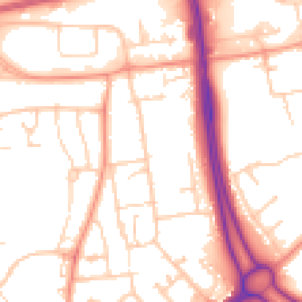
Daytime· 07:00 – 23:00
53.4dB

Night-time· 23:00 – 07:00
43.2dB