39 Beaconsfield Avenue, Portsmouth, PO6 2PS
About 39 Beaconsfield Avenue
39 Beaconsfield Avenue is a three-bedroom end-of-terrace house in Portsmouth (PO6 2PS). It has a recorded floor area of 106 m² (around 1141 sq ft), construction records dating it to 1930-1949 and council tax band C. The latest certificate (November 2021) shows a D (score 66), on the cusp of jumping into the C band. The recommended improvements would lift it to B (score 83), a 2-band jump.
At 106 m² the property is well over the postcode median (71 m² across 31 EPCs), placing it in the larger end of the local stock. One planning record on file: an extension approved in 2022. Past consents include an extension, meaningful when judging how the property has evolved. Across 2007–2022, sale prices on this property compounded at 3.6% per year. On a £-per-square-foot basis, the last sale (£346/sq ft) was about 71.3% above the typical sold price in the postcode. Most recent transfer: March 2022 at £395,000. That sale was during the post-pandemic price surge, when transactions cleared materially above pre-2020 trend.
Know exactly what you're buying at 39 Beaconsfield Avenue
Before you offer, see what the listing won't tell you, the true value, the red flags and the full history.
Already flagged here
Valuation
against the asking price
Risks
planning & flood
Sold prices
similar homes nearby
Trends
the local market
What this property has
Inside
- Bedrooms3
- Bathrooms1
- Dining roomYes
Outside
- Private gardenYes
- GarageDetached
Energy performance
Recommended upgrades on file would lift this property by multiple EPC bands.
EPC Rating
Planning history
39 Beaconsfield Avenue has an approved single-storey rear extension on the planning record.
- Jul 2022ExtensionOutlineIn report
Extension: Single storey · Rear of property
Construction of single storey rear extension extending 4m beyond the rear wall, with a height of 2.6m to the eaves and a maximum height of 3.9m
- Agent
- Thorns Young Architectural
- Documents
- 4 docs on file
- Reference
- 22/00047/GPDC
We flagged 2 things worth checking at 39 Beaconsfield Avenue
Independent checks surfaced things a buyer would want to understand before offering. The report explains each one in full, with the underlying data and what to ask.
- Signs of HMO activity in the area
- Larger development activity nearby
30-day money-back guarantee
Sales history & valuation
The latest sale landed in the post-pandemic price surge — useful context when reading the figure.
£428,000
Modelled from EPC, postcode comparables and a sale-price growth of 3.6% per year over 15 years.
£395,000
Growth on file: 3.6% per year over 15 years.
Sales timeline
31 March 2022Most recent
£395,000
+70.3%over 15 years16 March 2007
£232,000
Median price across the last 5 sales in PO6 2PS: £330,000 (2025–2023).
Nearby sales in PO6 2PS
49 Beaconsfield Avenue, Portsmouth, PO6 2PS
Sold Oct 2025
£396,50075a, Beaconsfield Avenue, Portsmouth, PO6 2PS
Sold Feb 2025
£209,99569a, Beaconsfield Avenue, Portsmouth, PO6 2PS
Sold Jun 2024
£200,00023 Beaconsfield Avenue, Portsmouth, PO6 2PS
Sold Dec 2023
£385,00041 Beaconsfield Avenue, Portsmouth, PO6 2PS
Sold Jan 2023
£330,000
Everything we know about 39 Beaconsfield Avenue, in one report
What it's really worth, what could be wrong, and the planning, sales and area data in full.
What we flagged
- Signs of HMO activity in the area
- Larger development activity nearby

Versus other Beaconsfield Avenue homes
On price per m², 39 Beaconsfield Avenue stands well clear of the street.
Price per m²
£3,726
Street avg £2,656
Floor Area
106 m²
Street avg 115 m²
Habitable Rooms
5 rooms
Street avg 5 rooms
CO₂ Emissions
3.9 t/year
Street avg 5.7 t/year
Similar properties nearby
1 Beaconsfield Avenue
PO6 2PS
1 Dovercourt Road
PO6 2RZ
1 Carshalton Avenue
PO6 2JT
1 Cranborne Road, Drayton
PO6 2BG
1 Chalkridge Road, Drayton
PO6 2BE
1 Braemar Avenue, Drayton
PO6 2NB
1 Donaldson Road
PO6 2SZ
1 Dorking Crescent
PO6 2QL
The neighbourhood at a glance
Rail-style transport is unusually close for this postcode.
Crime
9/mo
Steady year-on-year across the wider district.
Nearest stop
0.2 km
The Salisbury — bus stop.
Closest school
0.1 km
Court Lane Infant Academy. 23 schools nearby.
Go deeper on the local area
The full report breaks down crime, transport links, schools and air quality in depth.
Road noise across the postcode
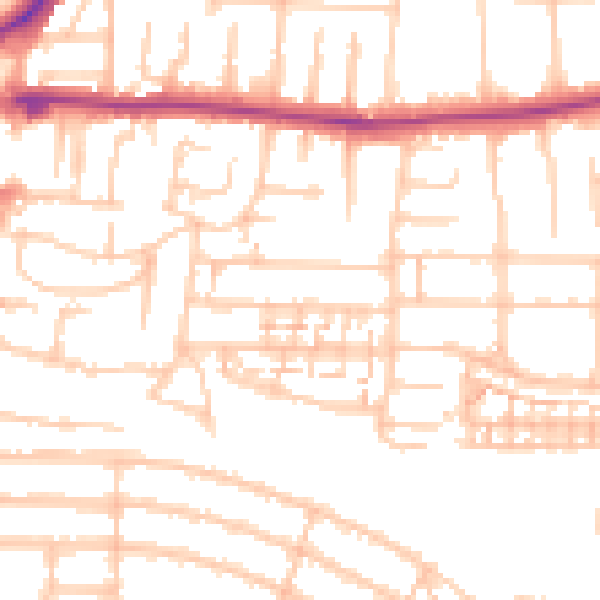
Daytime· 07:00 – 23:00
52.7dB

Night-time· 23:00 – 07:00
42.3dB